55th parallel north

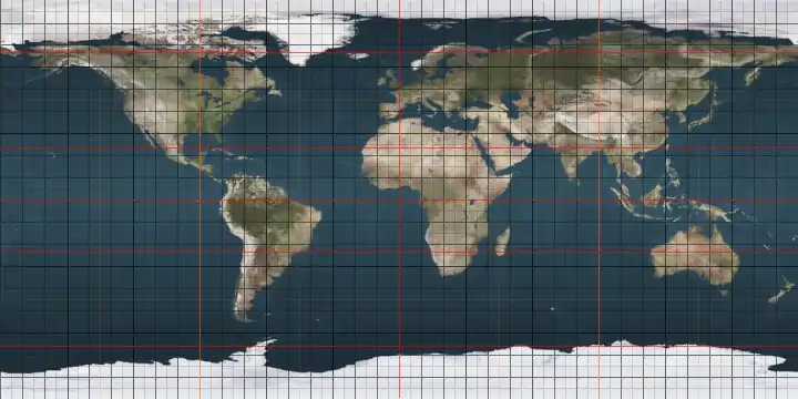
The 55th parallel north is a circle of latitude that is 55 degrees north of the Earth's equatorial plane. It crosses Europe, Asia, the Pacific Ocean, North America, and the Atlantic Ocean.

55°
55th parallel north

At this latitude the sun is visible for 17 hours, 22 minutes during the summer solstice and 7 hours, 10 minutes during the winter solstice.[1]

This latitude also roughly corresponds to the minimum latitude in which nautical twilight can last all night near the summer solstice.

Around the world

Starting at the Prime Meridian and heading eastwards, the parallel 55° north passes through:

Co-ordinates Country, territory or sea Notes
55°0′N 0°0′E North Sea
55°0′N 8°21′E  Germany Island of Sylt, close to Germany's northernmost point
55°0′N 8°23′E Wadden Sea
55°0′N 8°39′E  Denmark Jutland (mainland) and the island of Als
55°0′N 9°58′E Little Belt
55°0′N 10°27′E  Denmark Islands of Skarø, Tåsinge and Langeland
55°0′N 10°54′E Great Belt
55°0′N 11°5′E Smålandsfarvandet
55°0′N 11°53′E  Denmark Islands of Sjælland and Møn
55°0′N 12°32′E Baltic Sea
55°0′N 14°59′E  Denmark Island of Bornholm. There is a small memorial at 55°N 15°E / 55; 15
55°0′N 15°6′E Baltic Sea
55°0′N 20°33′E  Russia Kaliningrad Oblast - passing through the Curonian Lagoon
55°0′N 22°38′E  Lithuania Marijampolė County
55°0′N 26°13′E  Belarus Vitebsk Region
55°0′N 30°58′E  Russia Smolensk Oblast
55°0′N 68°12′E  Kazakhstan North Kazakhstan Region
55°0′N 71°1′E  Russia Passing just north of Omsk at 54°59′N 73°22′E
Passing just south of Novosibirsk at 55°3′N 82°57′E
55°0′N 135°24′E Sea of Okhotsk
55°0′N 136°47′E  Russia Feklistova Island
55°0′N 137°4′E Sea of Okhotsk
55°0′N 137°26′E  Russia Bolshoy Shantar Island
55°0′N 138°11′E Sea of Okhotsk
55°0′N 155°35′E  Russia Kamchatka Peninsula
55°0′N 161°59′E Pacific Ocean
55°0′N 166°8′E  Russia Bering Island
55°0′N 166°23′E Bering Sea Passing just north of Medny Island,  Russia
55°0′N 163°57′W  United States Alaska - Unimak Island and the Alaska Peninsula
55°0′N 162°34′W Pacific Ocean Gulf of Alaska - passing just south of Dolgoi Island and Unga Island, Alaska,  United States
55°0′N 160°8′W  United States Alaska - Nagai Island
55°0′N 160°4′W Pacific Ocean Gulf of Alaska
55°0′N 159°25′W  United States Alaska - Little Koniuji Island
55°0′N 159°21′W Pacific Ocean Gulf of Alaska
55°0′N 133°9′W  United States Alaska - Dall Island, Sukkwan Island and Prince of Wales Island
55°0′N 131°59′W Clarence Strait
55°0′N 131°36′W  United States Alaska - Annette Island and Duke Island
55°0′N 131°15′W Revillagigedo Channel
55°0′N 131°0′W  United States Alaska - Alaska Panhandle
55°0′N 130°15′W  Canada British Columbia - Pearse Island and the mainland
Alberta
Saskatchewan
Manitoba
Ontario
55°0′N 82°16′W Hudson Bay
55°0′N 78°28′W  Canada Quebec
Newfoundland and Labrador - for about 12 km
Quebec
Newfoundland and Labrador - for about 5 km
Quebec - for about 3 km
Newfoundland and Labrador
Quebec
Newfoundland and Labrador - mainland and the Adlavik Islands
55°0′N 58°40′W Atlantic Ocean
55°0′N 8°33′W  Ireland Island of Arranmore and mainland
55°0′N 7°24′W  United Kingdom Northern Ireland (passing through the city of Derry)
55°0′N 5°59′W North Channel
55°0′N 5°10′W  United Kingdom Scotland (passing through Gretna)
England (passing through the Newcastle-upon-Tyne urban area)
55°0′N 1°25′W North Sea

Notable cities and towns on 55°N

Use as a boundary

The 55th parallel serves as the southern boundary of Nunavik territory in Quebec.

See also

References

This article is issued from Wikipedia. The text is licensed under Creative Commons - Attribution - Sharealike. Additional terms may apply for the media files.