96th Street station (IND Eighth Avenue Line)
96th Street is a local station on the IND Eighth Avenue Line of the New York City Subway. Located at West 96th Street and Central Park West on the Upper West Side, it is served by the B on weekdays, the C train at all times except nights, and the A train during late nights only.
96 Street | ||||||||||||||||||||||||||||||||||||||||||||||||||||||||||||||||||||||||||||||||||||||||||||||||||||||||||||||||||||||||||||||||||||||
|---|---|---|---|---|---|---|---|---|---|---|---|---|---|---|---|---|---|---|---|---|---|---|---|---|---|---|---|---|---|---|---|---|---|---|---|---|---|---|---|---|---|---|---|---|---|---|---|---|---|---|---|---|---|---|---|---|---|---|---|---|---|---|---|---|---|---|---|---|---|---|---|---|---|---|---|---|---|---|---|---|---|---|---|---|---|---|---|---|---|---|---|---|---|---|---|---|---|---|---|---|---|---|---|---|---|---|---|---|---|---|---|---|---|---|---|---|---|---|---|---|---|---|---|---|---|---|---|---|---|---|---|---|---|---|
_06.jpg.webp) Uptown platform | ||||||||||||||||||||||||||||||||||||||||||||||||||||||||||||||||||||||||||||||||||||||||||||||||||||||||||||||||||||||||||||||||||||||
| Station statistics | ||||||||||||||||||||||||||||||||||||||||||||||||||||||||||||||||||||||||||||||||||||||||||||||||||||||||||||||||||||||||||||||||||||||
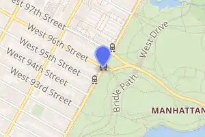
| Address | West 96th Street & Central Park West New York, NY 10025 | |||||||||||||||||||||||||||||||||||||||||||||||||||||||||||||||||||||||||||||||||||||||||||||||||||||||||||||||||||||||||||||||||||||
| Borough | Manhattan | |||||||||||||||||||||||||||||||||||||||||||||||||||||||||||||||||||||||||||||||||||||||||||||||||||||||||||||||||||||||||||||||||||||
| Locale | Upper West Side | |||||||||||||||||||||||||||||||||||||||||||||||||||||||||||||||||||||||||||||||||||||||||||||||||||||||||||||||||||||||||||||||||||||
| Coordinates | 40.791622°N 73.964725°W | |||||||||||||||||||||||||||||||||||||||||||||||||||||||||||||||||||||||||||||||||||||||||||||||||||||||||||||||||||||||||||||||||||||
| Division | B (IND) | |||||||||||||||||||||||||||||||||||||||||||||||||||||||||||||||||||||||||||||||||||||||||||||||||||||||||||||||||||||||||||||||||||||
| Line | IND Eighth Avenue Line | |||||||||||||||||||||||||||||||||||||||||||||||||||||||||||||||||||||||||||||||||||||||||||||||||||||||||||||||||||||||||||||||||||||
| Services | A B C | |||||||||||||||||||||||||||||||||||||||||||||||||||||||||||||||||||||||||||||||||||||||||||||||||||||||||||||||||||||||||||||||||||||
| Transit | ||||||||||||||||||||||||||||||||||||||||||||||||||||||||||||||||||||||||||||||||||||||||||||||||||||||||||||||||||||||||||||||||||||||
| Structure | Underground | |||||||||||||||||||||||||||||||||||||||||||||||||||||||||||||||||||||||||||||||||||||||||||||||||||||||||||||||||||||||||||||||||||||
| Levels | 2 | |||||||||||||||||||||||||||||||||||||||||||||||||||||||||||||||||||||||||||||||||||||||||||||||||||||||||||||||||||||||||||||||||||||
| Platforms | 2 side platforms (1 on each level) | |||||||||||||||||||||||||||||||||||||||||||||||||||||||||||||||||||||||||||||||||||||||||||||||||||||||||||||||||||||||||||||||||||||
| Tracks | 4 (2 on each level) | |||||||||||||||||||||||||||||||||||||||||||||||||||||||||||||||||||||||||||||||||||||||||||||||||||||||||||||||||||||||||||||||||||||
| Other information | ||||||||||||||||||||||||||||||||||||||||||||||||||||||||||||||||||||||||||||||||||||||||||||||||||||||||||||||||||||||||||||||||||||||
| Opened | September 10, 1932[1] | |||||||||||||||||||||||||||||||||||||||||||||||||||||||||||||||||||||||||||||||||||||||||||||||||||||||||||||||||||||||||||||||||||||
| Station code | 157[2] | |||||||||||||||||||||||||||||||||||||||||||||||||||||||||||||||||||||||||||||||||||||||||||||||||||||||||||||||||||||||||||||||||||||
| Accessible | not ADA-accessible; accessibility planned | |||||||||||||||||||||||||||||||||||||||||||||||||||||||||||||||||||||||||||||||||||||||||||||||||||||||||||||||||||||||||||||||||||||
| Opposite- direction transfer | Yes | |||||||||||||||||||||||||||||||||||||||||||||||||||||||||||||||||||||||||||||||||||||||||||||||||||||||||||||||||||||||||||||||||||||
| Traffic | ||||||||||||||||||||||||||||||||||||||||||||||||||||||||||||||||||||||||||||||||||||||||||||||||||||||||||||||||||||||||||||||||||||||
| 2019 | 3,038,864[3] | |||||||||||||||||||||||||||||||||||||||||||||||||||||||||||||||||||||||||||||||||||||||||||||||||||||||||||||||||||||||||||||||||||||
| Rank | 167 out of 424[3] | |||||||||||||||||||||||||||||||||||||||||||||||||||||||||||||||||||||||||||||||||||||||||||||||||||||||||||||||||||||||||||||||||||||
| Station succession | ||||||||||||||||||||||||||||||||||||||||||||||||||||||||||||||||||||||||||||||||||||||||||||||||||||||||||||||||||||||||||||||||||||||
| Next north | 103rd Street: A | |||||||||||||||||||||||||||||||||||||||||||||||||||||||||||||||||||||||||||||||||||||||||||||||||||||||||||||||||||||||||||||||||||||
| Next south | 86th Street: A | |||||||||||||||||||||||||||||||||||||||||||||||||||||||||||||||||||||||||||||||||||||||||||||||||||||||||||||||||||||||||||||||||||||
| ||||||||||||||||||||||||||||||||||||||||||||||||||||||||||||||||||||||||||||||||||||||||||||||||||||||||||||||||||||||||||||||||||||||
| ||||||||||||||||||||||||||||||||||||||||||||||||||||||||||||||||||||||||||||||||||||||||||||||||||||||||||||||||||||||||||||||||||||||
| ||||||||||||||||||||||||||||||||||||||||||||||||||||||||||||||||||||||||||||||||||||||||||||||||||||||||||||||||||||||||||||||||||||||
| ||||||||||||||||||||||||||||||||||||||||||||||||||||||||||||||||||||||||||||||||||||||||||||||||||||||||||||||||||||||||||||||||||||||

History
The station opened on September 10, 1932, as part of the city-operated Independent Subway System (IND)'s initial segment, the Eighth Avenue Line between Chambers Street and 207th Street.[4] Construction of the whole line cost $191.2 million. While the IRT Broadway–Seventh Avenue Line already provided parallel service, the new Eighth Avenue subway via Central Park West provided an alternative route.[5]
In 2019, the Metropolitan Transportation Authority announced that the station would become ADA-accessible as part of the agency's 2020–2024 Capital Program.[6]
Station layout
| G | Street level | Exit/entrance |
| B1 | Northbound express | ← |
| Northbound local | ← ← ← | |
| Side platform | ||
| Mezzanine | Fare control, station agent, MetroCard machines | |
| B2 | Southbound express | |
| Southbound local | | |
| Side platform | ||
This underground station has two levels with northbound trains using the upper level and southbound trains using the lower level. Each level has one side platform to the west of two tracks.[7]
The platforms have no trim line, but name tablets read "96TH ST." in white sans-serif font on a midnight blue background and black border. "96" signs in the same format as the directional signs run along the platform walls at regular intervals at the same level as the name tablets. Blue columns run along both platforms at regular intervals with alternating ones having the standard black station name plate in white numbering.
Exits
All fare control areas are on the upper level platform and two staircases, one adjacent to each area, go down to the lower level. The full-time one at 96th Street is at the center of the platform. A staircase of four steps go down to a bank of three turnstiles that lead to a token booth. The other fare control area at 97th Street, at the station's extreme north end, is unstaffed, containing High Entry/Exit Turnstiles.[8] The northwest staircase was relocated with a longer passageway due to the widening of 97th Street.
Two staircases connect the two platforms. There are currently three exits to the following locations:
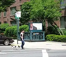
- Southwestern corner of West 96th Street and Central Park West.[8]
- Both western corners (one staircase each) of West 97th Street and Central Park West.[8]
Directional signs that have been covered indicate that there was a third set of exits that led to both western corners (one staircase each) to West 95th Street.[9] Further evidence of this exit's existence includes new tiling with doorways that lead to converted storage spaces on both levels. This exit was closed by 1940[10] and possibly as early as November 1932 - just two months after the opening of the station - due to frequent vandalism.[11]
References
- "List of the 28 Stations on the New 8th Av. Line". The New York Times. September 10, 1932. p. 6. ISSN 0362-4331. Retrieved April 21, 2020.
- "Station Developers' Information". Metropolitan Transportation Authority. Retrieved June 13, 2017.
- "Facts and Figures: Annual Subway Ridership 2014–2019". Metropolitan Transportation Authority. 2020. Retrieved May 26, 2020.
- Crowell, Paul (September 10, 1932). "Gay Midnight Crowd Rides First Trains In The New Subway: Throngs at Station an Hour Before Time, Rush Turnstiles When Chains are Dropped" (PDF). New York Times. Retrieved November 8, 2015.
- Duffus, R. l (September 9, 1932). "NEW LINE FIRST UNIT IN CITY-WIDE SYSTEM; 8th Av. Tube to Ease West Side Congestion at Once -- Branches to Link 4 Boroughs Later. LAST WORD IN SUBWAYS Run From 207th to Chambers St. Cut to 33 Minutes -- 42d St. Has World's Largest Station. COST HAS BEEN $191,200,000 Years of Digging Up City Streets, Tunneling Rock and Building Road Finally Brought to Completion". The New York Times. p. 12. ISSN 0362-4331. Retrieved August 3, 2017.
- "Press Release - MTA Headquarters - MTA Announces 20 Additional Subway Stations to Receive Accessibility Improvements Under Proposed 2020-2024 Capital Plan". MTA. December 19, 2019. Retrieved December 24, 2019.
- Dougherty, Peter (2006) [2002]. Tracks of the New York City Subway 2006 (3rd ed.). Dougherty. OCLC 49777633 – via Google Books.
- "MTA Neighborhood Maps: Upper West Side" (PDF). mta.info. Metropolitan Transportation Authority. 2015. Retrieved December 30, 2016.
- Review of the A and C Lines (PDF) (Report). Metropolitan Transportation Authority. December 11, 2015. Archived from the original (PDF) on February 3, 2020. Retrieved January 19, 2016.
- https://1940s.nyc/map/photo/nynyma_rec0040_1_01209_0129#17.28/40.791364/-73.965773
- https://www.nycsubway.org/wiki/History_of_the_Independent_Subway#The_Independent_City-Owned_System_Opens_For_Business
External links
| Wikimedia Commons has media related to 96th Street (IND Eighth Avenue Line). |
- nycsubway.org – IND 8th Avenue: 96th Street
- Station Reporter — B Train
- Station Reporter — C Train
- The Subway Nut — 96th Street Pictures
- 96th Street entrance from Google Maps Street View
- 97th Street entrance from Google Maps Street View
- Platform from Google Maps Street View


.jpg.webp)