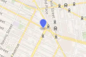
Atlantic Avenue–Barclays Center station
Atlantic Avenue–Barclays Center (formerly Atlantic Avenue/Pacific Street) is a New York City Subway station complex shared by the BMT Fourth Avenue Line, the BMT Brighton Line and the IRT Eastern Parkway Line, located at Atlantic, Fourth, and Flatbush Avenues and Pacific Street in Downtown Brooklyn. The complex is served by the 2, 4, D, N, Q and R trains at all times; the 3 train at all times except late nights; the 5 and B trains during weekdays; and a few rush-hour W trains.
Atlantic Avenue–Barclays Center | |||||||||||||||
|---|---|---|---|---|---|---|---|---|---|---|---|---|---|---|---|
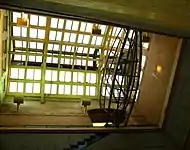
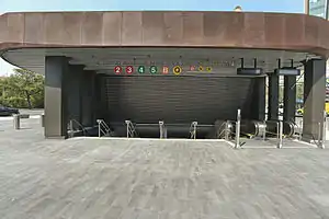 Entrance from Barclays Center | |||||||||||||||
| Station statistics | |||||||||||||||
| Address | Atlantic Avenue, Pacific Street, Flatbush Avenue & Fourth Avenue Brooklyn, NY 11217[1] | ||||||||||||||
| Borough | Brooklyn | ||||||||||||||
| Locale | Downtown Brooklyn | ||||||||||||||
| Coordinates | 40.684462°N 73.978758°W | ||||||||||||||
| Division | A (IRT), B (BMT) | ||||||||||||||
| Line | BMT Fourth Avenue Line BMT Brighton Line IRT Eastern Parkway Line | ||||||||||||||
| Services | 2 3 4 5 B D N Q R W | ||||||||||||||
| Transit | |||||||||||||||
| Levels | 3 | ||||||||||||||
| Other information | |||||||||||||||
| Station code | 617[3] | ||||||||||||||
| Accessible | |||||||||||||||
| Traffic | |||||||||||||||
| 2019 | 13,939,794[4] | ||||||||||||||
| Rank | 20 out of 424[4] | ||||||||||||||
| |||||||||||||||
| |||||||||||||||
| |||||||||||||||
Atlantic Avenue Control House | |||||||||||||||
| MPS | Interborough Rapid Transit Subway Control Houses TR | ||||||||||||||
| NRHP reference No. | 80002643[5] | ||||||||||||||
| Added to NRHP | May 6, 1980 | ||||||||||||||
Atlantic Avenue Subway Station (IRT and BMT) | |||||||||||||||
| MPS | New York City Subway System MPS | ||||||||||||||
| NRHP reference No. | 04001023[5] | ||||||||||||||
| Added to NRHP | September 17, 2004 | ||||||||||||||

As of 2019, it is the busiest subway station in Brooklyn, with 13,939,794 passengers, and is ranked 20th overall.[4] The control house has been listed on the National Register of Historic Places since 1980,[6] while the station complex as a whole has been listed on the National Register of Historic Places since 2004,[6] and is ADA-compliant.
History
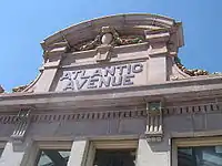
The IRT Eastern Parkway Line station was built first, in 1908, the terminal of a four-stop subway extension from Lower Manhattan to Downtown Brooklyn via the Joralemon Street Tunnel.[7] The station's control house, a grand, ornate entrance to what was then the terminal of the Interborough Rapid Transit Company's Brooklyn lines, was designed by Heins & LaFarge, who also built the Cathedral of St. John the Divine in Morningside Heights, Manhattan.[8] This control house was listed on the National Register of Historic Places in 1980; however, the actual entrance is now removed and now serves as a skylight into the IRT station.[6]
In 1909, to address overcrowding, the New York Public Service Commission proposed lengthening platforms at stations along the original IRT subway.[9]:168 On January 18, 1910, a modification was made to Contracts 1 and 2 to lengthen station platforms to accommodate ten-car express and six-car local trains. In addition to $1.5 million (equivalent to $41.2 million in 2019) spent on platform lengthening, $500,000 (equivalent to $13,719,643 in 2019) was spent on building additional entrances and exits. It was anticipated that these improvements would increase capacity by 25 percent.[10]:15 The island platform at the Atlantic Avenue station on the modern Eastern Parkway Line was extended 105 feet (32 m) to the east.[10]:116 On January 23 and 24, 1911, ten-car express trains began running.[9]:168[11]
During the 1964–1965 fiscal year, the Brighton Line platforms at Atlantic Avenue, along with those at six other stations on the Brighton Line, were lengthened to 615 feet to accommodate a ten-car train of 60-foot IND cars, or a nine-car train of 67-foot BMT cars.[12]
The station was overhauled in the late 1970s. The Metropolitan Transportation Authority (MTA) fixed the station's structure and overhauled its appearance. It refurbished the wall tilings and replaced the old signs and incandescent lighting with modern fixtures. It also fixed the staircases and platform edges. On January 16, 1978, the ex-IRT and ex-BMT stations were connected into a single station complex, eliminating a "double fare" that formerly was required to transfer between the Atlantic Ave. IRT/BMT platforms and the Fourth Ave. BMT side of the station.[13][14]
The station complex underwent another major overhaul from 1999 to 2003, using funds from the 1987 capital program;[15] the $49 million in funding from that program had been delayed in 1994 due to the MTA's budget issues.[16] This time the station received state of the art repairs and was updated for ADA-accessibility, with the installation of eight elevators in the station, as well as the widening or construction of fifteen staircases.[8] The MTA repaired the staircases, re-tiled the walls and floors, upgraded the station's lights and the public address system, installed ADA yellow safety threads along the platform edge, installed new trackbeds for local and express trains entering the IRT station, and widened the 100-year-old passageways between the stations.[8] An escalator was replaced at Hanson Place, the kiosk on Times Plaza was rehabilitated , and a new station entrance was added at Hanson Place.[17] To achieve this, the entire IRT station had to be supported by large 36-foot-long (11 m) crossbeams hanging from the roof of the station box, a construction technique that had never been used previously; the station was also supported by conventional columns from below. The entire feat raised the subway infrastructure under Flatbush Avenue, as well as the avenue itself, by less than an inch while the 350-foot-long (110 m) passageways were widened from 15 to 42 feet (4.6 to 12.8 m).[8] In 2004, the entire station was made a NRHP landmark.[6] Late that year, the MTA installed elevators on both sides of the platform and street level to accommodate wheelchairs and those with disabilities.
In June 2009, the MTA sold the naming rights of the station complex to Forest City Ratner Companies for 20 years at $200,000 per year, one of the few such renames in the system (Willets Point–Shea Stadium, in Queens, was another example of a station with such naming rights, until the MTA simply renamed it to Mets–Willets Point following Shea Stadium's demolition).[18] Barclays Center, whose naming rights were bought by Barclays Bank, opened September 2012 and is part of Forest City Ratner Companies' Pacific Park project. As a result, the station was renamed to its present name, Atlantic Avenue–Barclays Center, in May 2012. A new mezzanine and fare control area was built near the sports complex.[19][20] Following this rename and the addition of a new exit, the MTA has considered selling the naming rights of other subway stations.[18]
Station layout
| G | Street level | Entrances/exits, pavilion, station house, fare control, station agents, LIRR ticket booth, MetroCard machines
|
| Barclays Center | ||
| Connection to Atlantic Terminal shopping mall | ||
| B1 Eastern Parkway platforms |
Side platform | |
| Northbound local | ← ← ← | |
| Northbound express | ← ← | |
| Island platform | ||
| Southbound express | | |
| Southbound local | | |
| Side platform | ||
| B1 LIRR platforms |
Track 1 | Atlantic Branch services toward Jamaica and Points East (Nostrand Avenue) → |
| Platform A, island platform | ||
| Track 2 | Atlantic Branch services toward Jamaica and Points East (Nostrand Avenue) → | |
| Track 3 | Atlantic Branch services toward Jamaica and Points East (Nostrand Avenue) → | |
| Platform B, island platform | ||
| Track 4 | Atlantic Branch services toward Jamaica and Points East (Nostrand Avenue) → | |
| Track 5 | Atlantic Branch services toward Jamaica and Points East (Nostrand Avenue) → | |
| Platform C, island platform | ||
| Track 6 | Atlantic Branch services toward Jamaica and Points East (Nostrand Avenue) → | |
| B2 | Mezzanine | Passageway between platforms |
| B3 Brighton platform |
Northbound | ← ← |
| Island platform | ||
| Southbound | | |
| B3 Fourth Avenue platforms |
Northbound local | ← ← ← |
| Island platform | ||
| Northbound express | ← ← | |
| Southbound express | | |
| Island platform | ||
| Southbound local | | |
The station consists of three levels. The shallowest below ground, the IRT Eastern Parkway Line platforms, is at the same level as the LIRR's Atlantic Terminal railway platforms and are only 20 feet (6.1 m) below street level. The second level below ground is the BMT Fourth Avenue Line platforms, which are 40 feet (12 m) deep and have a mezzanine, and a connecting passageway to the IRT Eastern Parkway Line and BMT Brighton Line, above the platforms. The deepest is the BMT Brighton Line platform, which are 50 feet (15 m) deep and have a mezzanine above them, which serves both the Brighton Line platform and the Eastern Parkway Line platforms.
Exits
To the Fourth Avenue portion of the complex:
- Stair to NW corner of 4th Avenue and Pacific Street[21]
 Stair and elevator to NE corner of 4th Avenue and Pacific Street[21]
To the Eastern Parkway/Brighton portion of the complex:
- Stair to western corner of Hanson Place and St. Felix Street[21]
- Stair and elevator to southern corner of Hanson Place and St. Felix Street[21]
- Passageway to 1 Hanson Place[21]
- Two stairs to north side of Flatbush Avenue southeast of Hanson Place[21]
- Passageway to Atlantic Terminal Station[21]
- Stair and escalators to Barclays Center at SE corner of Atlantic and Flatbush Avenues[21]
The Eastern Parkway Line platforms had an underpass with exits to the north and south sides of Flatbush Avenue between Atlantic Avenue and Pacific Street. The exit to the north side was replaced with a larger single entrance near Barclays Center and sealed. The exit to the south side was retained as an emergency exit.
IRT Eastern Parkway Line platforms
Atlantic Avenue–Barclays Center | ||||||||||||||||||||||||||||||||||||||||||||||||||||||||||||||||||||||||||||||||||||||||||||||||
|---|---|---|---|---|---|---|---|---|---|---|---|---|---|---|---|---|---|---|---|---|---|---|---|---|---|---|---|---|---|---|---|---|---|---|---|---|---|---|---|---|---|---|---|---|---|---|---|---|---|---|---|---|---|---|---|---|---|---|---|---|---|---|---|---|---|---|---|---|---|---|---|---|---|---|---|---|---|---|---|---|---|---|---|---|---|---|---|---|---|---|---|---|---|---|---|---|
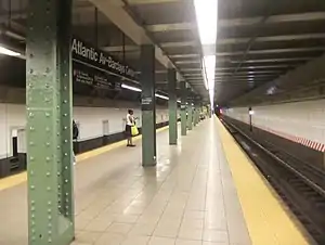
.JPG.webp) Southbound local platform | ||||||||||||||||||||||||||||||||||||||||||||||||||||||||||||||||||||||||||||||||||||||||||||||||
| Station statistics | ||||||||||||||||||||||||||||||||||||||||||||||||||||||||||||||||||||||||||||||||||||||||||||||||
| Division | A (IRT) | |||||||||||||||||||||||||||||||||||||||||||||||||||||||||||||||||||||||||||||||||||||||||||||||
| Line | IRT Eastern Parkway Line | |||||||||||||||||||||||||||||||||||||||||||||||||||||||||||||||||||||||||||||||||||||||||||||||
| Services | 2 3 4 5 | |||||||||||||||||||||||||||||||||||||||||||||||||||||||||||||||||||||||||||||||||||||||||||||||
| Structure | Underground | |||||||||||||||||||||||||||||||||||||||||||||||||||||||||||||||||||||||||||||||||||||||||||||||
| Platforms | 2 side platforms (local) 1 island platform (express) | |||||||||||||||||||||||||||||||||||||||||||||||||||||||||||||||||||||||||||||||||||||||||||||||
| Tracks | 4 | |||||||||||||||||||||||||||||||||||||||||||||||||||||||||||||||||||||||||||||||||||||||||||||||
| Other information | ||||||||||||||||||||||||||||||||||||||||||||||||||||||||||||||||||||||||||||||||||||||||||||||||
| Opened | May 1, 1908 | |||||||||||||||||||||||||||||||||||||||||||||||||||||||||||||||||||||||||||||||||||||||||||||||
| Station code | 338[3] | |||||||||||||||||||||||||||||||||||||||||||||||||||||||||||||||||||||||||||||||||||||||||||||||
| Accessible | ||||||||||||||||||||||||||||||||||||||||||||||||||||||||||||||||||||||||||||||||||||||||||||||||
| Opposite- direction transfer | Yes | |||||||||||||||||||||||||||||||||||||||||||||||||||||||||||||||||||||||||||||||||||||||||||||||
| Former/other names | Atlantic Avenue | |||||||||||||||||||||||||||||||||||||||||||||||||||||||||||||||||||||||||||||||||||||||||||||||
| Station succession | ||||||||||||||||||||||||||||||||||||||||||||||||||||||||||||||||||||||||||||||||||||||||||||||||
| Next north | Nevins Street: 2 | |||||||||||||||||||||||||||||||||||||||||||||||||||||||||||||||||||||||||||||||||||||||||||||||
| Next south | Bergen Street (local): 2 Franklin Avenue–Medgar Evers College (express): 4 | |||||||||||||||||||||||||||||||||||||||||||||||||||||||||||||||||||||||||||||||||||||||||||||||
| ||||||||||||||||||||||||||||||||||||||||||||||||||||||||||||||||||||||||||||||||||||||||||||||||
| ||||||||||||||||||||||||||||||||||||||||||||||||||||||||||||||||||||||||||||||||||||||||||||||||
Atlantic Avenue–Barclays Center (originally Atlantic Avenue) is an express station on the IRT Eastern Parkway Line which has four tracks, one island platform, and two side platforms. On the center platform, there are two old indicator signs which mark the next train, formerly used for non-rush hour short turn trains. An old style sign to the Brooklyn Academy of Music also exists. The trackway to the Long Island Rail Road Atlantic Branch is still visible at the north end of the northbound local track, although much of it is behind corrugated wall; more information about this and other unused trackways is at Bergen Street. The LIRR Atlantic Terminal platforms, slightly lower, are clearly visible through floor-to-ceiling railings.
This station has been completely renovated. The northbound local trackway and track have been completely redone with concrete base and welded rail.
The IRT Eastern Parkway Line platform has a passageway to the BMT Fourth Avenue and Brighton Lines under the platforms, with the Fourth Avenue Line to the southwest and the Brighton Line to the northeast. Another passageway between the Eastern Parkway and Brighton Line is present at the south end of the station, which also leads to an exit immediately adjacent to Barclays Center. The Barclays Center exit features a part-time booth that is staffed during events at the arena and two escalators.[21]
Although the station is wheelchair accessible, the Eastern Parkway Line express platform was formerly too narrow in some areas to accommodate wheelchairs. Passengers were notified of this fact by announcements on trains before reaching the station. The stairs have since been trimmed in width to allow full wheelchair access.
North of this station, there is an unused trackway, splitting from the southbound local track for a proposed subway under Fourth Avenue (later built as the BMT Fourth Avenue Line). It merges with the Manhattan-bound express track and ends on a bumper block between the two express tracks at Nevins Street. When this station originally opened in 1908 it was the terminal for the line, and had two side platforms, an island platform, and two tracks. All the platforms were connected together at their southern ends.
This station is one of three express stations to have side platforms for local services and a center island platform for express services, the other two being the 34th Street–Penn Station stops on the IND Eighth Avenue Line and the IRT Broadway–Seventh Avenue Line respectively. The reason for this is that the Atlantic Avenue station was originally planned as a two-track station with only the island (express) platform; the side (local) platforms were added to the plans when construction was already underway. However, this layout helps to reduce overcrowding because the station is connected to Atlantic Terminal, and the next station west from Atlantic Avenue, Nevins Street, is also an express station with the more common two-island-platform configuration. This limits overcrowding by preventing cross-platform interchanges between local and express services.
BMT Brighton Line platform
Atlantic Avenue–Barclays Center | ||||||||||||||||||||||||||||||||||||||||||||||||||||||||||||||||||||||||||||||||||
|---|---|---|---|---|---|---|---|---|---|---|---|---|---|---|---|---|---|---|---|---|---|---|---|---|---|---|---|---|---|---|---|---|---|---|---|---|---|---|---|---|---|---|---|---|---|---|---|---|---|---|---|---|---|---|---|---|---|---|---|---|---|---|---|---|---|---|---|---|---|---|---|---|---|---|---|---|---|---|---|---|---|---|
.JPG.webp) Manhattan-bound B train of R68 cars arrives at the station | ||||||||||||||||||||||||||||||||||||||||||||||||||||||||||||||||||||||||||||||||||
| Station statistics | ||||||||||||||||||||||||||||||||||||||||||||||||||||||||||||||||||||||||||||||||||
| Division | B (BMT) | |||||||||||||||||||||||||||||||||||||||||||||||||||||||||||||||||||||||||||||||||
| Line | BMT Brighton Line | |||||||||||||||||||||||||||||||||||||||||||||||||||||||||||||||||||||||||||||||||
| Services | B Q | |||||||||||||||||||||||||||||||||||||||||||||||||||||||||||||||||||||||||||||||||
| Structure | Underground | |||||||||||||||||||||||||||||||||||||||||||||||||||||||||||||||||||||||||||||||||
| Platforms | 1 island platform | |||||||||||||||||||||||||||||||||||||||||||||||||||||||||||||||||||||||||||||||||
| Tracks | 2 | |||||||||||||||||||||||||||||||||||||||||||||||||||||||||||||||||||||||||||||||||
| Other information | ||||||||||||||||||||||||||||||||||||||||||||||||||||||||||||||||||||||||||||||||||
| Opened | August 1, 1920[22] | |||||||||||||||||||||||||||||||||||||||||||||||||||||||||||||||||||||||||||||||||
| Station code | 040f[3] | |||||||||||||||||||||||||||||||||||||||||||||||||||||||||||||||||||||||||||||||||
| Accessible | ||||||||||||||||||||||||||||||||||||||||||||||||||||||||||||||||||||||||||||||||||
| Opposite- direction transfer | Yes | |||||||||||||||||||||||||||||||||||||||||||||||||||||||||||||||||||||||||||||||||
| Former/other names | Atlantic Avenue | |||||||||||||||||||||||||||||||||||||||||||||||||||||||||||||||||||||||||||||||||
| Station succession | ||||||||||||||||||||||||||||||||||||||||||||||||||||||||||||||||||||||||||||||||||
| Next north | DeKalb Avenue: B | |||||||||||||||||||||||||||||||||||||||||||||||||||||||||||||||||||||||||||||||||
| Next south | Seventh Avenue: B | |||||||||||||||||||||||||||||||||||||||||||||||||||||||||||||||||||||||||||||||||
| ||||||||||||||||||||||||||||||||||||||||||||||||||||||||||||||||||||||||||||||||||
| ||||||||||||||||||||||||||||||||||||||||||||||||||||||||||||||||||||||||||||||||||
Atlantic Avenue–Barclays Center (originally Atlantic Avenue) on the BMT Brighton Line has two tracks and an island platform.
The platform has seven staircases, three to the main mezzanine, two to the Hanson Place exit at the north end, which is an escalator that leads to a separate mezzanine with no transfers to the other lines and two at the south end, which leads to both an exit immediately adjacent to Barclays Center and another mezzanine that connects to the IRT platforms. The Barclays Center exit features a part-time booth that is staffed during events at the arena and two escalators.[21]
The street staircase on the Hanson Place mezzanine leads to the Williamsburgh Savings Bank Tower. The exit at Hanson Place once had a booth that has since been removed.[21] The lower level of this mezzanine had a passageway, now sealed, that ran above the platform from Hanson Place. The "To Hanson Place" and other signs are covered up. This area is now space used by MTA employees with the entrance at the other side.
The main mezzanine also has an out-of-system passageway to the LIRR's Atlantic Terminal and the full-time fare control at the IRT side of the station.[21] Two of the street staircases lead to the Atlantic Terminal Mall. Lightboxes with rotating content line these walls. There is a removed staircase in between the two sets of stairs. The northernmost staircase was added during renovation, while the other two staircases were narrowed in order to comply with ADA guidelines regarding minimum 36-inch width clearances.
A platform extension is clearly visible at the south end of the platform, where the name tablets and "A" are authentic replicas on the northbound platform wall, while the southbound wall was tiled around them. The area on the southbound wall where the platform extends out is made of replicas as well. Since there were no mosaics built, only a green wall was present prior to renovation, which indicates where the platform was extended in the 1964–1965 to fit ten car trains.[12]
North of this station, a bellmouth is visible from a Manhattan-bound train.[23] The bellmouth was for the proposed Ashland Place Connection which would have connected to the now-demolished BMT Fulton Street El.
BMT Fourth Avenue Line platforms
Atlantic Avenue–Barclays Center | ||||||||||||||||||||||||||||||||||||||||||||||||||||||||||||||||||||||||||||||||||||||||||||||||||||||||||||||
|---|---|---|---|---|---|---|---|---|---|---|---|---|---|---|---|---|---|---|---|---|---|---|---|---|---|---|---|---|---|---|---|---|---|---|---|---|---|---|---|---|---|---|---|---|---|---|---|---|---|---|---|---|---|---|---|---|---|---|---|---|---|---|---|---|---|---|---|---|---|---|---|---|---|---|---|---|---|---|---|---|---|---|---|---|---|---|---|---|---|---|---|---|---|---|---|---|---|---|---|---|---|---|---|---|---|---|---|---|---|---|
 Manhattan-bound platform | ||||||||||||||||||||||||||||||||||||||||||||||||||||||||||||||||||||||||||||||||||||||||||||||||||||||||||||||
| Station statistics | ||||||||||||||||||||||||||||||||||||||||||||||||||||||||||||||||||||||||||||||||||||||||||||||||||||||||||||||
| Division | B (BMT) | |||||||||||||||||||||||||||||||||||||||||||||||||||||||||||||||||||||||||||||||||||||||||||||||||||||||||||||
| Line | BMT Fourth Avenue Line | |||||||||||||||||||||||||||||||||||||||||||||||||||||||||||||||||||||||||||||||||||||||||||||||||||||||||||||
| Services | D N R W | |||||||||||||||||||||||||||||||||||||||||||||||||||||||||||||||||||||||||||||||||||||||||||||||||||||||||||||
| Structure | Underground | |||||||||||||||||||||||||||||||||||||||||||||||||||||||||||||||||||||||||||||||||||||||||||||||||||||||||||||
| Platforms | 2 island platforms cross-platform interchange | |||||||||||||||||||||||||||||||||||||||||||||||||||||||||||||||||||||||||||||||||||||||||||||||||||||||||||||
| Tracks | 4 | |||||||||||||||||||||||||||||||||||||||||||||||||||||||||||||||||||||||||||||||||||||||||||||||||||||||||||||
| Other information | ||||||||||||||||||||||||||||||||||||||||||||||||||||||||||||||||||||||||||||||||||||||||||||||||||||||||||||||
| Opened | June 22, 1915[24] | |||||||||||||||||||||||||||||||||||||||||||||||||||||||||||||||||||||||||||||||||||||||||||||||||||||||||||||
| Station code | 027[3] | |||||||||||||||||||||||||||||||||||||||||||||||||||||||||||||||||||||||||||||||||||||||||||||||||||||||||||||
| Accessible | ||||||||||||||||||||||||||||||||||||||||||||||||||||||||||||||||||||||||||||||||||||||||||||||||||||||||||||||
| Opposite- direction transfer | Yes | |||||||||||||||||||||||||||||||||||||||||||||||||||||||||||||||||||||||||||||||||||||||||||||||||||||||||||||
| Station succession | ||||||||||||||||||||||||||||||||||||||||||||||||||||||||||||||||||||||||||||||||||||||||||||||||||||||||||||||
| Next north | DeKalb Avenue (local): D Canal Street (express via Broadway): N Grand Street (express via 6th Avenue): D | |||||||||||||||||||||||||||||||||||||||||||||||||||||||||||||||||||||||||||||||||||||||||||||||||||||||||||||
| Next south | Union Street (local): D 36th Street (express): D | |||||||||||||||||||||||||||||||||||||||||||||||||||||||||||||||||||||||||||||||||||||||||||||||||||||||||||||
| ||||||||||||||||||||||||||||||||||||||||||||||||||||||||||||||||||||||||||||||||||||||||||||||||||||||||||||||
| ||||||||||||||||||||||||||||||||||||||||||||||||||||||||||||||||||||||||||||||||||||||||||||||||||||||||||||||
Atlantic Avenue–Barclays Center (originally Pacific Street then Atlantic Avenue–Pacific Street) is an express station on the BMT Fourth Avenue Line that has four tracks and two island platforms. It opened on June 22, 1915.[24] A wall separates the two platforms.
At the north end of the BMT Fourth Avenue platforms, two staircases and one elevator go up to the main fare control area, where a turnstile bank provides access to/from the station and two staircases going up to either northern corners of Pacific Street and Fourth Avenue. The northeast corner also has an elevator going down to the mezzanine. A pathway connects to the rest of the complex.[21]
BMT Fifth Avenue Line station
Atlantic Avenue | |||||||||||||||||||||||||||||
|---|---|---|---|---|---|---|---|---|---|---|---|---|---|---|---|---|---|---|---|---|---|---|---|---|---|---|---|---|---|
| Former New York City Subway station | |||||||||||||||||||||||||||||
 The Fifth Avenue Line station was located right above the headhouse for this station complex | |||||||||||||||||||||||||||||
| Station statistics | |||||||||||||||||||||||||||||
| Address | Flatbush Avenue and Atlantic Avenue Brooklyn, NY 11217 | ||||||||||||||||||||||||||||
| Borough | Brooklyn | ||||||||||||||||||||||||||||
| Locale | Downtown Brooklyn | ||||||||||||||||||||||||||||
| Division | B (BMT) | ||||||||||||||||||||||||||||
| Services | BMT Fifth Avenue Line BMT Culver Line BMT West End Line (–1916) | ||||||||||||||||||||||||||||
| Structure | Elevated | ||||||||||||||||||||||||||||
| Platforms | 1 island platform | ||||||||||||||||||||||||||||
| Tracks | 2 | ||||||||||||||||||||||||||||
| Other information | |||||||||||||||||||||||||||||
| Opened | November 5, 1888 | ||||||||||||||||||||||||||||
| Closed | June 1, 1940[25] | ||||||||||||||||||||||||||||
| Station succession | |||||||||||||||||||||||||||||
| Next north | Fulton Street | ||||||||||||||||||||||||||||
| Next south | St. Mark's Avenue | ||||||||||||||||||||||||||||
| |||||||||||||||||||||||||||||
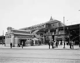
The station complex formerly had an elevated portion on the BMT Fifth Avenue Line, called Atlantic Avenue. It was served by trains of the BMT Culver Line and BMT Fifth Avenue Line and had two tracks and one island platform. It was located at Flatbush Avenue and Atlantic Avenue, right above the headhouse for the current complex. It also served the St. Johns Place Line, Flatbush Avenue Line, Third Avenue Line, and Seventh Avenue Line streetcars.
On June 25, 1923 two cars of a train coming from 65th Street Terminal derailed and fell towards Flatbush Avenue. Eight passengers died and many were injured.[26][27] With increased use of the subways compared to the elevated lines, and the completion of the unification of the city's three subway systems, the Fifth Avenue Line was closed at midnight on June 1, 1940, and was demolished in 1941.[28][29][30][31]
Gallery
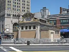 Looking southwest at the head-house. The Fifth Avenue Line station has been demolished
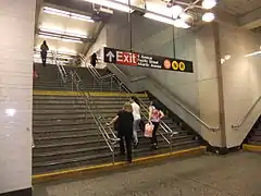 Stair from IRT mezzanine to Fourth Avenue mezzanine and exit, directly below the former headhouse
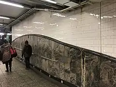
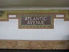 Tilework
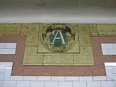 Close-up
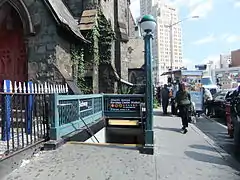 Street stair at the NW corner of Fourth Avenue and Pacific Street
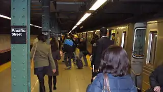 BMT Fourth Avenue southbound platform in 2007 bearing the old Pacific Street name
Hook, Line and Sinker
This is a three-part art installation made by George Trakas for the 2004 renovation of the station.
 "Hook" on a transfer corridor
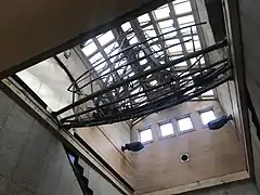 "Line" in the former control house
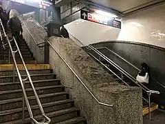 "Sinker" on the double-wide stairway to the northbound 2/3 platform
References
- "Borough of Brooklyn, New York City". Government of New York City. Retrieved April 16, 2020.
- "Brooklyn Bus Map" (PDF). Metropolitan Transportation Authority. October 2020. Retrieved December 1, 2020.
- "Station Developers' Information". Metropolitan Transportation Authority. Retrieved June 13, 2017.
- "Facts and Figures: Annual Subway Ridership 2014–2019". Metropolitan Transportation Authority. 2020. Retrieved May 26, 2020.
- "NPS Focus". National Register of Historic Places. National Park Service. Retrieved January 25, 2012.
- "National Register of Historical Places – NEW YORK (NY), Kings County". nationalregisterofhistoricplaces.com.
- "Brooklyn Joyful Over Its Tunnel". The New York Times. January 10, 1908. Retrieved August 1, 2016.
- Luo, Michael (December 27, 2003). "How to Hold Up a Subway Tunnel: Get a Big Hanger; An Unusual Feat of Engineering Makes the Renovation of a Brooklyn Station Possible". The New York Times. ISSN 0362-4331. Retrieved August 2, 2016.
- Hood, Clifton (1978). "The Impact of the IRT in New York City" (PDF). Historic American Engineering Record. pp. 146–207 (PDF pp. 147–208). Retrieved December 20, 2020.
 This article incorporates text from this source, which is in the public domain.
 - Report of the Public Service Commission for the First District of the State of New York For The Year Ending December 31, 1910. Public Service Commission. 1911.
- "Ten-car Trains in Subway to-day; New Service Begins on Lenox Av. Line and Will Be Extended to Broadway To-morrow". The New York Times. January 23, 1911. ISSN 0362-4331. Retrieved April 5, 2018.
- Annual Report 1964–1965. New York City Transit Authority. 1965.
- "Double Fare to Be Eliminated At 3 Subway Transfer Points". The New York Times. December 16, 1977. ISSN 0362-4331. Retrieved August 2, 2016.
- "www.nycsubway.org: The New York Transit Authority in the 1970s". nycsubway.org. Retrieved August 2, 2016.
- "www.nycsubway.org: The New York Transit Authority in the 1980s". nycsubway.org. Retrieved August 2, 2016.
- Jr, James C. Mckinley (November 15, 1994). "Subway Work In Flushing Is Restored". The New York Times. ISSN 0362-4331. Retrieved August 2, 2016.
- "What's happening? Atlantic Avenue Station Complex B D Q N R 2 3 4 5 Planned Station Rehabilitation". New York City Transit. 1997. Missing or empty
|url=(help) - Flegenheimer, Matt (July 19, 2013). "M.T.A. Considers Selling Rights to Name Subway Stations". The New York Times. ISSN 0362-4331. Retrieved August 2, 2016.
- McShane, Larry (June 24, 2009). "MTA signs off on sweet Atlantic Yards deal Bruce Ratner: Money down drops from $100M to $20M". Daily News. Retrieved June 25, 2009.
- Grynbaum, Michael M. (June 23, 2009). "M.T.A. Sells Naming Rights to Subway Station". The New York Times. Retrieved June 25, 2009.
- "MTA Neighborhood Maps: Downtown Brooklyn and Borough Hall" (PDF). mta.info. Metropolitan Transportation Authority. 2015. Retrieved August 2, 2015.
- "New Subways Add Seven More Miles to BRT on Aug 1". Brooklyn Daily Eagle. July 25, 1920. Retrieved August 19, 2016 – via newspapers.com.
- https://www.youtube.com/watch?v=JR6b5KhAtFA The provision of the never-built connection north of Atlantic Avenue can be seen towards the right, at the 1:13 mark in the video.
- "Through Tube to Coney, 48 Minutes: First Train on Fourth Avenue Route Beats West End Line Eleven Minutes". Brooklyn Daily Eagle. June 22, 1915. Retrieved June 29, 2015.
- "Plans Pushed to Mark Fulton 'L's" Last Run". The Brooklyn Daily Eagle. May 27, 1940. p. 12. Retrieved October 16, 2019 – via Brooklyn Public Library; newspapers.com
 .
. - Under the Sidewalks of New York The Story of the Greatest Subway System By Brian J. Cudahy
- "The Forgotten Brooklyn Elevated Train Crash Of 1923". Stuff Nobody Cares About. Forgotten New York. June 25, 2012. Retrieved March 28, 2015.
- Sparberg, Andrew J. (October 1, 2014). From a Nickel to a Token: The Journey from Board of Transportation to MTA. Fordham University Press. ISBN 9780823261901.
- "Photo of the Week: Elevated Train Station |". www.brooklynhistory.org. Retrieved August 2, 2016.
- "1940: What's Going On". The New York Public Library. Retrieved August 2, 2016.
- "B.M.T. 'El' Lines to Shift Service; City to Close 2 Sections This Week; New Schedules Affect Fulton St., Lexington Ave. and Culver Roads--Free Transfers to the Independent System at Some Stations". The New York Times. May 27, 1940. ISSN 0362-4331. Retrieved August 2, 2016.
Further reading
External links
| Wikimedia Commons has media related to |
nycsubway.org:
- nycsubway.org – Brooklyn IRT: Atlantic Avenue
- nycsubway.org – BMT Brighton Line: Atlantic Avenue
- nycsubway.org – BMT 4th Avenue: Pacific Street
- nycsubway.org – Brooklyn IRT Contract 2 map: (includes current and former track configurations, and provisions for future connections)
- nycsubway.org — Hook, Line, and Sinker Artwork by George Trakas (2004)
- nycsubway.org — Steps to the Subway Artwork by Tim Connor (unknown date)
The Subway Nut:
- The Subway Nut — Pacific Street (D, M, N, R) Pictures
- The Subway Nut — Atlantic Avenue (B, Q) Pictures
- The Subway Nut — Atlantic Avenue (2,3,4,5) Pictures
Google Maps Street View:
- Hanson Place entrance (new station building)
- Williamsburg Savings Bank entrance to Brighton Line on Hanson Place
- Now decorative headhouse
- Pacific Street entrance
- Entrance in front of the Barclays Center
- Entrance from the Atlantic Terminal
- IRT platforms
- BMT Fourth Avenue Line platform
- BMT Brighton Line platform
Others:
- MTA's Arts For Transit — Atlantic Avenue–Pacific Street
- Station Reporter — Atlantic Avenue/Pacific Street Complex
| Eastern Pkwy. Line |
|
|---|---|
| Fourth Ave. Line |
|
| Brighton Line |
|
| |
| Topics |  | |
|---|---|---|
| Lists by county |
| |
| Lists by city | ||
| Other lists | ||
| ||