Aberdeen Parish, New Brunswick
Aberdeen is a civil parish in Carleton County, New Brunswick, Canada,[2] located in the backlands east of the Saint John River. It comprises two local service districts (LSD),[3] both of which are members of the Western Valley Regional Service Commission (WVRSC).[4]
Aberdeen | |
|---|---|
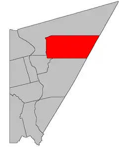 Location within Carleton County, New Brunswick | |
| Coordinates: 46.53°N 67.34°W | |
| Country | |
| Province | |
| County | Carleton |
| Erected | 1863 |
| Area | |
| • Land | 446.20 km2 (172.28 sq mi) |
| Population (2016)[1] | |
| • Total | 781 |
| • Density | 1.8/km2 (5/sq mi) |
| • Pop 2011-2016 | |
| • Dwellings | 347 |
| Time zone | UTC-4 (AST) |
| • Summer (DST) | UTC-3 (ADT) |
The Census subdivision of Aberdeen Parish shares the civil parish's borders.[1]
Origin of name
The parish may have been named in memory of Lord Aberdeen, a former Prime Minister of the United Kingdom who died in 1860.[5]
History
Aberdeen was erected in 1863 from parts of Brighton, Kent, and Peel Parishes.[6] It was centred around the Glassville and Knowlesville grant settlements.
In 1956 the western boundary was altered slightly, transferring a reserved road to Kent Parish.[7] A reserved road is a strip of land reserved to the Crown that runs between blocks of grants.
Boundaries
Aberdeen Parish is bounded on the west by the western side of grants running along the Ketchum Ridge, West Glassville, Old West Glassville, Shikatehawk, and Denney Hill Roads; on the north by the north line of a grant on the Denney Hill Road prolonged to the York County line; on the east by the York County line; and on the south by the southern line of a grant southwest of the intersection of the Black Brook and Ketchum Ridge roads, prolonged to the York County line.[2]
Local service districts
Both LSDs assess for the basic LSD services of fire protection, police services, land use planning, emergency measures, and dog control.[8]
Aberdeen Parish
The local service district of the parish of Aberdeen originally comprised the entire parish.
It was established 23 November 1966[9] to assess for fire protection. Community services were added on 20 December 1967.[10]
Today Aberdeen additionally assesses for community & recreation services.[8] The taxing authority is 207.00 Aberdeen.
LSD advisory committee: Yes. Chair Gailen Allan has sat on the WVRSC board since at least 2015.[11][12][13][14][15][16]
Glassville
Glassville comprises an irregular area around the junction of Route 107, Route 580, and the Centre Glassville Road.
The LSD was established on 18 December 1974 to add street lighting and first aid & ambulance services.[17]
Today Glassville additionally assesses for street lighting.[8] The taxing authority is 223.00 Glassville.
LSD advisory committee: Yes. Chair Brent Pearson has sat on the WVRSC board since at least 2015.[11][12][13][14][15][16]
Communities
Parish population total does not include incorporated municipalities (in bold):
|
|
|
Demographics
PopulationPopulation trend[18]
|
LanguageMother tongue (2016)[1]
|
See also
Notes
- Based on rounded population of 780.
References
- "Census Profile, 2016 Census: Aberdeen, Parish [Census subdivision], New Brunswick". Statistics Canada. Retrieved September 7, 2019.
- "Chapter T-3 Territorial Division Act". Government of New Brunswick. Retrieved 13 November 2020.
- "New Brunswick Regulation 84-168 under the Municipalities Act (O.C. 84-582)". Government of New Brunswick. Retrieved 20 December 2020.
- "Communities in each of the 12 Regional Service Commissions (RSC) / Les communautés dans chacune des 12 Commissions de services régionaux (CSR)" (PDF), Government of New Brunswick, July 2017, retrieved 1 February 2021
- Ganong, William F. (1896). A Monograph of the Place-Nomenclature of the Province of New Brunswick. Royal Society of Canada. p. 216.
- "26 Vic. c. 43 An Act to erect a new Parish in the County of Carleton.". Acts of the General Assembly of Her Majesty's Province of New Brunswick, Passed in the Month of April, 1863. Fredericton: Government of New Brunswick. 1863. pp. 99–101.
- "5 Elizabeth II, 1956, c. 64 An Act to Amend the Territorial Division Act". Acts of the Legislature of New Brunswick Passed During the Session of 1956. Fredericton: Government of New Brunswick. 1956. pp. 137–138.
- "2020 Local Government Statistics for New Brunswick" (PDF). Department of Environment and Local Government. p. 55. Retrieved 20 December 2020.
- "Regulation 66–41 under the Municipalities Act (O. C. 66–968)". The Royal Gazette. Fredericton. 124: 604–605. 21 December 1966.
- "Regulation 67–130 under the Municipalities Act (O. C. 67–1196)". The Royal Gazette. Fredericton. 126: 10–11. 3 January 1968.
- "2015 Annual Report" (PDF). Western Valley Regional Service Commission. 2016. p. 2. Retrieved 27 January 2021.
- "2016 Annual Report" (PDF). Western Valley Regional Service Commission. 2016. p. 2. Retrieved 27 January 2021.
- "2017 Annual Report" (PDF). Western Valley Regional Service Commission. 2016. p. 2. Retrieved 27 January 2021.
- "2018 Annual Report" (PDF). Western Valley Regional Service Commission. 2016. p. 2. Retrieved 27 January 2021.
- "2019 Annual Report" (PDF). Western Valley Regional Service Commission. 2016. p. 2. Retrieved 27 January 2021.
- "Board of Directors Meeting: Minutes of Meeting" (PDF). Western Valley Regional Service Commission. 3 September 2020. Retrieved 26 January 2021.
- "Regulation 74–222 under the Municipalities Act (O. C. 74–1063)". The Royal Gazette. Fredericton. 133: 15. 1 January 1975.
- Statistics Canada: 1951, 1996, 2001, 2006, 2011 census
Places adjacent to Aberdeen Parish, New Brunswick | ||||||||||
|---|---|---|---|---|---|---|---|---|---|---|
| ||||||||||
| Subdivisions | |
|---|---|
| Cities | |
| Counties | |
| |
