Douglas Parish, New Brunswick
Douglas is a civil parish in York County, New Brunswick, Canada.[2]
Douglas | |
|---|---|
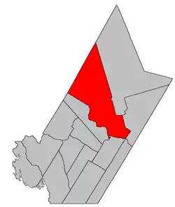 Location within York County, New Brunswick. | |
| Coordinates: 45.98°N 66.7325°W | |
| Country | |
| Province | |
| County | York |
| Erected | 1824 |
| Area | |
| • Land | 1,446.95 km2 (558.67 sq mi) |
| Population (2016)[1] | |
| • Total | 6,154 |
| • Density | 4.3/km2 (11/sq mi) |
| • Change 2011-2016 | |
| • Dwellings | 2,546 |
| Time zone | UTC-4 (AST) |
| • Summer (DST) | UTC-3 (ADT) |
For governance purposes it is divided between the city of Fredericton and the local service districts of Estey's Bridge and the parish of Douglas,[3] all of which are members of Regional Service Commission 11 (RSC11).[4] Douglas Parish includes the special service areas of Carlisle Road and Lower Douglas.
Origin of name
The parish was named in honour of Sir Howard Douglas, Lieutenant Governor of New Brunswick at the time.[5]
History
Douglas was erected in 1824 from Queensbury and Saint Marys Parish.[6]
In 1835 the boundary with Queensbury was moved upriver, adding four grants to Douglas.[7]
In 1837 part of the interior of Douglas was included in the newly erected Stanley Parish.[8]
In 1838 Stanley was dissolved, implicitly returning area to Douglas.[9]
In 1842 the boundary with Queensbury was extended to Southampton Parish, adding part of Queensbury to Douglas.[10]
In 1845 Madam Keswick Island (Keswick and Mitchell Islands) was transferred to Douglas from Kingsclear Parish.[11]
In 1847 part of the interior was included in the newly erected Stanley Parish,[12] which had different boundaries than the previous version.
In 1850 Douglas took Upper and Lower Shores Islands from Kingsclear and was extended back to the county line.[13]
In 1867 part of Sugar Island was transferred from Kingsclear.[14]
In 1869 part of Douglas along the length of its southwestern boundary was erected as Bright Parish.[15] The Sugar Island portion of Douglas was returned to Kingsclear.[16]
In 1903 Nevers Island and the northern part of Sugar Island were transferred to Douglas from Kingsclear.[17]
In 1973 Nevers Island was returned to Kingsclear.[18]
Delineation
Douglas Parish is defined in the Territorial Division Act[2] as being bounded:
- South and southeast by the Saint John River and the City of Fredericton; west by a line commencing at the mouth of the Keswick River; thence following the various courses of the said Keswick River up to the mouth of the Howard Brook; thence by the magnet of the year one thousand eight hundred and sixty-nine north forty degrees west till it strikes the County line; northwest by the County line, and east by Stanley and Saint Marys Parishes, including Upper Shores, Lower Shores, Mitchells, Merrithews[lower-alpha 1] and Keswick Islands, and the north range of lots, comprising lots number one to number nine, inclusive, and number thirty-seven to number seventy-one, inclusive, on Sugar Island.
Communities
Parish population total does not include incorporated municipalities (in bold):
|
|
|
Bodies of water
Bodies of water at least partly in the parish
- Saint John River
Demographics
PopulationPopulation trend[19][20][21][1]
|
LanguageMother tongue (2016)[1]
|
See also
Notes
- Officially a former name for Lower Shores Island, this may actually refer to one of the small islands between Lower Shores and Upper Shores Islands.
References
- "Census Profile, 2016 Census Douglas, Parish [Census subdivision], New Brunswick". Statistics Canada. Retrieved October 8, 2019.
- "Chapter T-3 Territorial Division Act". Government of New Brunswick. Retrieved 13 November 2020.
- "New Brunswick Regulation 84-168 under the Municipalities Act (O.C. 84-582)". Government of New Brunswick. Retrieved 25 July 2020.
- "Communities in each of the 12 Regional Service Commissions (RSC) / Les communautés dans chacune des 12 Commissions de services régionaux (CSR)" (PDF), Government of New Brunswick, July 2017, retrieved 2 February 2021
- Ganong, William F. (1896). A Monograph of the Place-Nomenclature of the Province of New Brunswick. Royal Society of Canada. p. 231.
- "5 Geo. IV c. 27 An Act for erecting a part of the Parishes of Saint Mary and Queensbury, in the County of York, into a separate and distinct Town or Parish.". Acts of the General Assembly of His Majesty's Province of New-Brunswick, Passed in the Year 1824. Fredericton: Government of New Brunswick. 1824. pp. 63–65.
- "5 Wm. IV c. 32 An Act to alter the division line between the Parishes of Douglas and Queensbury in the County of York.". Acts of the General Assembly of His Majesty's Province of New-Brunswick, Passed in the Year 1835. Fredericton: Government of New Brunswick. 1835. pp. 40–41.
- "7 Wm. IV c. 25 An Act for erecting a part of the Parishes of Saint Mary's and Douglas in the County of York, into a separate and distinct Town or Parish.". Acts of the General Assembly of His Majesty's Province of New Brunswick, Passed in the Year 1837. Fredericton: Government of New Brunswick. 1837. pp. 82–83.
- "1 Vic. c. 34 An Act to repeal an Act, intituled 'An Act for erecting a part of the Parishes of Saint Mary's and Douglas in the County of York, into a separate and distinct Town or Parish.'". Acts of the General Assembly of Her Majesty's Province of New Brunswick, Passed in the Year 1838. Fredericton: Government of New Brunswick. 1838. pp. 77–78.
- "5 Vic. c. 11 An Act to alter the Division Line of the Parishes of Douglas and Queensbury, in the County of York.". Acts of the General Assembly of Her Majesty's Province of New Brunswick, Passed in the Year 1842. Fredericton: Government of New Brunswick. 1842. p. 10.
- "8 Vic. c. 66 An Act to annex the Madam Kiswick Island to the Parish of Douglas, in the County of York.". Acts of the General Assembly of Her Majesty's Province of New Brunswick, Passed in the Year 1845. Fredericton: Government of New Brunswick. 1845. p. 46.
- "9 Vic. c. 38 An Act for erecting a part of the Parishes of Saint Mary's and Douglas, in the County of York, into a separate and distinct Town or Parish.". Acts of the General Assembly of Her Majesty's Province of New Brunswick, Passed in the Year 1846. Fredericton: Government of New Brunswick. 1846. pp. 41–42.
- "13 Vic. c. 51 An Act to consolidate all the Laws now in force for the division of the Province into Counties, Towns and Parishes.". Acts of the General Assembly of Her Mjaesty's Province of New Brunswick, Passed in the Year 1850. Fredericton: Government of New Brunswick. 1850. pp. 142–152, 145–149. Book was poorly proofread, resulting in title typo and reuse of page numbers 145–152.
- "30 Vic. c. 30 An Act to alter and amend Chapter 1, Title I, of the Revised Statutes, 'Of the Division of the Province into Counties and Parishes.'.". Acts of the General Assembly of Her Majesty's Province of New Brunswick, Passed in the Month of June 1867. Fredericton: Government of New Brunswick. 1867. p. 53.
- "32 Vic. c. 49 An Act to erect part of the Parish of Douglas, in the County of York, into a separate Town or Parish.". Acts of the General Assembly of Her Majesty's Province of New Brunswick. Passed in the Month of April 1869. Fredericton: Government of New Brunswick. 1869. pp. 94–95.
- "32 Vic. c. 79 An Act relating to certain Islands in the River Saint John, lying in front of the Parishes of Kingsclear and Douglas, in the County of York.". Acts of the General Assembly of Her Majesty's Province of New Brunswick. Passed in the Month of April 1869. Fredericton: Government of New Brunswick. 1869. pp. 136–137.
- "Chapter 2. Respecting the Division of the Province into Counties, Towns, and Parishes.". The Consolidated Statutes of New Brunswick, 1903. Vol. I. Fredericton: Government of New Brunswick. 1903. pp. 17–54.
- "Chapter T-3 Territorial Division Act". Revised Statutes of New Brunswick 1973 Volume IV. Fredericton: Government of New Brunswick. 1973. pp. 1–70. The original printed version is cited separately to distinguish it from the edited version available online.
- Statistics Canada: 1996, 2001, 2006 census
- 2006 Statistics Canada Community Profile: Douglas Parish, New Brunswick
- 2011 Statistics Canada Census Profile: Douglas Parish, New Brunswick
External links
Places adjacent to Douglas Parish, New Brunswick | |
|---|---|
| Subdivisions | |
|---|---|
| Cities | |
| Counties | |
| |