Kent Parish, New Brunswick
Kent is a civil parish in the northeastern corner of Carleton County, New Brunswick, Canada.[2] It comprises one village, two local service districts, and part of one town, all of which are members of the Western Valley Regional Service Commission (WVRSC).[3]
Kent | |
|---|---|
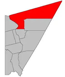 Location within Carleton County, New Brunswick. | |
| Coordinates: 46.665°N 67.1725°W | |
| Country | |
| Province | |
| County | Carleton |
| Erected | 1821 |
| Area | |
| • Land | 840.20 km2 (324.40 sq mi) |
| Population (2016)[1] | |
| • Total | 2,153 |
| • Density | 2.6/km2 (7/sq mi) |
| • Pop 2011-2016 | |
| • Dwellings | 953 |
| Time zone | UTC-4 (AST) |
| • Summer (DST) | UTC-3 (ADT) |
The Census subdivision of Kent Parish includes all of the civil parish except the two municipalities.[1]
Origin of name
The parish was named in memory of the Duke of Kent,[4] father of Queen Victoria.
History
Kent was erected in 1821 within York County from unassigned lands north of Wakefield Parish.[5] At the time it included most of modern Madawaska County and Victoria County, the western part of Restigouche County, and parts of Maine and Quebec then claimed by New Brunswick.
In 1833 Kent was divided into five parishes, removing all of the parish west of the Saint John River and all of the parish north of a line due east from its current starting point on the Saint John.[6]
In 1850 the northern line was moved south, now running due east from the mouth of the River de Chute.[7]
In 1863 the southeastern part of Kent was included in the newly erected Aberdeen Parish.[8]
In 1864 the northern boundary of Carleton County east of the Saint John River was changed to its modern position.[9] the boundary between Kent and Perth Parish was not addressed, leaving part of Perth in Carleton County.
In 1877 the northern boundary of Kent was explicitly changed to match the county line.[10]
Boundaries
Kent Parish is bounded on the west by the Saint John River; on the north by Victoria County; and on the south and east by a line running due east from opposite the mouth of Whitemarsh Brook to a reserved road along the western line of grants on the Ketchum Ridge Road, then north along reserved roads on the western side of land grants along the Ketchum Ridge, West Glassville, Old West Glassville, Shikatehawk, and Denney Hill Roads to the north line of a grant south of the junction of the Denney Hill and Burke Roads, running briefly northeasterly to the northwestern corner of a lot west of the end of Kenneth Road before turning due east and running to the York County line, then running northeast along York County until it meets the Victoria County line. is defined in the Territorial Division Act[2] as being bounded:
Municipalities
The town of Florenceville-Bristol occupies the southwestern corner of the parish along the Saint John River.[11]
The village of Bath comprises and irregular area along the Saint John River south of the Monquart Stream.[11]
Local service districts
Both LSDs assess for the basic LSD services of fire protection, police services, land use planning, emergency measures, and dog control.[12]
Kent Parish
The local service district of the parish of Kent originally comprised all of the parish outside the villages of Bath and Bristol.
It was established on 23 November 1966 to assess for fire protection following the abolition of county governments by the new Municipalities Act.[13] Community services were added on 20 December 1967[14] and non-fire related rescue on 23 October 2015.[15]
Today the LSD additionally assesses for community & recreation services.[12] The taxing authority is 209.00 Kent.
LSD advisory committee: Yes, as of September 2017.[16] Chair Alma Kilfoil served on the WVRSC board from at least 2015 until her resignation on 30 September 2017.[17][18][16]
Upper Kent
Upper Kent comprises a narrow strip along the Saint John River around the community of Upper Kent.
It was established on 27 June 1968[19] to add street lighting, community planning, and garbage collection. Non-fire related rescue was added on 23 October 2015.[15]
Today Upper Kent additionally assesses for street lighting and community & recreation services.[12] The taxing authority is 220.00 Upper Kent.
LSD advisory committee: unknown
Communities
Parish population total does not include incorporated municipalities (in bold):
|
|
|
Bodies of water
Bodies of water at least partly in the parish
- Saint John River
Demographics
Population
|
LanguageMother tongue (2016)[1]
|
See also
References
- "Census Profile, 2016 Census Kent, Parish [Census subdivision], New Brunswick". Statistics Canada. Retrieved September 6, 2019.
- "Chapter T-3 Territorial Division Act". Government of New Brunswick. Retrieved 13 November 2020.
- "Communities in each of the 12 Regional Service Commissions (RSC) / Les communautés dans chacune des 12 Commissions de services régionaux (CSR)" (PDF), Government of New Brunswick, July 2017, retrieved 1 February 2021
- Ganong, William F. (1896). A Monograph of the Place-Nomenclature of the Province of New Brunswick. Royal Society of Canada. p. 243. Ganong cites page 100 of Noticia of New Brunswick as his source.
- "2 Geo. IV c. 22 An Act to erect the upper part of the County of York, into a Town or Parish.". Acts of the General Assembly of His Majesty's Province of New-Brunswick, Passed in the Year 1821. Fredericton: Government of New Brunswick. 1821. p. 43.
- "3 Wm. IV c. 17 An Act to divide the Parish of Kent, in the County of Carleton, into Five Towns or Parishes.". Acts of the General Assembly of His Majesty's Province of New Brunswick, Passed in the Year 1833. Fredericton: Government of New Brunswick. 1833. pp. 114–115.
- "13 Vic. c. 51 An Act to consolidate all the Laws now in force for the division of the Province into Counties, Towns and Parishes.". Acts of the General Assembly of Her Mjaesty's Province of New Brunswick, Passed in the Year 1850. Fredericton: Government of New Brunswick. 1850. pp. 142–152, 145–149. Book was poorly proofread, resulting in title typo and reuse of page numbers 145–152.
- "26 Vic. c. 43 An Act to erect a new Parish in the County of Carleton.". Acts of the General Assembly of Her Majesty's Province of New Brunswick, Passed in the Month of April, 1863. Fredericton: Government of New Brunswick. 1863. pp. 99–101.
- "27 Vic. c. 27 An Act to define the Boundaries between the Counties of Carleton and Victoria.". Acts of the General Assembly of Her Majesty's Province of New Brunswick, Passed in the Month of April 1864. Fredericton: Government of New Brunswick. 1864. pp. 50–51.
- "Chapter 2 The Division of the Province into Counties, Towns, and Parishes.". The Consolidated Statutes of New Brunswick. Fredericton: Government of New Brunswick. 1877. pp. 56–85.
- "New Brunswick Regulation 85-6 under the Municipalities Act (O.C. 85-45)". Government of New Brunswick. Retrieved 30 December 2020.
- "2020 Local Government Statistics for New Brunswick" (PDF). Department of Environment and Local Government. p. 55. Retrieved 30 December 2020.
- "Regulation 66–41 under the Municipalities Act (O. C. 66–968)". The Royal Gazette. Fredericton. 124: 604–605. 21 December 1966.
- "Regulation 67–130 under the Municipalities Act (O. C. 67–1196)". The Royal Gazette. Fredericton. 126: 10–11. 3 January 1968.
- "Regulation 2015-56 under the Municipalities Act (O. C. 2015-246)" (PDF). The Royal Gazette. Fredericton. 173: 1320. 4 November 2015. ISSN 1714-9428.
- "2017 Annual Report" (PDF). Western Valley Regional Service Commission. 2016. p. 2. Retrieved 27 January 2021.
- "2015 Annual Report" (PDF). Western Valley Regional Service Commission. 2016. p. 2. Retrieved 27 January 2021.
- "2016 Annual Report" (PDF). Western Valley Regional Service Commission. 2016. p. 2. Retrieved 27 January 2021.
- "Regulation 68–64 under the Municipalities Act (O. C. 68–592)". The Royal Gazette. Fredericton. 126: 407–408. 24 July 1968.
- Statistics Canada: 1996, 2001, 2006 census
- 2011 Statistics Canada Census Profile: Kent Parish, New Brunswick
External links
Places adjacent to Kent Parish, New Brunswick | |
|---|---|
| Subdivisions | |
|---|---|
| Cities | |
| Counties | |
| |