Abriaquí Fault
The Abriaquí Fault (Spanish: Falla de Abriaquí) is an oblique thrust fault in the department of Antioquia in northwestern Colombia. The fault has a total length of 33.8 kilometres (21.0 mi) and runs along an average northwest to southeast strike of 311 ± 2 in the Western Ranges of the Colombian Andes.
| Abriaquí Fault | |
|---|---|
| Falla de Abriaquí | |
 | |
| Etymology | Abriaquí |
| Coordinates | 06°40′09″N 76°06′38″W |
| Country | |
| Region | Andean |
| State | Antioquia |
| Characteristics | |
| Range | Western Ranges, Andes |
| Part of | Andean oblique faults |
| Length | 33.8 km (21.0 mi) |
| Strike | 311 ± 2 |
| Dip | Northeast |
| Dip angle | High |
| Displacement | 0.2–1 mm (0.0079–0.0394 in)/yr |
| Tectonics | |
| Plate | North Andean |
| Status | Inactive |
| Type | Oblique thrust fault |
| Movement | Reverse sinistral |
| Age | Quaternary |
| Orogeny | Andean |
Description
The Abriaquí Fault parallels the Cañasgordas Fault to the south, cutting Cretaceous oceanic volcanic rocks as well as Tertiary and Cretaceous sedimentary rocks. The fault has a well defined fault trace with scarps, saddles, and deflected streams. The slip rate is estimated at 0.2 to 1 millimetre (0.0079 to 0.0394 in) per year deduced from displaced geomorphologic features.[1]
References
- Paris et al., 2000, p.18
Bibliography
- Paris, Gabriel; Michael N. Machette; Richard L. Dart, and Kathleen M. Haller. 2000a. Map and Database of Quaternary Faults and Folds in Colombia and its Offshore Regions, 1–66. USGS. Accessed 2017-09-18.
Maps
- Paris, Gabriel; Michael N. Machette; Richard L. Dart, and Kathleen M. Haller. 2000b. Map of Quaternary Faults and Folds of Colombia and Its Offshore Regions, 1. USGS. Accessed 2017-09-18.
Further reading
- Page, W.D. 1986. Seismic geology and seismicity of Northwestern Colombia, 1–200. San Francisco, California, Woodward-Clyde Consultants Report for ISA and Integral Ltda., Medellín.
| Tectonic plates | 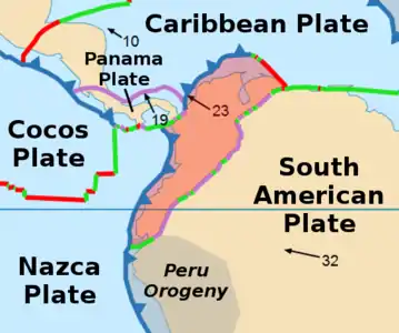 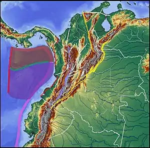 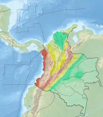 | ||||||||||
|---|---|---|---|---|---|---|---|---|---|---|---|
| Terranes |
| ||||||||||
| Terrane-bounding fault systems |
| ||||||||||
| Intraterrane faults |
| ||||||||||
| Major earthquakes | |||||||||||
| Orogenies |
| ||||||||||
| Other topics | |||||||||||
| Sources |
| ||||||||||
This article is issued from Wikipedia. The text is licensed under Creative Commons - Attribution - Sharealike. Additional terms may apply for the media files.
