Abriaquí
Abriaquí is a town and municipality in Antioquia Department, Colombia.
Abriaquí | |
|---|---|
Municipality and town | |
 Flag | |
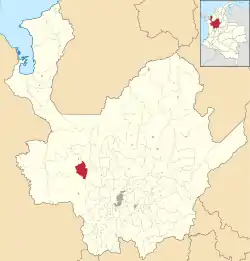 Location of the municipality and town of Abriaquí in the Antioquia Department of Colombia | |
 Abriaquí Location in Colombia | |
| Coordinates: 6°38′N 76°04′W | |
| Country | |
| Department | |
| Subregion | Western |
| Area | |
| • Total | 290 km2 (110 sq mi) |
| Population (2002) | |
| • Total | 4,200 |
| Time zone | UTC-5 (Colombia Standard Time) |
Climate
Abriaquí has a subtropical highland climate (Cfb) with heavy rainfall year-round.
| Climate data for Abriaquí | |||||||||||||
|---|---|---|---|---|---|---|---|---|---|---|---|---|---|
| Month | Jan | Feb | Mar | Apr | May | Jun | Jul | Aug | Sep | Oct | Nov | Dec | Year |
| Average high °C (°F) | 23.3 (73.9) |
23.8 (74.8) |
24.2 (75.6) |
24.0 (75.2) |
23.2 (73.8) |
23.1 (73.6) |
23.7 (74.7) |
23.3 (73.9) |
22.7 (72.9) |
22.3 (72.1) |
22.3 (72.1) |
22.9 (73.2) |
23.2 (73.8) |
| Daily mean °C (°F) | 17.9 (64.2) |
18.3 (64.9) |
18.8 (65.8) |
18.9 (66.0) |
18.4 (65.1) |
18.3 (64.9) |
18.4 (65.1) |
18.1 (64.6) |
17.8 (64.0) |
17.8 (64.0) |
17.6 (63.7) |
17.7 (63.9) |
18.2 (64.7) |
| Average low °C (°F) | 12.6 (54.7) |
12.9 (55.2) |
13.5 (56.3) |
13.8 (56.8) |
13.7 (56.7) |
13.5 (56.3) |
13.2 (55.8) |
13.0 (55.4) |
13.0 (55.4) |
13.3 (55.9) |
13.0 (55.4) |
12.5 (54.5) |
13.2 (55.7) |
| Average rainfall mm (inches) | 92.4 (3.64) |
108.7 (4.28) |
151.1 (5.95) |
240.9 (9.48) |
261.9 (10.31) |
187.4 (7.38) |
141.5 (5.57) |
160.8 (6.33) |
218.1 (8.59) |
270.0 (10.63) |
235.0 (9.25) |
153.8 (6.06) |
2,221.6 (87.47) |
| Average rainy days | 11 | 12 | 16 | 21 | 22 | 17 | 15 | 16 | 20 | 24 | 22 | 15 | 211 |
| Source 1: IDEAM[1] | |||||||||||||
| Source 2: Climate-Data.org[2] | |||||||||||||
References
- "Data". www.ideam.gov.co. Retrieved 2020-09-01.
- "Climate: Abriaquí". Climate-Data.org. Retrieved September 1, 2020.
Capital: Medellín | |||||||||||||||||||
| Regions and municipalities |
| ||||||||||||||||||
| Related topics | |||||||||||||||||||
This article is issued from Wikipedia. The text is licensed under Creative Commons - Attribution - Sharealike. Additional terms may apply for the media files.