Allenview, Queensland
Allenview is a rural locality in the Scenic Rim Region, Queensland, Australia.[2] In the 2016 census, Allenview had a population of 184 people.[1]
| Allenview Scenic Rim Region, Queensland | |||||||||||||||
|---|---|---|---|---|---|---|---|---|---|---|---|---|---|---|---|
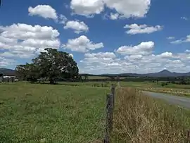 Brookland Road, 2016 | |||||||||||||||
 Allenview | |||||||||||||||
| Coordinates | 27.9119°S 152.9166°E | ||||||||||||||
| Population | 184 (2016 census)[1] | ||||||||||||||
| • Density | 4.220/km2 (10.93/sq mi) | ||||||||||||||
| Postcode(s) | 4285 | ||||||||||||||
| Area | 43.6 km2 (16.8 sq mi) | ||||||||||||||
| Time zone | AEST (UTC+10:00) | ||||||||||||||
| Location |
| ||||||||||||||
| LGA(s) | Scenic Rim Region | ||||||||||||||
| State electorate(s) | Scenic Rim | ||||||||||||||
| Federal Division(s) | Wright | ||||||||||||||
| |||||||||||||||
Geography
Most of the eastern boundary is marked by the Logan River where irrigated agriculture is the predominate land use. The North Coast railway line also marks a section of the eastern boundary. In the west is the Wyaralong Dam and Teviot Brook which aligns with a small section of the western boundary.
Allan's Creek (as it is currently spelled) crosses the railway line at the intersection of three present-day localities: Allenview, Bromelton and Gleneagle.[3]
History
Brooklands State School opened on 3 October 1910 and closed on 1965.[4] It was located at approximately 637 Brookland Road (27.8738°S 152.9331°E).[5][6]
Allen's Creek Provisional School opened on 4 October 1927 and closed on 18 September 1929. It was a railway camp school and provided schooling for children of workers building the Sydney–Brisbane rail corridor.[7]
In the 2016 census, Allenview had a population of 184 people.[1]
Demographics
Allenview has a population of 184 at the 2016 census. The locality contains 68 households, in which 51.1% of the population are males and 48.9% of the population are females with a median age of 43, 5 above the national average. The average weekly household income is $1,724, $286 above the national average.[1]
Education
There are no schools in Allenview. The nearest primary schools are Woodhill State School in neighbouring Woodhill to the east and Gleneagle State School in neighbouring Gleneagle to the south-east. The nearest secondary schools are Flagstone State College in Flagstone to the north and Beaudesert State High School in Beaudesert to the south-east.[3]
References
- Australian Bureau of Statistics (27 June 2017). "Allenview (SSC)". 2016 Census QuickStats. Retrieved 20 October 2018.

- "Allenview – locality in Scenic Rim Region (entry 45105)". Queensland Place Names. Queensland Government. Retrieved 5 November 2019.
- "Queensland Globe". State of Queensland. Retrieved 17 October 2020.
- Queensland Family History Society (2010), Queensland schools past and present (Version 1.01 ed.), Queensland Family History Society, ISBN 978-1-921171-26-0
- "Flinders" (Map). Queensland Government. 1927. Archived from the original on 21 June 2020. Retrieved 28 January 2021.
- "Flinders" (Map). Queensland Government. 1954. Archived from the original on 29 April 2020. Retrieved 28 January 2021.
- Queensland Family History Society (2010), Queensland schools past and present (Version 1.01 ed.), Queensland Family History Society, ISBN 978-1-921171-26-0
External links
![]() Media related to Allenview, Queensland at Wikimedia Commons
Media related to Allenview, Queensland at Wikimedia Commons