Coleyville, Queensland
Coleyville is a rural locality in the Scenic Rim Region, Queensland, Australia.[2] In the 2016 census, Coleyville had a population of 185 people.[1]
| Coleyville Queensland | |||||||||||||||
|---|---|---|---|---|---|---|---|---|---|---|---|---|---|---|---|
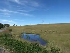 Fields along Rosewood Warrill View Road, 2015 | |||||||||||||||
 Coleyville | |||||||||||||||
| Coordinates | 27.8036°S 152.5888°E | ||||||||||||||
| Population | 185 (2016 census)[1] | ||||||||||||||
| • Density | 4.660/km2 (12.07/sq mi) | ||||||||||||||
| Postcode(s) | 4307 | ||||||||||||||
| Elevation | 65 m (213 ft) | ||||||||||||||
| Area | 39.7 km2 (15.3 sq mi) | ||||||||||||||
| Time zone | AEST (UTC+10:00) | ||||||||||||||
| LGA(s) | Scenic Rim Region | ||||||||||||||
| State electorate(s) | Scenic Rim | ||||||||||||||
| Federal Division(s) | Wright | ||||||||||||||
| |||||||||||||||
Geography
In the east of Coleyville elevations rise towards the summit of Mount Walker. Mount Walker Creek, a tributary of Warrill Creek, is the main waterway in the locality. The land, like most parts of the Fassifern Valley, is mainly used for agricultural purposes.
History
The locality is named after settlers Philemon and Sylvia Coley. in 1866 the couple emigrated from Halesowen, Worcestershire, England, and settled in the area.[2]
At the 2011 Australia Census Coleyville and surrounds recorded a population of 392.[3]
Demographics
Coleyville has a population of 185 at the 2016 census. The locality contains 55 households, in which 50.0% of the population are males and 50.0% of the population are females with a median age of 45, 7 years above the national average. The average weekly household income is $1,812, $374 above the national average.
4.8% of Coleyville's population is either of Aborigional or Torres Strait Islander descent. 65.9% of the population aged 15 or over is either registered or de facto married, while 33.1% of the population is not married. 31.2% of the population is currently attending some form of a compulsory education. The most common nominated ancestries were Australian (31.3%), English (31.3%) and German (13.6%), while the most common country of birth was Australia (85.6%), and the most commonly spoken language at home was English (87.4%). The most common nominated religions were No religion (19.9%), Anglican (18.8%) and the Churches of Christ (16.5%). The most common occupation was a manager (19.2%) and the majority/plurality of residents worked 40 or more hours per week (52.9%).<ref name=Census2016>
References
- Australian Bureau of Statistics (27 June 2017). "Coleyville (SSC)". 2016 Census QuickStats. Retrieved 20 October 2018.

- "Coleyville – locality in Scenic Rim Region (entry 45130)". Queensland Place Names. Queensland Government. Retrieved 5 November 2019.
- Australian Bureau of Statistics (31 October 2012). "Coleyville (State Suburb)". 2011 Census QuickStats. Retrieved 10 August 2014.