Bairin Left Banner
Baarin Left Banner (Mongolian: ᠪᠠᠭᠠᠷᠢᠨ ᠵᠡᠭᠦᠨ ᠬᠣᠰᠢᠭᠤ Baɣarin Jegün qosiɣu; Chinese: 巴林左旗; pinyin: Bālín Zuǒ Qí), or Bairin, is a banner of eastern Inner Mongolia, China, under the administration of the prefecture-level city of Chifeng.[1][2] The banner spans an area of 6,644 square kilometers,[2] and as of 2018, has a population of 340,020.[3] Baarin Mongols live here. The distinct Mongolian dialect of this region is called Baarin. It is located at the intersection of two national highways: China National Highway 303 and 305.
Bairin Left Banner
巴林左旗 • ᠪᠠᠭᠠᠷᠢᠨᠵᠡᠭᠦᠨᠬᠣᠰᠢᠭᠤ | |
|---|---|
 Lindong South Pagoda from the ruins of Shangjing | |
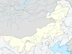 Baarin Zuoqi Location in Inner Mongolia | |
| Coordinates (Bairin Left Banner government): 43°57′39″N 119°21′48″E | |
| Country | People's Republic of China |
| Region | Inner Mongolia |
| Prefecture-level city | Chifeng |
| Banner seat | Lindong |
| Area | |
| • Total | 6,644 km2 (2,565 sq mi) |
| Elevation | 484 m (1,588 ft) |
| Population | |
| • Total | 340,020 |
| • Density | 51/km2 (130/sq mi) |
| Time zone | UTC+8 (China Standard) |
| Postal code | 025450 |
| Area code(s) | 0476 |
History

Balin Left Banner has a long history, with archaeological digs dating to the 40th Century BC.[4] Archaeological relics uncovered in the banner are believed to include those of the Hongshan culture and the Fuhe culture.[4]
Around the time China was undergoing the Warring States period, the area of Bairin Left Banner was home to the Shanrong and Donghu people.[4] Later, the area would be home to the Wuhuan and the Xianbei.[4]
During the first few centuries of the Common Era, the area was home to the Khitan people and the Kumo Xi.[4]
In 918 CE, the capital of the Khitan-led Liao Dynasty, Shangjing (Chinese: 上京), was built in present-day Bairin Left Banner.[4] From 918 CE to 938 it was known as Huangdu (皇都).[4]
During the time of the Republic of China, many Han Chinese began moving to the area.[4]
On March 1, 1933, the banner, then known as Lindong County (林东县; 林東縣), was invaded by Japanese forces, who occupied the county until August 10, 1945.[4]
On June 1, 1946, the Communist Party of China established a local government in the area, the Lindong Administrative Committee (林东行政委员会; 林東行政委員會).[4]
From the establishment of the People's Republic of China throughout the early 1980s, the area underwent numerous administrative reorganizations, culminating in October 1983, with the placement of the Bairin Left Banner under the prefecture-level city of Chifeng.[4]
Climate
Baarin Left Banner has a continental, semi-arid climate (Köppen BSk), with very cold and dry winters, hot, somewhat humid summers, and strong winds, especially in spring. The monthly 24-hour average temperature ranges from −13.1 °C (8.4 °F) in January to 22.8 °C (73.0 °F) in July, with the annual mean at 5.89 °C (42.6 °F). The annual precipitation is approximately 370 millimetres (14.6 in), with more than half of it falling in July and August alone. Due to the aridity and elevation, diurnal temperature variation often exceeds 15 °C (27 °F) in spring, averaging 13.7 °C (24.7 °F) annually. There are 2,934 hours of bright sunshine annually, with each of the winter months having over 70% of the possible total, and this percentage falling to 52 in July.
| Climate data for Baarin Left Banner (1981−2010 normals) | |||||||||||||
|---|---|---|---|---|---|---|---|---|---|---|---|---|---|
| Month | Jan | Feb | Mar | Apr | May | Jun | Jul | Aug | Sep | Oct | Nov | Dec | Year |
| Average high °C (°F) | −6.1 (21.0) |
−1.7 (28.9) |
5.4 (41.7) |
15.7 (60.3) |
22.9 (73.2) |
27.0 (80.6) |
28.5 (83.3) |
27.6 (81.7) |
22.5 (72.5) |
14.4 (57.9) |
3.1 (37.6) |
−4.2 (24.4) |
12.9 (55.3) |
| Daily mean °C (°F) | −13.1 (8.4) |
−9.2 (15.4) |
−1.9 (28.6) |
8.1 (46.6) |
15.8 (60.4) |
20.6 (69.1) |
22.8 (73.0) |
21.0 (69.8) |
14.7 (58.5) |
6.7 (44.1) |
−4.0 (24.8) |
−10.8 (12.6) |
5.9 (42.6) |
| Average low °C (°F) | −18.9 (−2.0) |
−15.9 (3.4) |
−9.2 (15.4) |
0.2 (32.4) |
7.7 (45.9) |
13.6 (56.5) |
17.0 (62.6) |
14.7 (58.5) |
7.2 (45.0) |
−0.3 (31.5) |
−9.8 (14.4) |
−16.4 (2.5) |
−0.8 (30.5) |
| Average precipitation mm (inches) | 1.1 (0.04) |
1.5 (0.06) |
4.6 (0.18) |
10.7 (0.42) |
24.1 (0.95) |
77.2 (3.04) |
118.1 (4.65) |
84.5 (3.33) |
31.2 (1.23) |
11.6 (0.46) |
4.3 (0.17) |
0.9 (0.04) |
369.8 (14.57) |
| Average precipitation days (≥ 0.1 mm) | 1.2 | 1.6 | 2.9 | 3.4 | 6.5 | 12.6 | 13.1 | 11.3 | 7.9 | 3.7 | 2.0 | 1.5 | 67.7 |
| Average relative humidity (%) | 47 | 42 | 39 | 35 | 38 | 56 | 68 | 69 | 59 | 48 | 49 | 49 | 50 |
| Mean monthly sunshine hours | 216.4 | 226.2 | 271.2 | 267.6 | 290.4 | 261.7 | 241.3 | 252.8 | 253.8 | 247.3 | 206.1 | 199.2 | 2,934 |
| Percent possible sunshine | 76 | 77 | 74 | 67 | 64 | 57 | 52 | 59 | 68 | 73 | 71 | 72 | 66 |
| Source: China Meteorological Administration (precipitation days and sunshine 1971–2000)[5][6] | |||||||||||||
Administrative divisions
Bairin Left Banner is divided into 7 towns, 2 sumu, and 2 townships.[7] The banner's seat of government is the town of Lindong.[2]
The banner's 7 towns are Lindong, Longchang, Shisan'aobao, Biliutai, Fuhe, Baiyinwula, and Halahada.[7]
The banner's 2 sumu are Chaganhada and Wulandaba.[7]
The banner's 2 townships are Sanshan Township and Huajialaga Township.[7]
References
- 2019年统计用区划代码 (in Chinese). National Bureau of Statistics of China. 2019. Archived from the original on 2020-08-12. Retrieved 2020-08-12.
- 巴林左旗概况地图. xzqh.org (in Chinese). 2013-04-09. Archived from the original on 2020-08-12. Retrieved 2020-08-12.
- 中国 | 人口数:内蒙古:赤峰市:巴林左旗 | 经济指标. www.ceicdata.com (in Chinese). Archived from the original on 2020-08-12. Retrieved 2020-08-12.
- 巴林左旗历史文化. www.blzq.gov.cn (in Chinese). Chifeng Balin Left Banner People's Government. 2020-02-29. Archived from the original on 2020-07-22. Retrieved 2020-08-12.
- 中国气象数据网 - WeatherBk Data (in Chinese). China Meteorological Administration. Retrieved 2020-04-15.
- 中国地面国际交换站气候标准值月值数据集(1971-2000年). China Meteorological Administration. Archived from the original on 2013-09-21. Retrieved 2010-05-25.
- 2019年统计用区划代码 (in Chinese). National Bureau of Statistics of China. 2019. Archived from the original on 2020-08-12. Retrieved 2020-08-12.
| Authority control |
|---|
