Genhe
Genhe (Gegengol) (Mongolian: ᠭᠡᠭᠡᠨ ᠭᠣᠤᠯ ᠬᠣᠲᠠ (Гэгээнгол хот) Gegen Gôûl Hôt; Chinese: 根河; pinyin: Gēnhé), formerly Ergun Left Banner or Ergun Zuoqi (simplified Chinese: 额尔古纳左旗; traditional Chinese: 額爾古納左旗; pinyin: É'ěrgǔnà Zuǒ Qí), is a city in the far northeast of Inner Mongolia, People's Republic of China. It is administratively a county-level city of Hulunbuir City.
Genhe
根河市 • ᢉᢉᠠᠠᠭᠣᠤᠯᠬᠣᠲᠠ | |
|---|---|
 Location of Genhe in Hulunbuir City | |
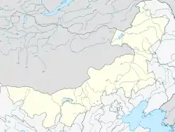
 Genhe Location of the city centre in Inner Mongolia | |
| Coordinates: 50°47′N 121°31′E | |
| Country | People's Republic of China |
| Region | Inner Mongolia |
| Prefecture-level city | Hulunbuir |
| Municipal seat | Hexi Subdistrict (河西街道) |
| Area | |
| • County-level city | 19,659.0 km2 (7,590.4 sq mi) |
| • Urban | 350.00 km2 (135.14 sq mi) |
| Elevation | 714 m (2,343 ft) |
| Population (2017)[1] | |
| • County-level city | 64,000 |
| • Density | 3.3/km2 (8.4/sq mi) |
| Time zone | UTC+8 (China Standard) |
| Postal code | 022300 |
| Area code(s) | 0470 |
Geography and climate

Genhe has a monsoon-influenced subarctic climate (Köppen Dwc), making it one of the coldest locations nationally, with an annual mean temperature of −3.56 °C (25.6 °F). Winters are long, severely cold, and very dry in terms of total precipitation, while summers are short and warm; the normal monthly mean temperature ranges from −28.1 °C (−18.6 °F) in January to 17.6 °C (63.7 °F) in July. Over two-thirds of the annual precipitation of 438 mm (17.2 in) is distributed from June through August.
| Climate data for Genhe (1981–2010 normals) | |||||||||||||
|---|---|---|---|---|---|---|---|---|---|---|---|---|---|
| Month | Jan | Feb | Mar | Apr | May | Jun | Jul | Aug | Sep | Oct | Nov | Dec | Year |
| Average high °C (°F) | −19.4 (−2.9) |
−12.0 (10.4) |
−2.9 (26.8) |
8.2 (46.8) |
17.0 (62.6) |
22.8 (73.0) |
24.5 (76.1) |
22.2 (72.0) |
15.7 (60.3) |
5.8 (42.4) |
−8.1 (17.4) |
−18.0 (−0.4) |
4.7 (40.4) |
| Daily mean °C (°F) | −28.1 (−18.6) |
−22.5 (−8.5) |
−12.3 (9.9) |
0.6 (33.1) |
8.9 (48.0) |
15.0 (59.0) |
17.6 (63.7) |
15.0 (59.0) |
7.3 (45.1) |
−2.1 (28.2) |
−16.3 (2.7) |
−25.8 (−14.4) |
−3.6 (25.6) |
| Average low °C (°F) | −34.7 (−30.5) |
−30.9 (−23.6) |
−21.5 (−6.7) |
−7.2 (19.0) |
−0.2 (31.6) |
6.6 (43.9) |
11.0 (51.8) |
8.9 (48.0) |
0.8 (33.4) |
−8.4 (16.9) |
−22.7 (−8.9) |
−31.6 (−24.9) |
−10.8 (12.5) |
| Average precipitation mm (inches) | 4.4 (0.17) |
3.2 (0.13) |
6.3 (0.25) |
16.8 (0.66) |
24.4 (0.96) |
79.1 (3.11) |
112.4 (4.43) |
110.0 (4.33) |
46.3 (1.82) |
19.2 (0.76) |
8.8 (0.35) |
7.1 (0.28) |
438.0 (17.24) |
| Average relative humidity (%) | 76 | 72 | 63 | 53 | 51 | 68 | 77 | 81 | 73 | 66 | 74 | 78 | 69 |
| Source: China Meteorological Administration[2] | |||||||||||||
Administrative divisions
Genhe is divided into four subdistricts, four towns, and one ethnic township.[3][4]
Subdistricts
The city's four subdistricts are Hedong Subdistrict, Hexi Subdistrict, Sengong Subdistrict, and Haolibao Subdistrict.[3]
Towns
The city's four towns are Jinhe, Alongshan, Mangui, and De'erbu'er.[3]
Ethnic Townships
The city's sole ethnic township is the Aoluguya Evenk Ethnic Township.[3][4]
Culture
A small number of ethnic Evenk reindeer herders remain in the city's Aoluguya Evenk Ethnic Township.[4]
References
- Ministry of Housing and Urban-Rural Development, ed. (2019). China Urban Construction Statistical Yearbook 2017. Beijing: China Statistics Press. p. 46. Retrieved 11 January 2020.
- 中国气象数据网 - WeatherBk Data (in Chinese). China Meteorological Administration. Retrieved 2020-04-15.
- 2019年统计用区划代码 (in Chinese). National Bureau of Statistics of China. 2019. Archived from the original on 2020-10-06. Retrieved 2020-10-06.
- Wang, Wei (2019-11-07). 中国最后的驯鹿部落——敖鲁古雅 [China's Last Reindeer Tribe——Aoluguya]. society.people.com.cn (in Chinese). Archived from the original on 2020-10-06. Retrieved 2020-10-06.
- www.xzqh.org (in Chinese)