Blaine County, Idaho
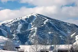
Blaine County is a county in the U.S. state of Idaho. As of the 2010 United States Census, the population was 21,376.[1] The county seat and largest city is Hailey.[2][3] It is also home to the Sun Valley ski resort, adjacent to Ketchum.
Blaine County | |
|---|---|
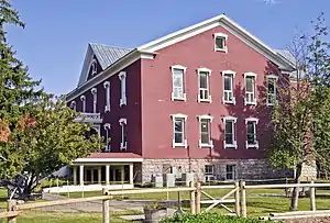 Blaine County Courthouse | |
 Seal | |
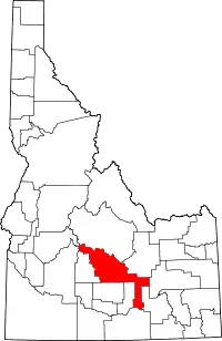 Location within the U.S. state of Idaho | |
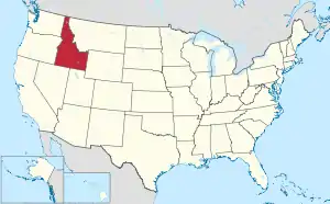 Idaho's location within the U.S. | |
| Coordinates: 43°23′N 113°59′W | |
| Country | |
| State | |
| Founded | March 5, 1895 |
| Named for | James G. Blaine |
| Seat | Hailey |
| Largest city | Hailey |
| Area | |
| • Total | 2,661 sq mi (6,890 km2) |
| • Land | 2,644 sq mi (6,850 km2) |
| • Water | 17 sq mi (40 km2) 0.6% |
| Population (2010) | |
| • Total | 21,376 |
| • Estimate (2018) | 22,601 |
| • Density | 8.0/sq mi (3.1/km2) |
| Time zone | UTC−7 (Mountain) |
| • Summer (DST) | UTC−6 (MDT) |
| Congressional district | 2nd |
| Website | www |
Blaine County was created by the territorial legislature on March 5, 1895, by combining Alturas and Logan counties; it was named for former congressman and 1884 Republican presidential nominee James G. Blaine.[2][4] Its present boundaries were set on February 8, 1917, when a western portion was partitioned off to form Camas County.[5]
Blaine County is part of the Hailey, ID Micropolitan Statistical Area.
History
The Wood River Valley in present-day Blaine County was organized as part of Alturas County by the Idaho Territorial Legislature in 1864.[6] By the 1880s the valley supported a thriving mining commerce; in 1882 the county seat of Alturas County was moved from Rocky Bar in present-day Elmore County to Hailey, in response to a population shift from Rocky Bar – which would eventually become a ghost town – to the Wood River Valley.[7]
The Blaine County boundaries described in its 1895 creation ordinance contained lands that soon were partitioned off to form other counties. Only thirteen days after the official formation date of Blaine, Lincoln County was formed from the county. Lincoln itself was later partitioned to create Gooding (1913), Minidoka (1913), and Jerome (1919) counties. Blaine County was further reduced in 1917 when Camas County was formed.[2]
The strong mining economy of the 1880s had substantially declined by 1890, when Idaho Territory became a state. The county began to recast itself as a tourism destination in 1936 with the opening of the Sun Valley resort, originally owned by the Union Pacific Railroad. The area soon attracted celebrity visitors, and later residents, most notably Ernest Hemingway, who is buried in the Ketchum Cemetery.[8] Celebrities who have lived in Blaine County include Adam West,[9] Demi Moore,[10] and John Kerry.[11]
County profile
Most Blaine County residents live in the Wood River Valley along State Highway 75 in the western half of the county. This area includes all of the county's incorporated cities and towns except Carey, which is located in the south-central part of the county at the junction of US 20 with US 26/93. The county's gerrymandered southeastern panhandle, known locally as the Yale area, is sparsely populated.[12]
As the home of a major ski resort, Blaine County has a higher cost of living than surrounding areas; the median value of its owner-occupied housing units is more than double the state average.[13] As a result, many who work in Blaine County live in outlying areas, particularly in the city of Shoshone in neighboring Lincoln County. It is estimated that 2,540 people from outside the county commute to work in Blaine County.[14]
Government and politics
Blaine County has gained a reputation as a Democratic Party enclave in strongly Republican Idaho.[15] The Democratic presidential candidate has won the county in every election since 1992, when George H. W. Bush finished third behind Bill Clinton and Ross Perot.[16] Blaine was the only Idaho county carried by Al Gore and John Kerry in 2000 and 2004 respectively.[17][18][19][20] In the 2008 election, Barack Obama carried the county by a 33.2% margin over John McCain, while McCain won statewide by a 25.3% margin.[21] It was one of three counties (with Latah and Teton) in Idaho won by Obama in 2008, and by far the highest margin.[22] Obama also carried Blaine County in 2012 with 58.8 percent of the vote, compared to Mitt Romney's 38.7 percent. During the 2012 election Blaine County was the only Idaho county in which Obama received over 50 percent of the vote, although he also carried Latah County with 49.6 percent of the vote. From 1968 through 1988, a less-populated Blaine County was won by the Republican candidate in all six presidential elections, as was the state of Idaho, although even then the county voted more Democratic than Idaho as a whole in every election going back to 1924.[23]
Similar to other Idaho counties, an elected three-member county commission heads the county government. Other elected officials include clerk, treasurer, sheriff, assessor and prosecutor.[24]
In 2006, Blaine County voted 66.3% against HJR 2, which amended the Idaho Constitution to outlaw same-sex marriage in Idaho; the measure passed with 63.4% of the statewide vote. Latah County, which contains Moscow (home of the University of Idaho), was the only other county where the measure failed.[25]
At the state level Blaine County is located in Legislative District 25,[26] which currently has an all-Democratic delegation in the Idaho Legislature.[27] Michelle Stennett, the current minority leader of the Idaho Senate, and Wendy Jaquet, a member of the Idaho House of Representatives and a former minority leader of that body, both live in Ketchum.
| Year | Republican | Democratic | Third parties |
|---|---|---|---|
| 2020 | 30.3% 4,032 | 67.1% 8,919 | 2.5% 338 |
| 2016 | 31.2% 3,340 | 59.8% 6,416 | 9.0% 968 |
| 2012 | 38.6% 3,939 | 58.8% 5,992 | 2.6% 263 |
| 2008 | 32.5% 3,439 | 65.7% 6,947 | 1.8% 187 |
| 2004 | 39.8% 4,034 | 59.1% 5,992 | 1.2% 121 |
| 2000 | 44.4% 3,528 | 47.2% 3,748 | 8.3% 662 |
| 1996 | 36.6% 3,003 | 46.7% 3,840 | 16.7% 1,374 |
| 1992 | 28.0% 2,243 | 35.7% 2,865 | 35.3% 2,831 |
| 1988 | 54.4% 3,130 | 43.4% 2,498 | 2.2% 127 |
| 1984 | 63.7% 3,603 | 34.8% 1,971 | 1.5% 83 |
| 1980 | 49.1% 2,716 | 33.3% 1,840 | 17.6% 973 |
| 1976 | 56.1% 2,176 | 41.4% 1,604 | 2.5% 97 |
| 1972 | 61.0% 2,113 | 35.8% 1,240 | 3.2% 112 |
| 1968 | 53.8% 1,337 | 32.8% 815 | 13.4% 332 |
| 1964 | 47.3% 1,161 | 52.7% 1,293 | |
| 1960 | 49.3% 1,216 | 50.7% 1,252 | |
| 1956 | 58.6% 1,384 | 41.4% 978 | |
| 1952 | 60.9% 1,609 | 39.1% 1,033 | |
| 1948 | 43.7% 945 | 54.7% 1,182 | 1.6% 35 |
| 1944 | 45.6% 874 | 54.1% 1,037 | 0.3% 5 |
| 1940 | 41.8% 1,124 | 58.0% 1,559 | 0.2% 4 |
| 1936 | 34.9% 735 | 64.6% 1,361 | 0.5% 11 |
| 1932 | 37.6% 693 | 61.5% 1,133 | 0.9% 17 |
| 1928 | 52.0% 849 | 47.7% 780 | 0.3% 5 |
| 1924 | 41.6% 732 | 30.9% 543 | 27.6% 485 |
| 1920 | 67.6% 1,169 | 32.4% 561 | |
| 1916 | 37.9% 1,231 | 56.3% 1,830 | 5.8% 189 |
| 1912 | 36.0% 988 | 36.2% 996 | 27.8% 764 |
| 1908 | 46.0% 1,197 | 48.0% 1,248 | 6.0% 155 |
| 1904 | 56.4% 1,225 | 35.7% 775 | 8.0% 173 |
| 1900 | 32.0% 634 | 68.0% 1,345 |
Geography
According to the U.S. Census Bureau, the county has a total area of 2,661 square miles (6,890 km2), of which 2,644 square miles (6,850 km2) is land and 17 square miles (44 km2) (0.6%) is water.[29]
Adjacent counties
- Butte County – northeast
- Bingham County – east
- Power County – southeast
- Cassia County – south
- Minidoka County – southwest
- Lincoln County – south
- Camas County – west
- Elmore County – northwest
- Custer County – northwest
National protected areas
- Craters of the Moon National Monument (part)
- Minidoka National Wildlife Refuge (part)
- Salmon-Challis National Forest (part)
- Sawtooth National Forest (part)
- Sawtooth National Recreation Area (part)
- Hemingway–Boulders Wilderness (part)
- Sawtooth Wilderness (part)
Demographics
| Historical population | |||
|---|---|---|---|
| Census | Pop. | %± | |
| 1900 | 4,900 | — | |
| 1910 | 8,387 | 71.2% | |
| 1920 | 4,473 | −46.7% | |
| 1930 | 3,768 | −15.8% | |
| 1940 | 5,295 | 40.5% | |
| 1950 | 5,384 | 1.7% | |
| 1960 | 4,598 | −14.6% | |
| 1970 | 5,749 | 25.0% | |
| 1980 | 9,841 | 71.2% | |
| 1990 | 13,552 | 37.7% | |
| 2000 | 18,991 | 40.1% | |
| 2010 | 21,376 | 12.6% | |
| 2018 (est.) | 22,601 | [30] | 5.7% |
| US Decennial Census[31] 1790–1960[32] 1900–1990[33] 1990–2000[34] 2010–2018[1] | |||
2000 census
As of the 2000 United States Census,[35] there were 18,991 people, 7,780 households, and 4,839 families in the county. The population density was 7 people per square mile (3/km2). There were 12,186 housing units at an average density of 5 per square mile (2/km2). The racial makeup of the county was 90.73% White, 0.13% Black or African American, 0.33% Native American, 0.73% Asian, 0.07% Pacific Islander, 6.43% from other races, and 1.57% from two or more races. 10.69% of the population were Hispanic or Latino of any race. 17.0% were of English, 14.6% German, 10.8% Irish and 6.2% American ancestry.
There were 7,780 households, out of which 31.90% had children under the age of 18 living with them, 51.20% were married couples living together, 7.20% had a female householder with no husband present, and 37.80% were non-families. 27.30% of all households were made up of individuals, and 5.50% had someone living alone who was 65 years of age or older. The average household size was 2.40 and the average family size was 2.96.
The county population contained 24.00% under the age of 18, 7.70% from 18 to 24, 32.60% from 25 to 44, 27.90% from 45 to 64, and 7.80% who were 65 years of age or older. The median age was 37 years. For every 100 females there were 107.90 males. For every 100 females age 18 and over, there were 106.80 males.
The median income for a household in the county was $50,496, and the median income for a family was $60,037. Males had a median income of $35,949 versus $27,487 for females. The per capita income for the county was $31,346. About 4.90% of families and 7.80% of the population were below the poverty line, including 7.80% of those under age 18 and 5.30% of those age 65 or over.
2010 census
As of the 2010 United States Census, there were 21,376 people, 8,823 households, and 5,575 families in the county.[36] The population density was 8.1 inhabitants per square mile (3.1/km2). There were 15,050 housing units at an average density of 5.7 per square mile (2.2/km2).[37] The racial makeup of the county was 84.9% white, 0.9% Asian, 0.6% American Indian, 0.2% black or African American, 0.1% Pacific islander, 11.8% from other races, and 1.5% from two or more races. Those of Hispanic or Latino origin made up 20.0% of the population.[36] In terms of ancestry, 24.1% were German, 18.8% were English, 11.4% were Irish, and 7.9% were American.[38]
Of the 8,823 households, 32.1% had children under the age of 18 living with them, 51.8% were married couples living together, 7.3% had a female householder with no husband present, 36.8% were non-families, and 28.7% of all households were made up of individuals. The average household size was 2.39 and the average family size was 2.99. The median age was 40.4 years.[36]
The median income for a household in the county was $61,854 and the median income for a family was $73,929. Males had a median income of $48,036 versus $37,603 for females. The per capita income for the county was $32,656. About 4.9% of families and 9.3% of the population were below the poverty line, including 10.9% of those under age 18 and 8.2% of those age 65 or over.[39]
Education
All but one public school in the county is administered by the Blaine County School District.[40] There are two public high schools in the county, Wood River High School in Hailey, and Carey High School in Carey. Syringa Mountain School is the first charter school to be approved in Blaine County; it opened in 2014.[41] The rural Yale area in the county's southeastern panhandle is served by schools in neighboring Minidoka County.[42]
Private schools include Community School in Sun Valley and The Sage School in Hailey.
The College of Southern Idaho, a community college based in Twin Falls, operates an off-campus outreach center in Hailey.[43]
Communities
Cities
Unincorporated communities
Festivals
Blaine County hosts Wagon Days, Trailing of the Sheep Festival, Sun Valley Harvest Festival, and the Sun Valley for the Arts Wine Auction, among other events.
The Blaine County Fair is an annual summer event.[52]
References
- "State & County QuickFacts". US Census Bureau. Archived from the original on January 2, 2016. Retrieved June 28, 2014.
- Nisson, Evelyn (May 24, 1962). "County seat was a juicy plum". Lewiston Morning Tribune. (Idaho). p. 9, section 2.
- "Find a County". National Association of Counties. Archived from the original on May 31, 2011. Retrieved June 7, 2011.
- "Blaine County". Idaho.gov. Archived from the original on November 4, 2011. Retrieved November 13, 2011.
- "Camas County". Idaho.gov. February 6, 1917. Archived from the original on November 20, 2011. Retrieved November 13, 2011.
- "Alturas County, Idaho Genealogy and History". Idahogenealogy.com. Retrieved November 13, 2011.
- "Blaine County Courthouse" (PDF). Idahohistory.net. July 7, 2010. Retrieved November 13, 2011.
- "Hemingway Haunts". Svguide.com. Retrieved November 13, 2011.
- Simons, Greg. "Adam West: Behind the Mask". Boiseweekly.com. Archived from the original on April 15, 2012. Retrieved November 13, 2011.
- "Demi Moore Biography". The Biography Channel. Archived from the original on April 11, 2008. Retrieved November 13, 2011.
- "Login".
- "Populated north, rural south: Blaine County's two worlds". Mtexpress.com. January 25, 2000. Archived from the original on January 29, 2013. Retrieved November 13, 2011.
- "Blaine County QuickFacts from the US Census Bureau". Quickfacts.census.gov. Archived from the original on January 2, 2016. Retrieved November 13, 2011.
- Blaine County estimate (PDF)
- Simons, Greg. "Real Western: Pondering the Democratic map of the Intermountain West". Boiseweekly.com. Archived from the original on September 26, 2008. Retrieved November 13, 2011.
- "Dave Leip's Atlas of US Presidential Elections". Uselectionatlas.org. Retrieved November 13, 2011.
- "1992 Presidential General Election Results – Idaho". Uselectionatlas.org. November 3, 1992. Retrieved November 13, 2011.
- "1996 Presidential General Election Results – Idaho". Uselectionatlas.org. November 5, 1996. Retrieved November 13, 2011.
- "2000 Presidential General Election Results – Idaho". Uselectionatlas.org. November 7, 2000. Retrieved November 13, 2011.
- "2004 Presidential General Election Results – Idaho". Uselectionatlas.org. November 19, 2004. Retrieved November 13, 2011.
- David Leip. "US Election Atlas". US Election Atlas. Retrieved November 13, 2011.
- 2008 – General Election Blaine Archived November 27, 2008, at the Wayback Machine
- "Blaine County, Idaho". PoliticalGraveyard.com. Retrieved May 16, 2012.
- "Blaine County Idaho Elected Officials". Co.blaine.id.us. Archived from the original on December 5, 2011. Retrieved November 13, 2011.
- "Idaho HJR 2 Results by County". Uselectionatlas.org. Retrieved November 13, 2011.
- "Idaho Legislative District Map" (PDF). Archived from the original (PDF) on November 17, 2011. Retrieved November 13, 2011.
- "Idaho Legislative Districts". Legislature.idaho.gov. July 29, 2004. Archived from the original on November 10, 2008. Retrieved November 13, 2011.
- Leip, David. "Atlas of US Presidential Elections". uselectionatlas.org. Retrieved April 4, 2018.
- "US Gazetteer files: 2010, 2000, and 1990". US Census Bureau. February 12, 2011. Retrieved April 23, 2011.
- "Population and Housing Unit Estimates". Retrieved August 2, 2019.
- "US Decennial Census". US Census Bureau. Retrieved June 28, 2014.
- "Historical Census Browser". University of Virginia Library. Retrieved June 28, 2014.
- "Population of Counties by Decennial Census: 1900 to 1990". US Census Bureau. Retrieved June 28, 2014.
- "Census 2000 PHC-T-4. Ranking Tables for Counties: 1990 and 2000" (PDF). US Census Bureau. Retrieved June 28, 2014.
- "U.S. Census website". US Census Bureau. Retrieved January 31, 2008.
- "Profile of General Population and Housing Characteristics: 2010 Demographic Profile Data". US Census Bureau. Archived from the original on February 13, 2020. Retrieved January 4, 2016.
- "Population, Housing Units, Area, and Density: 2010 – County". US Census Bureau. Archived from the original on February 13, 2020. Retrieved January 4, 2016.
- "Selected Social Characteristics in the US – 2006–2010 American Community Survey 5-Year Estimates". US Census Bureau. Archived from the original on February 13, 2020. Retrieved January 4, 2016.
- "Selected Economic Characteristics – 2006–2010 American Community Survey 5-Year Estimates". US Census Bureau. Archived from the original on February 13, 2020. Retrieved January 4, 2016.
- "Blaine County School District". Blaineschools.org. Retrieved November 13, 2011.
- "Only Idaho Public Waldorf School Opens in Hailey". magicvalley.com. Retrieved September 21, 2014.
- "Blaine County School District : Neighborhood School Boundaries". Blaineschools.org. Archived from the original on September 29, 2011. Retrieved November 13, 2011.
- Edit Szanto; Chika Daggett; RD Van Noy. "CSI Off-Campus Centers | Blaine County Center". Offcampus.csi.edu. Retrieved November 13, 2011.
- Cathedral Pines ID Google Maps (accessed January 18, 2019)
- Doniphan ID Google Maps (accessed January 17, 2019)
- Galena ID Google Maps (accessed January 18, 2019)
- Sawtooth City ID Google Maps (accessed January 18, 2019)
- Stanton Crossing ID Google Maps (accessed January 18, 2019)
- Tikura ID Google Maps (accessed January 18, 2019)
- Bounder ID Google Maps (accessed January 18, 2019)
- Vienna Mine Google Maps (accessed January 18, 2019)
- "Idaho Mountain Express: Dozens of 4-H kids take awards at county fair – August 31, 2011". Mtexpress.com. August 31, 2011. Archived from the original on September 4, 2012. Retrieved November 13, 2011.
External links
Places adjacent to Blaine County, Idaho | ||||||||||
|---|---|---|---|---|---|---|---|---|---|---|
| ||||||||||
Municipalities and communities of Blaine County, Idaho, United States | ||
|---|---|---|
| Cities | Map of Idaho highlighting Blaine County | |
| Unincorporated communities | ||
| ||
Boise (capital) | ||
| Topics |
| |
| Society | ||
| Regions | ||
| Larger cities | ||
| Smaller cities | ||
| Counties |
| |
| Authority control |
|---|