Bettviller
Bettviller (German: Bettweiler) is a commune in the Moselle department of the Grand Est administrative region in north-eastern France.
Bettviller | |
|---|---|
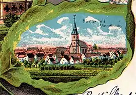 A depiction of Bettviller in 1904 | |
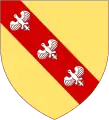
.svg.png.webp) Coat of arms | |
Location of Bettviller 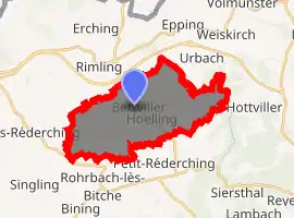
| |
 Bettviller  Bettviller | |
| Coordinates: 49°04′47″N 7°17′09″E | |
| Country | France |
| Region | Grand Est |
| Department | Moselle |
| Arrondissement | Sarreguemines |
| Canton | Bitche |
| Intercommunality | CC du Pays de Bitche |
| Government | |
| • Mayor (2008–2014) | Jean-Claude Picard |
| Area 1 | 18.41 km2 (7.11 sq mi) |
| Population (2017-01-01)[1] | 831 |
| • Density | 45/km2 (120/sq mi) |
| Time zone | UTC+01:00 (CET) |
| • Summer (DST) | UTC+02:00 (CEST) |
| INSEE/Postal code | 57074 /57410 |
| Elevation | 252–376 m (827–1,234 ft) (avg. 305 m or 1,001 ft) |
| 1 French Land Register data, which excludes lakes, ponds, glaciers > 1 km2 (0.386 sq mi or 247 acres) and river estuaries. | |
The village belongs to the Pays de Bitche. It is mentioned for the first time in 1157, in the forms "Bedebur" and "Bedeviller" in 1496 (oratory). The present village was built in the 16th century.
Population
| Year | Pop. | ±% |
|---|---|---|
| 1793 | 894 | — |
| 1800 | 811 | −9.3% |
| 1806 | 1,017 | +25.4% |
| 1821 | 1,230 | +20.9% |
| 1836 | 1,110 | −9.8% |
| 1841 | 1,086 | −2.2% |
| 1861 | 1,055 | −2.9% |
| 1866 | 1,072 | +1.6% |
| 1872 | 1,056 | −1.5% |
| 1876 | 1,035 | −2.0% |
| 1881 | 980 | −5.3% |
| 1886 | 936 | −4.5% |
| 1891 | 935 | −0.1% |
| 1896 | 932 | −0.3% |
| 1901 | 939 | +0.8% |
| 1906 | 951 | +1.3% |
| 1911 | 968 | +1.8% |
| 1921 | 972 | +0.4% |
| 1926 | 960 | −1.2% |
| 1931 | 963 | +0.3% |
| 1936 | 946 | −1.8% |
| 1946 | 868 | −8.2% |
| 1954 | 809 | −6.8% |
| 1962 | 814 | +0.6% |
| 1968 | 826 | +1.5% |
| 1975 | 752 | −9.0% |
| 1982 | 729 | −3.1% |
| 1990 | 697 | −4.4% |
| 1999 | 741 | +6.3% |
| 2006 | 841 | +13.5% |
| 2009 | 838 | −0.4% |
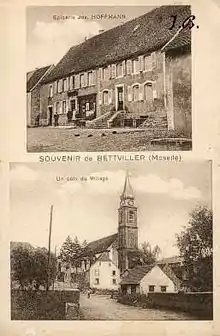
Bettviller, old postcard
See also
References
- "Populations légales 2017". INSEE. Retrieved 6 January 2020.
External links
| Wikimedia Commons has media related to Bettviller. |
| Authority control |
|---|
This article is issued from Wikipedia. The text is licensed under Creative Commons - Attribution - Sharealike. Additional terms may apply for the media files.