Hettange-Grande
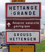
Hettange-Grande (German: Großhettingen, Lorraine Franconian: Grouss-Hetténgen) is a commune in the Moselle department in Grand Est in north-eastern France.
Hettange-Grande | |
|---|---|
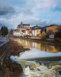
 The Church of Hettnage-Grande, located on the hill "Le Rocher" in the town center from the river "La Kissel" | |
 Coat of arms | |
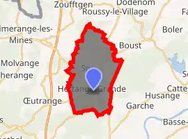
Location of Hettange-Grande 
| |
 Hettange-Grande  Hettange-Grande | |
| Coordinates: 49°24′24″N 6°09′14″E | |
| Country | France |
| Region | Grand Est |
| Department | Moselle |
| Arrondissement | Thionville |
| Canton | Yutz |
| Government | |
| • Mayor (2020–2026) | Roland Balcerzak[1] |
| Area 1 | 16.27 km2 (6.28 sq mi) |
| Population (2017-01-01)[2] | 7,653 |
| • Density | 470/km2 (1,200/sq mi) |
| Time zone | UTC+01:00 (CET) |
| • Summer (DST) | UTC+02:00 (CEST) |
| INSEE/Postal code | 57323 /57330 |
| Elevation | 155–247 m (509–810 ft) |
| 1 French Land Register data, which excludes lakes, ponds, glaciers > 1 km2 (0.386 sq mi or 247 acres) and river estuaries. | |
The town gave its name to the Hettangian, the earliest age of the Jurassic period of the geologic timescale.
Geography
Hettange-Grande is located close to the borders between Belgium, France, Germany, and Luxembourg.

History
Hettange-Grande was part of the Duchy of Luxembourg until the 1659 Treaty of the Pyrenees, when it was ceded to France during the first Partition of Luxembourg, along with the nearby town of Thionville.
Transportation
The commune is located on the A31 highway (also called the Lorraine-Bourgogne highway) which goes from the Burgundy region up to Luxembourg. The departmental road 653 highway, which runs from Thionville to Frisange (Luxembourg) crosses the town centre.

Twin towns
Hettange-Grande is twinned with:
References
- "Répertoire national des élus: les maires". data.gouv.fr, Plateforme ouverte des données publiques françaises (in French). 2 December 2020. Retrieved 7 December 2020.
- "Populations légales 2017". INSEE. Retrieved 6 January 2020.