Blacks Harbour, New Brunswick
Blacks Harbour (2016 population: 894)[3] is an incorporated village in New Brunswick, Canada. It is in a harbour of the same name opening onto the Bay of Fundy. It is 15 kilometres southeast of the town of St. George, 3 kilometres west of Beaver Harbour and 56 kilometres east from the town of St. Stephen on Route 176.
Blacks Harbour | |
|---|---|
Village | |
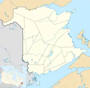 Blacks Harbour Location within New Brunswick. | |
| Coordinates: 45°03′32″N 66°47′05″W | |
| Country | Canada |
| Province | New Brunswick |
| County | Charlotte |
| Incorporated | 1972 |
| Area | |
| • Total | 8.90 km2 (3.44 sq mi) |
| Population (2016)[2] | |
| • Total | 894 |
| • Density | 110.3/km2 (286/sq mi) |
| • Pop 2006-2011 | |
| • Dwellings | 417 |
| Time zone | UTC-4 (AST) |
| • Summer (DST) | UTC-3 (ADT) |
| Postal code(s) | E5H |
| Area code(s) | 506 |
| Highways | |
| Website | www.blacksharbour.ca/ home_page.html |
Blacks Harbours' exact origin is unknown, possibly an early family name. Post office dates from 1889.[4]
Blacks Harbour is the northern terminus for the year-round Blacks Harbour to Grand Manan Island Ferry.
Fishing has been a vital part of its existence for over 200 years. Connors Brothers Limited was founded in 1885 at Blacks Harbour, now a major international processor of all types of seafood. The company is also a major New Brunswick employer.
Census data
Population
| Canada census – Blacks Harbour, New Brunswick community profile | |||
|---|---|---|---|
| 2011 | 2006 | ||
| Population: | 982 (+3.2% from 2006) | 952 (-12.0% from 2001) | |
| Land area: | 8.90 km2 (3.44 sq mi) | 8.90 km2 (3.44 sq mi) | |
| Population density: | 110.3/km2 (286/sq mi) | 107.0/km2 (277/sq mi) | |
| Median age: | 42.5 (M: 40.2, F: 45.0) | 41.0 (M: 38.8, F: 42.4) | |
| Total private dwellings: | 417 | 415 | |
| Median household income: | $43,367 | $36,575 | |
| References: 2011[5] 2006[6] earlier[7] | |||
|
|
|
Language
| Canada Census Mother Tongue - Blacks Harbour, New Brunswick[8] | ||||||||||||||||||
|---|---|---|---|---|---|---|---|---|---|---|---|---|---|---|---|---|---|---|
| Census | Total | English |
French |
English & French |
Other | |||||||||||||
| Year | Responses | Count | Trend | Pop % | Count | Trend | Pop % | Count | Trend | Pop % | Count | Trend | Pop % | |||||
2011 |
950 |
850 | 89.47% | 65 | 6.84% | 5 | 0.53% | 30 | 3.16% | |||||||||
2006 |
930 |
835 | 89.79% | 80 | 8.60% | 0 | 0.00% | 15 | 1.61% | |||||||||
2001 |
1,065 |
965 | 90.61% | 100 | 9.39% | 0 | 0.00% | 0 | 0.00% | |||||||||
1996 |
1,135 |
975 | n/a | 85.90% | 105 | n/a | 9.25% | 10 | n/a | 0.88% | 45 | n/a | 3.96% | |||||
References
- 2011 Statistics Canada Census Profile: Blacks Harbour, New Brunswick
- Canada, Government of Canada, Statistics. "Census Profile, 2016 Census - Blacks Harbour, Village [Census subdivision], New Brunswick and New Brunswick [Province]". www12.statcan.gc.ca. Retrieved 28 June 2018.
- Hamilton, William (1978). The Macmillan Book of Canadian Place Names. Toronto: Macmillan. p. 71. ISBN 0-7715-9754-1.
- "2011 Community Profiles". 2011 Canadian Census. Statistics Canada. 5 July 2013. Retrieved 19 May 2014.
- "2006 Community Profiles". 2006 Canadian Census. Statistics Canada. 30 March 2011. Retrieved 19 May 2014.
- "2001 Community Profiles". 2001 Canadian Census. Statistics Canada. 17 February 2012.
- Statistics Canada: 1996, 2001, 2006, 2011 census
Places adjacent to Blacks Harbour, New Brunswick | ||||||||||
|---|---|---|---|---|---|---|---|---|---|---|
| ||||||||||
