Candé-sur-Beuvron
Candé-sur-Beuvron is a commune in the Loir-et-Cher department in central France.
Candé-sur-Beuvron | |
|---|---|
_Mairie.JPG.webp) Town hall | |
Location of Candé-sur-Beuvron 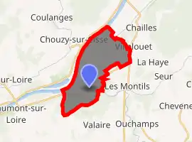
| |
 Candé-sur-Beuvron  Candé-sur-Beuvron | |
| Coordinates: 47°29′45″N 1°15′40″E | |
| Country | France |
| Region | Centre-Val de Loire |
| Department | Loir-et-Cher |
| Arrondissement | Blois |
| Canton | Blois-3 |
| Intercommunality | Communauté d'agglomération de Blois |
| Government | |
| • Mayor (2014–2020) | Stéphane Ledoux |
| Area 1 | 15.49 km2 (5.98 sq mi) |
| Population (2017-01-01)[1] | 1,497 |
| • Density | 97/km2 (250/sq mi) |
| Time zone | UTC+01:00 (CET) |
| • Summer (DST) | UTC+02:00 (CEST) |
| INSEE/Postal code | 41029 /41120 |
| Elevation | 62–111 m (203–364 ft) (avg. 68 m or 223 ft) |
| 1 French Land Register data, which excludes lakes, ponds, glaciers > 1 km2 (0.386 sq mi or 247 acres) and river estuaries. | |
Geography
The Cosson river flows southwest through the middle of the commune, then flows into the Beuvron, which flows west through the southern part of the commune before flowing into the Loire, which forms the commune's western border.
The village lies between the Cosson and the Beuvron.
Population
| Year | Pop. | ±% |
|---|---|---|
| 1793 | 492 | — |
| 1806 | 535 | +8.7% |
| 1821 | 563 | +5.2% |
| 1831 | 589 | +4.6% |
| 1841 | 579 | −1.7% |
| 1851 | 635 | +9.7% |
| 1861 | 677 | +6.6% |
| 1872 | 688 | +1.6% |
| 1881 | 696 | +1.2% |
| 1891 | 692 | −0.6% |
| 1901 | 627 | −9.4% |
| 1911 | 527 | −15.9% |
| 1921 | 431 | −18.2% |
| 1931 | 444 | +3.0% |
| 1946 | 463 | +4.3% |
| 1954 | 528 | +14.0% |
| 1962 | 501 | −5.1% |
| 1968 | 508 | +1.4% |
| 1975 | 540 | +6.3% |
| 1982 | 916 | +69.6% |
| 1990 | 1,134 | +23.8% |
| 1999 | 1,208 | +6.5% |
| 2008 | 1,471 | +21.8% |
| 2013 | 1,529 | +3.9% |
References
- "Populations légales 2017". INSEE. Retrieved 6 January 2020.
| Wikimedia Commons has media related to Candé-sur-Beuvron. |
| Authority control |
|---|
This article is issued from Wikipedia. The text is licensed under Creative Commons - Attribution - Sharealike. Additional terms may apply for the media files.