Savonnières
Savonnières is a commune in the Indre-et-Loire department in central France.
Savonnières | |
|---|---|
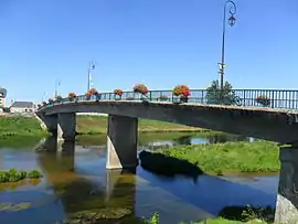 Bridge across the Cher | |
.svg.png.webp) Coat of arms | |
Location of Savonnières 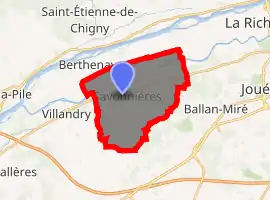
| |
 Savonnières  Savonnières | |
| Coordinates: 47°20′55″N 0°32′57″E | |
| Country | France |
| Region | Centre-Val de Loire |
| Department | Indre-et-Loire |
| Arrondissement | Tours |
| Canton | Ballan-Miré |
| Intercommunality | Tours Métropole Val de Loire |
| Government | |
| • Mayor (2008–2014) | Bernard Lorido |
| Area 1 | 16.46 km2 (6.36 sq mi) |
| Population (2017-01-01)[1] | 3,152 |
| • Density | 190/km2 (500/sq mi) |
| Time zone | UTC+01:00 (CET) |
| • Summer (DST) | UTC+02:00 (CEST) |
| INSEE/Postal code | 37243 /37510 |
| Elevation | 37–96 m (121–315 ft) |
| 1 French Land Register data, which excludes lakes, ponds, glaciers > 1 km2 (0.386 sq mi or 247 acres) and river estuaries. | |
Population
| Year | Pop. | ±% |
|---|---|---|
| 1793 | 1,166 | — |
| 1800 | 1,305 | +11.9% |
| 1806 | 1,344 | +3.0% |
| 1821 | 1,353 | +0.7% |
| 1831 | 1,358 | +0.4% |
| 1836 | 1,305 | −3.9% |
| 1841 | 1,254 | −3.9% |
| 1846 | 1,258 | +0.3% |
| 1851 | 1,289 | +2.5% |
| 1856 | 1,366 | +6.0% |
| 1861 | 1,332 | −2.5% |
| 1866 | 1,306 | −2.0% |
| 1872 | 1,234 | −5.5% |
| 1876 | 1,284 | +4.1% |
| 1881 | 1,326 | +3.3% |
| 1886 | 1,316 | −0.8% |
| 1891 | 1,262 | −4.1% |
| 1896 | 1,216 | −3.6% |
| 1901 | 1,195 | −1.7% |
| 1906 | 1,169 | −2.2% |
| 1911 | 1,101 | −5.8% |
| 1921 | 1,027 | −6.7% |
| 1926 | 992 | −3.4% |
| 1931 | 947 | −4.5% |
| 1936 | 936 | −1.2% |
| 1946 | 971 | +3.7% |
| 1954 | 1,034 | +6.5% |
| 1962 | 1,116 | +7.9% |
| 1968 | 1,260 | +12.9% |
| 1975 | 1,446 | +14.8% |
| 1982 | 1,813 | +25.4% |
| 1990 | 2,030 | +12.0% |
| 1999 | 2,558 | +26.0% |
| 2006 | 2,919 | +14.1% |
| 2009 | 3,041 | +4.2% |
References
- "Populations légales 2017". INSEE. Retrieved 6 January 2020.
| Wikimedia Commons has media related to Savonnières. |
| Authority control |
|
|---|
This article is issued from Wikipedia. The text is licensed under Creative Commons - Attribution - Sharealike. Additional terms may apply for the media files.