Vernou-sur-Brenne
Vernou-sur-Brenne is a commune in the Indre-et-Loire department in central France.
Vernou-sur-Brenne | |
|---|---|
_1.jpg.webp) The church of Sainte-Trininté, in Vernou-sur-Brenne | |
.svg.png.webp) Coat of arms | |
Location of Vernou-sur-Brenne 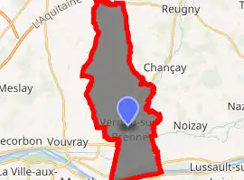
| |
 Vernou-sur-Brenne  Vernou-sur-Brenne | |
| Coordinates: 47°25′19″N 0°50′47″E | |
| Country | France |
| Region | Centre-Val de Loire |
| Department | Indre-et-Loire |
| Arrondissement | Tours |
| Canton | Vouvray |
| Government | |
| • Mayor (2008–2014) | Jean Hurel |
| Area 1 | 25.91 km2 (10.00 sq mi) |
| Population (2017-01-01)[1] | 2,707 |
| • Density | 100/km2 (270/sq mi) |
| Time zone | UTC+01:00 (CET) |
| • Summer (DST) | UTC+02:00 (CEST) |
| INSEE/Postal code | 37270 /37210 |
| Elevation | 47–130 m (154–427 ft) |
| 1 French Land Register data, which excludes lakes, ponds, glaciers > 1 km2 (0.386 sq mi or 247 acres) and river estuaries. | |
Population
| Year | Pop. | ±% |
|---|---|---|
| 1793 | 1,500 | — |
| 1800 | 1,518 | +1.2% |
| 1806 | 1,547 | +1.9% |
| 1821 | 1,668 | +7.8% |
| 1831 | 1,760 | +5.5% |
| 1836 | 1,828 | +3.9% |
| 1841 | 1,890 | +3.4% |
| 1846 | 1,953 | +3.3% |
| 1851 | 1,847 | −5.4% |
| 1856 | 1,776 | −3.8% |
| 1861 | 1,837 | +3.4% |
| 1866 | 1,932 | +5.2% |
| 1872 | 1,918 | −0.7% |
| 1876 | 1,873 | −2.3% |
| 1881 | 1,862 | −0.6% |
| 1886 | 1,927 | +3.5% |
| 1891 | 1,975 | +2.5% |
| 1896 | 1,848 | −6.4% |
| 1901 | 1,866 | +1.0% |
| 1906 | 1,907 | +2.2% |
| 1911 | 1,785 | −6.4% |
| 1921 | 1,682 | −5.8% |
| 1926 | 1,684 | +0.1% |
| 1931 | 1,571 | −6.7% |
| 1936 | 1,531 | −2.5% |
| 1946 | 1,789 | +16.9% |
| 1954 | 1,962 | +9.7% |
| 1962 | 1,822 | −7.1% |
| 1968 | 2,000 | +9.8% |
| 1975 | 1,992 | −0.4% |
| 1982 | 2,050 | +2.9% |
| 1990 | 2,197 | +7.2% |
| 1999 | 2,451 | +11.6% |
| 2006 | 2,711 | +10.6% |
| 2009 | 2,715 | +0.1% |
References
- "Populations légales 2017". INSEE. Retrieved 6 January 2020.
| Wikimedia Commons has media related to Vernou-sur-Brenne. |
| Authority control |
|---|
This article is issued from Wikipedia. The text is licensed under Creative Commons - Attribution - Sharealike. Additional terms may apply for the media files.
