Cairo Governorate
Cairo Governorate is the most populated of the governorates of Egypt. Its capital, the city of Cairo, is the national capital of Egypt, and is part of the Greater Cairo metropolitan area. Because it is completely urbanized, the governorate is considered a city proper, and functions as a municipality. However, there are uninhabited desert areas.
Cairo Governorate | |
|---|---|
 Flag  | |
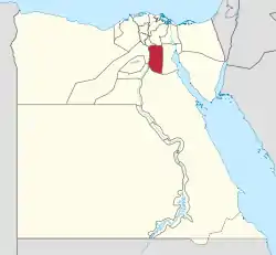 Cairo Governorate on the map of Egypt | |
| Country | |
| Seat | Cairo (capital) |
| Government | |
| • Governor | Khaled Abdel-Aal Abdel-Hafez[1] |
| Area | |
| • Total | 3,085 km2 (1,191 sq mi) |
| Population (January 2018) | |
| • Total | 9,655,000[2] |
| Time zone | UTC+2 (EET) |
| HDI (2018) | 0.743[3] high · 3rd |
| Website | بوابة محافظة القاهرة |
| Year | Pop. | ±% |
|---|---|---|
| 1937 | 1,312,096 | — |
| 1947 | 2,090,654 | +59.3% |
| 1957 | 2,877,195 | +37.6% |
| 1966 | 4,220,000 | +46.7% |
| 1976 | 5,084,463 | +20.5% |
| 1986 | 6,052,836 | +19.0% |
| 1996 | 6,800,991 | +12.4% |
| 2006 | 7,902,085 | +16.2% |
| 2014 | 9,102,232 | +15.2% |
| 2018 | 9,655,000 | +6.1% |
| sources:[4][5][6][2] | ||
Parts of the governorate were separated in April 2008 to form the Helwan Governorate, only to be reincorporated into the Cairo Governorate in April 2011.
Overview
The rate of poverty is more than 60% in this governorate, but recently some social safety networks have been provided in the form of financial assistance and job opportunities. The funding has been coordinated by the country's Ministry of Finance and with assistance from international organizations.[7]
Municipal divisions
The governorate is divided into the following municipal divisions for administrative purposes, with a total estimated population as of July 2017 of 9,570,441.[8][9]
| Anglicized name | Native name | Arabic transliteration | Population (July 2017 Est.) | Type |
|---|---|---|---|---|
| 15 May City | قسم 15 مايو | Māyū | 93,879 | Kism (fully urban) |
| Abdeen | قسم عابدين | 'Ābidīn | 40,450 | Kism (fully urban) |
| El Darb El Ahmar | قسم الدرب الأحمر | Al-Darb Al-Aḥmar[10] | 58,677 | Kism (fully urban) |
| Ain Shams | قسم عين شمس | 'Ain Schams | 616,374 | Kism (fully urban) |
| Amreya | قسم الاميريه | Al-Amīriīah | 153,046 | Kism (fully urban) |
| Azbakeya | قسم الأزبكية | Al-Azbakiyah | 19,826 | Kism (fully urban) |
| El Basatin | قسم البساتين | Al-Basātīn | 497,041 | Kism (fully urban) |
| El Gamaliya | قسم الجمالية | Al-Jamāliyah | 36,485 | Kism (fully urban) |
| El Khalifa | قسم الخليفة | Al-Khalīfah | 105,578 | Kism (fully urban) |
| Maadi | قسم المعادي | Al-Ma'ādī | 88,869 | Kism (fully urban) |
| El Marg | قسم المرج | Al-Marj | 801,222 | Kism (fully urban) |
| El Masara | قسم المعصره | Al-Ma'ṣarah | 270,907 | Kism (fully urban) |
| El Matareya | قسم المطرية | Al-Maṭariyah | 604,428 | Kism (fully urban) |
| El Mokattam | قسم المقطم | Al-Muqaṭṭam | 224,860 | Kism (fully urban) |
| El Muski | قسم الموسكي | Al-Mūskī | 16,715 | Kism (fully urban) |
| New Cairo 1 | قسم أول القاهرة الجديدة | Al-Qāhirah al-Jadīdah 1 | 136,271 | Kism (fully urban) |
| New Cairo 2 | قسم ثان القاهرة الجديدة | Al-Qāhirah al-Jadīdah 2 | 90,960 | Kism (fully urban) |
| New Cairo 3 | قسم ثالث القاهره الجديده | Al-Qāhirah al-Jadīdah 3 | 71,112 | Kism (fully urban) |
| El Weili | قسم الوايلي | Al-Waylī | 79,548 | Kism (fully urban) |
| El Nozha | قسم النزهة | An-Nuzhah | 231,987 | Kism (fully urban) |
| El Sahel | قسم الساحل | Al-sahel | 187,806 | Kism (fully urban) |
| El Sharabiya | قسم الشرابية | Ash-Sharābiyah | 187,806 | Kism (fully urban) |
| El Shorouk | قسم الشروق | Ash-Shurūq | 87,565 | Kism (fully urban) |
| El Segil | قسم الساحل | As-Sāḥil | 317,442 | Kism (fully urban) |
| El Salam | قسم أول السلام | As-Salām 1 | 482,271 | Kism (fully urban) |
| El Salam | قسم ثان السلام | As-Salām 2 | 154,267 | Kism (fully urban) |
| El Sayeda Zeinab | قسم السيدة زينب | As-Sayyidah Zaynab | 136,722 | Kism (fully urban) |
| El Tebbin | قسم التبين | At-Tibbīn | 72,276 | Kism (fully urban) |
| El Zaher | قسم الظاهر | Aẓ-Ẓāhir | 72,101 | Kism (fully urban) |
| Zamalek | قسم الزمالك | Az-Zamālik | 14,993 | Kism (fully urban) |
| El Zawya El Hamra | قسم الزاوية الحمراء | Az-Zāwiyah al-Ḥamrā' | 319,198 | Kism (fully urban) |
| Zeitoun | قسم الزيتون | Az-Zaytūn | 174,738 | Kism (fully urban) |
| Bab El Sharia | قسم باب الشعرية | Bāb ash-Sha'riyah | 46,823 | Kism (fully urban) |
| Bulaq | قسم بولاق | Būlāq | 48,301 | Kism (fully urban) |
| Dar El Salam | قسم دار السلام | Dār as-Salām | 527,335 | Kism (fully urban) |
| Hada'iq El Qobbah | قسم حدائق القبة | Hada'iq al-Qubbah | 317,092 | Kism (fully urban) |
| Helwan | قسم حلوان | Ḥulwān | 522,927 | Kism (fully urban) |
| Nasr City 1 | قسم مدينة نصر أول | Madīnat an-Naṣr 1 | 636,864 | Kism (fully urban) |
| Nasr City 2 | قسم ثانى مدينه نصر | Madīnat an-Naṣr 2 | 72,414 | Kism (fully urban) |
| Badr City | قسم مدينة بدر | Madīnat Badr | 31,398 | Kism (fully urban) |
| Heliopolis | قسم مصر الجديدة | Miṣr al-Jādidah | 134,549 | Kism (fully urban) |
| Old Cairo | قسم مصر القديمة | Miṣr al-Qadīmah | 251,125 | Kism (fully urban) |
| Manshiyat Naser | قسم منشأة ناصر | Munsha'āt Nāṣr | 259,205 | Kism (fully urban) |
| Qasr El Nil | قسم قصر النيل | Qaṣr an-Nīl | 10,596 | Kism (fully urban) |
| Rod El Farag | قسم روض الفرج | Rūd al-Faraj | 146,102 | Kism (fully urban) |
| Shubra | قسم شبرا | Shubrā | 76,942 | Kism (fully urban) |
| Tura | قسم طره | Ṭurah | 231,154 | Kism (fully urban) |
Governor
The former governor was Galal Saeed, who previously served as Minister of Transport under Kamal Ganzouri.[11]
The current governor is Khaled Abdel-Aal Abdel-Hafez, appointed 30 August 2018.[1]
Industrial zones
According to the Egyptian Governing Authority for Investment and Free Zones (GAFI), in affiliation with the Ministry of Investment (MOI), the following industrial zones are located in this governorate:[12]
- Torah and Shaq Al Tho’ban
- South Helwan
- Katamia
- Shaq Al Tho’ban
- Al Robeky
- Al Maasara
- Division Maadi Company for Development and Reconstruction
- Egypt-Ismailia. Road - Al Nozha District
- El Salam City
- El Marg District
- El Sharabya District
- (New urban community industrial zone) Badr City
- (New urban community industrial zone) 15 May
- (New urban community industrial zone) New Cairo
- (New urban community industrial zone) Al Shrouk
Due to its congestion and overcrowded streets, Cairo is not attractive to investors. UN-Habitat is promoting alternative methods of transportation with the aim of relieving these issues.[13]
Projects and programs
In a program that began on 28 August 2012 (through 2018), the European Union invested 40 million Euros on upgrading the infrastructure of informal areas in Cairo Governorate.[14]
See also
References
- "رسمياً.. المحافظون الجدد ونوابهم يؤدون اليمين الدستورية أمام الرئيس". Almasry Alyoum (in Arabic). 30 August 2018. Archived from the original on 31 August 2018. Retrieved 22 October 2017.
- "Population by governorate - CAPMAS". capmas.gov.eg. Archived from the original on 2 November 2018. Retrieved 10 October 2018.
- "Sub-national HDI - Area Database - Global Data Lab". hdi.globaldatalab.org. Retrieved 13 May 2020.
- "EGYPT Administrative Division". Citypopulation.de. 8 January 2012. Archived from the original on 20 February 2014. Retrieved 1 June 2012.
- United Nations 1960 Demographic Yearbook (PDF). United Nations. p. 289. Retrieved 10 December 2018.
- Law, Gwillim (1999). Administrative Subdivisions of Countries. McFarland & Company, Inc. p. 115.
- "Social Solidarity Ministry to provide citizens with disabilities financial support". Egypt Independent. 25 July 2017. Retrieved 11 December 2018.
- "Cairo Governorates Subdivisions". CityPopulation.de. Archived from the original on 28 August 2018. Retrieved 22 November 2018.
- "Markazes of Egypt". statoids.com. Gwillim Law. Archived from the original on 19 October 2017. Retrieved 26 November 2018.
- Wilton-Steer, Harry Johnstone, photography by Christopher (21 March 2018). "Alive with artisans: Cairo's al-Darb al-Ahmar district – a photo essay". The Guardian.
- "New governors are mostly generals". Mada Masr. Archived from the original on 14 August 2013. Retrieved 15 August 2013.
- "Industrial Zones of Governorate". Ministry of Investment Egypt. Archived from the original on 23 November 2018. Retrieved 23 November 2018.
- "Egypt-Urban Issues". UN-Habitat Egypt. Archived from the original on 30 October 2016. Retrieved 30 October 2016.
- "Upgrading Informal Areas in the Greater Cairo Region". European Union External Action. Archived from the original on 2 January 2017. Retrieved 2 January 2017.
External links
- Cairo Governorate Official website (in Arabic and English)
- City subdivisions
- List of previous governors (in Arabic)
| Urban | ||
|---|---|---|
| Lower Egypt | ||
| Upper Egypt | ||
| Frontier | ||
| Authority control |
|---|
