Sharqia Governorate
Sharqia Governorate (Arabic: محافظة الشرقية Muḥāfẓet El Sharʔiya, Egyptian Arabic pronunciation: [eʃ.ʃæɾˈʔejjæ], rural: [eʃ.ʃæɾˈɡejje]) is the 3rd most populous of the governorates of Egypt. Located in the northern part of the country, its capital is the city of Zagazig.
Sharqiyya Governorate | |
|---|---|
 Flag  | |
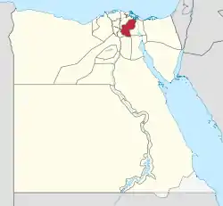 Sharqia Governorate on the map of Egypt | |
| Coordinates: 30.7°N 31.63°E | |
| Country | |
| Seat | Zagazig (capital) |
| Government | |
| • Governor | Mamdouh Mustafa El-Sayed Ahmed Gharab[1] |
| Area | |
| • Total | 4,180 km2 (1,610 sq mi) |
| Population (December 2018) | |
| • Total | 8,017,894[2] |
| Time zone | UTC+2 (EET) |
| HDI (2017) | 0.694[3] medium |
| Website | www |
Overview
Bilbeis is the former capital of Sharqia. A section of the governorate once was part of the Qalyubia Governorate. There is a strong agriculture industry, poultry and fish farming in Sharqia.[4]
The rate of poverty is more than 60% in this governorate but recently some social safety networks have been provided in the form of financial assistance and job opportunities. The funding has been coordinated by the country's Ministry of Finance and with assistance from international organizations.[5]
Municipal divisions
The governorate is divided into the following municipal divisions for administrative purposes, with a total estimated population as of July 2017 of 7,192,355. In some instances there is a markaz and a kism with the same name.[6][7]
| Anglicized name | Native name | Arabic transliteration | Population (July 2017 Est.) | Type |
|---|---|---|---|---|
| Abu Hammad | مركز أبو حماد | Abū Ḥammād | 433,336 | Markaz |
| Abu Kebir | مركز أبوكبير | Abū Kabīr | 447,083 | Markaz |
| El Husseiniya | مركز الحسينية | Al-Ḥusayniyah | 373,774 | Markaz |
| El Ibrahimiya | مركز الأبراهيمية | Al-Ibrāhīmiyah | 183,209 | Markaz |
| El Qanayat | قسم القنايات | Al-Qanāyāt | 63,016 | Kism (fully urban) |
| El Qurein | قسم القرين | Al-Qurayn | 84,358 | Kism (fully urban) |
| New Salhia | قسم الصالحية الجديدة | Aṣ-Ṣaliḥiyah al-Jadīdah | 52,883 | Kism (fully urban) |
| Awlad Saqr | مركز أولاد صقر | Awlād Ṣaqr | 226,973 | Markaz |
| Zagazig 1 | قسم اول الزقازيق | Az-Zaqāzīq 1 | 176,240 | Kism (fully urban) |
| Zagazig 2 | قسم ثان الزقازيق | Az-Zaqāzīq 2 | 207,463 | Kism (fully urban) |
| Zagazig | مركز الزقازيق | Az-Zaqāzīq | 877,977 | Markaz |
| Bilbeis | مركز بلبيس | Bilbays | 818,029 | Markaz |
| Diyarb Negm | مركز ديرب نجم | Diyarb Najm | 493,043 | Markaz |
| Faqous | قسم فاقوس | Fāqūs | 104,244 | Kism (fully urban) |
| Faqous | مركز فاقوس | Fāqūs | 615,176 | Markaz |
| Hihya | مركز ههيا | Hihyā | 299,620 | Markaz |
| Kafr Saqr | مركز كفر صقر | Kafr Ṣaqr | 279,595 | Markaz |
| 10th of Ramadan City 1 | قسم أول مدينة عشرة رمضان | Madīnat 'Ashirh min-Ramaḍān 1 | 74,164 | Kism (fully urban) |
| 10th of Ramadan City 2 | قسم ثان مدينة عشرة رمضان | Madīnat 'Ashirh min-Ramaḍān 2 | 145,278 | Kism (fully urban) |
| Mashtool El Souk | مركز مشتول السوق | Mashtūl as-Sūq | 219,794 | Markaz |
| Minya El Qamh | مركز منيا القمح | Minyā al-Qamḥ | 771,987 | Markaz |
| Minshat Abu Omar | مركز منشاه ابوعمر | Munshāh Abū 'Umar | 86,670 | Markaz |
| Tanis | مركز صان الحجر | Ṣān al-Ḥajar | 158,443 | Markaz |
Population
According to population estimates, in 2015 the majority of residents in the governorate lived in rural areas, with an urbanization rate of only 23.1%. Out of an estimated 6,485,412 people residing in the governorate in 2015, 4,987,707 people lived in rural areas and 1,497,705 lived in urban areas.[8]
Industrial zones
According to the Governing Authority for Investment and Free Zones (GAFI) the governorate is home to two industrial zones. They are located in New Salhia, and in 10th of Ramadan.[9]
Cities and towns
The following cities and towns are located in Sharqia Governorate.
| Name | Population
(2006 census)[10] |
Location |
|---|---|---|
| 10th of Ramadan | 29,601 | 30.306503°N 31.741455°E |
| Abu Hammad | 36,592 | 30.544376°N 31.679831°E |
| Abu Kebir | 104,100 | 30.716667°N 31.666667°E |
| Awlad Saqr | 19,515 | 30.9303418°N 31.6974966°E |
| Bilbeis | 141,285 | 30.416667°N 31.566667°E |
| Diyarb Negm | 52,611 | 30.751389°N 31.457778°E |
| El Husseiniya | 29,565 | 30.8610931°N 31.919806°E |
| El Ibrahimiya | 35,022 | 30.7183986°N 31.5630861°E |
| El Qurein | 64,559 | 30.601771°N 31.744135°E |
| Faqous | 73,081 | 30.733333°N 31.8°E |
| Hihya | 43,672 | 30.668702°N 31.5904°E |
| Kafr Saqr | 30,004 | 30.796389°N 31.626111°E |
| Mashtool El Souk | 47,153 | 30.360556°N 31.3775°E |
| Minya El Qamh | 67,450 | 30.515278°N 31.346111°E |
| El Salheya El Gedida | 9,350 | 30.629774°N 31.941019°E |
| Zagazig* | 318,393 | 30.566667°N 31.5°E |
Notable people
- El-Said Badawi, sociolinguist
- Mohamed Morsi, former President of Egypt
- Ahmed Shafik, former Prime Minister of Egypt and Presidential Candidate for Egyptian presidential election, 2012
- Abaza family, the largest family in Sharqia and Egypt's largest family of Circassian origin.[11][12]
- Ahmed Subhy Mansour, founder of the Quranist movement
- Abdel Halim Hafez, popular singer and actor
- Miral al-Tahawy, award-winning Bedouin novelist
- Yusuf Abu Rayya, award-winning novelist
- Husayn Fawzi Al Najjar, political historian and Islamic scholar
- Magdi Yacoub, professor of cardiothoracic surgery at the National Heart and Lung Institute
- Sama El Masry, actress, belly dancer, and activist
- Ahmed Fouad Negm, Egyptian vernacular poet
- Rushdy Abaza, actor
- Fekry Pasha Abaza, journalist and political activist
- Ahmed 'Urabi, the leader of the 1881 nationalist uprising against the British
- Hamada Helal, Egyptian singer
- Emad Moteab, Egptian footballer
- Ahmed el-Mansy, an Egyptian officer who was killed in clashes with terrorists in North Sinai
- Ahmad Salem, Egyptian actor, pilot and engineer
References
- "رسمياً.. المحافظون الجدد ونوابهم يؤدون اليمين الدستورية أمام الرئيس". Almasry Alyoum (in Arabic). 30 August 2018. Archived from the original on 2018-08-31. Retrieved 2018-08-31.
- "Population Estimates By Governorate ( Urban /Rural ) 10/12/2018". www.capmas.gov.eg. Archived from the original on 2018-11-02. Retrieved 10 October 2018.
- "Sub-national HDI - Area Database - Global Data Lab". hdi.globaldatalab.org. Retrieved 2018-09-13.
- "Al-Sharqiyyah GOVERNORATE, EGYPT". britannica.
- "Social Solidarity Ministry to provide citizens with disabilities financial support". Egypt Independent. 25 July 2017. Retrieved 11 December 2018.
- "Ash-Sharqiyah Governorates Subdivisions". CityPopulation.de. Retrieved 2018-11-22.
- "Markazes of Egypt". statoids.com. Gwillim Law. Archived from the original on 2017-10-19. Retrieved 26 November 2018.
- "Population Estimates By Sex & Governorate 1/1/2015" (PDF). CAPMAS. Archived (PDF) from the original on 2015-10-19. Retrieved 23 October 2016.
- "Industrial Zones of Governorate". Ministry of Investment Egypt. Archived from the original on 2018-11-23. Retrieved 23 November 2018.
- البيانات السكانية لمدينة أو قرية حسب تقديرات السكان 2006 - محافظة الشرقية. الجهاز المركزي للتعبئة العامة والإحصاء. تاريخ الوصول: 9 يناير 2016.
- "Families who rule Egypt: 1. The Abazas, family of bashas (in Arabic)". Archived from the original on 2015-11-28. Retrieved 2015-12-24.
- "Arab or Circassian? Or a mix of both? (in Arabic)". al-Hayat. Archived from the original on 2016-12-27. Retrieved 2015-12-24.
External links
| Urban | ||
|---|---|---|
| Lower Egypt | ||
| Upper Egypt | ||
| Frontier | ||
| Authority control |
|---|