Sohag Governorate
Sohag Governorate is one of the governorates of Egypt. It is located in the southern part of the country (Upper Egypt), and covers a stretch of the Nile Valley.[4] Since 1960, its capital has been the city of Sohag. Prior to that, the capital was the city of Girga and the name of the governorate was Girga Governorate.[5]
Sohag Governorate | |
|---|---|
 Flag | |
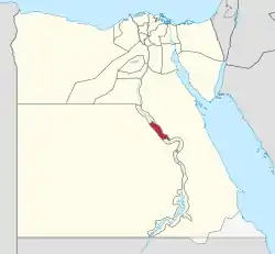 Sohag Governorate on the map of Egypt | |
| Coordinates: 26.56°N 31.7°E | |
| Country | |
| Seat | Sohag (capital) |
| Government | |
| • Governor | Ahmed Abdullah Al Ansari[1] |
| Area | |
| • Total | 1,547 km2 (597 sq mi) |
| Population (January 2018) | |
| • Total | 5,063,000[2] |
| Time zone | UTC+2 (EET) |
| HDI (2017) | 0.650[3] medium |
| Website | www |
Overview
The rate of poverty is more than 60% in this governorate but recently some social safety networks have been provided in the form of financial assistance and job opportunities. The funding has been coordinated by the country's Ministry of Finance and with assistance from international organizations.[6]
In early 2019, some residents of the poorer villages of Sohag were able to move into their new homes built, in part, with aid from the National Bank of Kuwait. There was a celebration for the completion of 115 homes where residents also received cattle and other gifts.[7]
Archaeology
In April 2019, the archaeological mission of the Ministry of Antiquities led by Mostafa Waziri uncovered a tomb of a nobleman called Toutou and his wife at Al-Dayabat archaeological site dating back to the Ptolemaic era. The tomb contained two tiny rooms with two limestone sarcophagi. Besides, well preserved mummy, mummified animals and birds including falcons, eagles, cats, dogs and shrews were also revealed in the tomb.[8][9][10]
Municipal divisions
The governorate is divided into municipal divisions with a total estimated population as of July 2017 of 4,995,155. In the case of Sohag governorate, there are two new cities, five agsam and twelve marakiz. In some instances there is a markaz and a kism with the same name.[11][12]
| Anglicized name | Native name Coptic/Arabic | Transliteration Coptic/Arabic | Population (July 2017 Est.) | Type |
|---|---|---|---|---|
| Akhmim | ϣⲙⲓⲛ/ مركز أخميم | Shmin/Akhmīm | 439,080 | Markaz |
| El Balyana | ⲡⲟⲩⲗⲁⲛⲏ/ مركز البلينا | Bulana/Al-Balyanā | 525,042 | Markaz |
| El Kawtar | ⲡⲉⲣⲟⲩⲟⲧ / قسم الكوثر | Berouod/Al-Kawthar | 4,859 | Kism (fully urban) |
| El Maragha | ⲁⲗⲙⲉⲣⲁⲅⲉ / مركز المراغة | Almaraga/Al-Marāghah | 394,232 | Markaz |
| El Munsha | ⲡⲥⲟⲓ / مركز المنشأة | Bsoi/Al-Munsha'āh | 404,030 | Markaz |
| Aserat | ⲁⲗⲁⲥⲉⲓⲣⲁⲧ / مركز العسيرات | Alasairat/Al-'Usayrāt | 195,927 | Markaz |
| Dar El Salam | ⲫⲉⲣϩⲱⲧⲡ / مركز دار السلام | Perhodb/Dar as-Salām | 411,524 | Markaz |
| Girga | ⲧⲓⲛ/ϭⲉⲣϭⲉ / قسم جرجا | Din/Girge/Jirjā | 146,756 | Kism (urban and rural parts) |
| Girga | ⲧⲓⲛ/ϭⲉⲣϭⲉ / مركز جرجا | Din/Girge/Jirjā | 331,824 | Markaz |
| Juhaynah West | ϫⲟⲩϩⲉⲓⲛⲉ ⲛ̀ⲉⲙⲉⲛⲧ / مركز جهينة الغربية | Juheina enEmend/Juhaynah al-Gharbiyah | 272,650 | Markaz |
| New Akhmim | ϣⲙⲓⲛ ⲙ̀ⲃⲉⲣⲓ / مدينة أخميم الجديدة | Shmin emWeri/Madīnat Akhmīm al-Jadīdah | 0 | New City |
| New Sohag | ⲥⲟⲩϩⲁϫ ⲙ̀ⲃⲉⲣⲓ / مدينة سوهاج الجديدة | Souhaj emWeri/Madīnat Sawhāj al-Jadīdah | 174 | New City |
| Saqultah | ⲥⲁⲕⲟⲩⲗⲑⲉ / مركز ساقلته | Sakulta/Sāqultah | 207,439 | Markaz |
| Sohag | ⲥⲟⲩϩⲁϫ / مركز سوهاج | Suhaj/Sawhāj | 536,871 | Markaz |
| Sohag 1 | ⲥⲟⲩϩⲁϫ 1 / قسم اول سوهاج | Suhaj Wai/Sawhāj 1 | 132,058 | Kism (fully urban) |
| Sohag 2 | ⲥⲟⲩϩⲁϫ 2 / قسم ثان سوهاج | Suhaj Snau/Sawhāj 2 | 109,376 | Kism (fully urban) |
| Tahta | ⲑⲁϩⲑⲱ / قسم طهطا | Tahto/Ṭahṭā | 165,026 | Kism (urban and rural parts) |
| Tahta | ⲑⲁϩⲑⲱ / مركز طهطا | Tahto/Ṭahṭā | 289,312 | Markaz |
| Tima | ⲧⲁⲙⲙⲁ / مركز طما | Dama/Ṭimā | 428,975 | Markaz |
Population
| Year | Pop. | ±% |
|---|---|---|
| 1937 | 1,118,402 | — |
| 1947 | 1,283,468 | +14.8% |
| 1957 | 1,449,000 | +12.9% |
| 1966 | 1,689,000 | +16.6% |
| 1976 | 1,924,960 | +14.0% |
| 1986 | 2,455,134 | +27.5% |
| 1996 | 3,123,114 | +27.2% |
| 2006 | 3,747,289 | +20.0% |
| 2015 | 4,603,861 | +22.9% |
| 2017 | 4,995,155 | +8.5% |
| 2018E | 5,063,000 | +1.4% |
| sources:[13][11][14][15] | ||
According to population estimates, in 2015 the majority of residents in the governorate lived in rural areas, with an urbanization rate of only 21.4%. Out of an estimated 4,603,861 people residing in the governorate in 2015, 3,618,543 people lived in rural areas and 985,318 lived in urban areas.[15]
Cities and towns
- Akhmim (Ipu or Khent-Min or Khemmis or Panopolis)
- Dar El Salam
- El Balyana
- El Mansha
- El Maragha
- El Usayrat
- Girga (Tjeny or Thinis)
- Juhayna
- Sakulta
- Sohag
- Tahta
- Tima
Industrial zones
According to the Egyptian Governing Authority for Investment and Free Zones (GAFI), in affiliation with the Ministry of Investment (MOI), the following industrial zones are located in this governorate:[16]
- Al Kawthar District
- Al Ahaiwa
- Beit Dawood, west of Gerga
- West Of Tahta
- (New urban community industrial zone) New Sohag
Important sites
- Abydos El Balyana (Abedju)
- Apollonos Polis (Kom Isfaht)
- Beit Khallaf
- El Hawawish
- El Salamuni
- Gabal El Haridi
- Hut-Repyt (Athribis or Wannina)
- Kom Ishqaw (Aphrodito)
- Tjebu (Djew-Qa or Antaeopolis or Qaw el-Kebir)
- Red Monastery
- White Monastery
- Sohag Museum
Notable people
- Imad Hamdi (actor)
- Hamdy Ahmed (actor)
- George Sidhum (actor)
- Refaa Rafea Eltahtawy (Translator)
References
- "رسمياً.. المحافظون الجدد ونوابهم يؤدون اليمين الدستورية أمام الرئيس". Almasry Alyoum (in Arabic). 30 August 2018. Archived from the original on 2018-08-31. Retrieved 2018-08-31.
- "Population Estimates By Governorate ( Urban /Rural ) 1/1/2018". www.capmas.gov.eg. Archived from the original on 2018-11-02. Retrieved 10 October 2018.
- "Sub-national HDI - Area Database - Global Data Lab". hdi.globaldatalab.org. Retrieved 2018-09-13.
- "Sohag Governorate". google.come. Google Map.
- Law, Gwillim (1999). Administrative Subdivisions of Countries: A Comprehensive World Reference, 1900 through 1998 (snippet view). Jefferson, NC: McFarland. p. 114. ISBN 978-0-7864-0729-3. Retrieved 2010-08-07.
- "Social Solidarity Ministry to provide citizens with disabilities financial support". Egypt Independent. 25 July 2017. Retrieved 11 December 2018.
- Al-Ghwait, Khaled (31 January 2019). "Orman and Bank of Kuwait celebrate the completion of the development of 115 houses in Sohag" (in Arabic). Retrieved 3 February 2019.
- "In Photos: Ptolemaic-era tomb discovered in Upper Egypt's Sohag - Ancient Egypt - Heritage". Ahram Online. Retrieved 2020-09-13.
- "Ptolemaic-era tomb discovered in Upper Egypt's Sohag". The Archaeology News Network. Retrieved 2020-09-13.
- "Ptolemaic-era tomb discovered in Upper Egypt - Xinhua | English.news.cn". www.xinhuanet.com. Retrieved 2020-09-13.
- "Sohag Governorate Subdivisions". CityPopulation.de. Archived from the original on 2018-11-26. Retrieved 2018-11-26.
- "Markazes of Egypt". statoids.com. Gwillim Law. Archived from the original on 2017-10-19. Retrieved 26 November 2018.
- Law, Gwillim (November 23, 1999). Administrative Subdivisions of Countries: A Comprehensive World Reference, 1900 Through 1998. McFarland. ISBN 978-0-7864-6097-7.
- "اPop. Estimates by Governorate 1/1/2018". www.capmas.gov.eg. Archived from the original on 2018-11-02. Retrieved 10 October 2018.
- "Population Estimates By Sex & Governorate 1/1/2015" (PDF). CAPMAS. Archived (PDF) from the original on 2015-10-19. Retrieved 23 October 2016.
- "Industrial Zones of Governorate". Ministry of Investment Egypt. Archived from the original on 2018-11-23. Retrieved 23 November 2018.
External links
- El Wattan News of Sohag Governorate
- Hopkins, Nicholas S., Directions of Change in Rural Egypt, Oxford University Press, 2004
Places adjacent to Sohag Governorate | |
|---|---|
| Urban | ||
|---|---|---|
| Lower Egypt | ||
| Upper Egypt | ||
| Frontier | ||
| Regions | ||
|---|---|---|
| Important sites | ||
| ||