Luxor Governorate
Luxor Governorate has been one of Egypt's governorates since 7 December 2009, when former president Hosni Mubarak announced its separation from the Qena Governorate.[5] It is located 635 km south of Cairo. It is currently the smallest governorate in Egypt, spanning approximately 5 km from north to south, and 1.5 km from east to west, and lies in Upper Egypt along the Nile. The city of Luxor is the capital of the Luxor governorate. The government is studying the possibility of extending the boundaries of the governorate to include the neighboring towns of Armant and Esna.[Outdated]
Luxor Governorate | |
|---|---|
 Flag 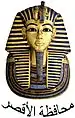 | |
.svg.png.webp) Luxor Governorate on the map of Egypt | |
| Country | |
| Seat | Luxor (capital) |
| Government | |
| • Governor | Mustafa Mohamed Alhem Khaled[2] |
| Area | |
| • Total | 2,960 km2 (1,140 sq mi) |
| Population (January 2018) | |
| • Total | 1,270,000[4] |
| Time zone | UTC+2 (EET) |
| Website | www |
Overview
Despite the governorate being one of the top destinations for tourists in Egypt,[3] the poverty rate is more than 60% in this governorate but recently some social safety networks have been provided in the form of financial assistance and job opportunities. The funding has been coordinated by the country's Ministry of Finance and with assistance from international organizations.[6]
Municipal divisions
The governorate is divided into the following municipal divisions with a total estimated population as of July 2017 of 1,255,703. In some instances there is a markaz and a kism with the same name.[7][8]
| Anglicized name | Native name | Arabic transliteration | Population (July 2017 Est.) | Type |
|---|---|---|---|---|
| Qurna | مركز القرنه | Al-Qarnah | 165,016 | Markaz |
| Luxor | قسم الأقصر | Al-Uqṣur | 243,817 | Kism (fully urban) |
| Luxor | مركز الأقصر | Al-Uqṣur | 165,928 | Markaz |
| Armant | مركز أرمنت | Armant | 174,774 | Markaz |
| Esna | مركز إسنا | Isnā | 432,908 | Markaz |
| Tiba | مركز شرطة طيبة | Shurṭah Ṭībah | 73,260 | Markaz |
Emblem
The emblem of Luxor represents the bust of Tutankhamun on board of an Ancient Egyptian canoe boat, cruising in the Nile, with an obelisk and the sun light in the background.
Geography
The governorate's total area is 2960 km2, representing 0.24% of the country's area.
Population
At the 2012 census, the population of the area which in 2009 was formed into the new Luxor Governorate was 1,064,000 people. 47.4% of them lived in urban areas, while 52.6% lived in rural areas. The annual population growth rate is 18.2 per thousand. Population estimates from 2015 puts the same figure at 1,147,058 with an urbanization rate of 37.8%.[9]
Industrial zones
According to the Egyptian Governing Authority for Investment and Free Zones (GAFI), in affiliation with the Ministry of Investment (MOI), the following industrial zones are located in this governorate:[10]
- El Boghdadi
- (New urban community industrial zone) New Tiba
References
- "Luxor Governorate". sis.gov.eg. Retrieved 11 December 2018.
- "رسمياً.. المحافظون الجدد ونوابهم يؤدون اليمين الدستورية أمام الرئيس". Almasry Alyoum (in Arabic). 30 August 2018. Archived from the original on 2018-08-31. Retrieved 2018-08-31.
- "Governorate in brief". luxor.gov.eg.
- "Population Estimates By Governorate (Urban /Rural) 1/1/2018". www.capmas.gov.eg. Archived from the original on 2018-11-02. Retrieved 10 October 2018.
- Luxor announced Egypt’s 29th governorate Archived 2010-02-13 at the Wayback Machine, report of Daily News Egypt of 7 December 2009.
- "Social Solidarity Ministry to provide citizens with disabilities financial support". Egypt Independent. 25 July 2017. Retrieved 11 December 2018.
- "Luxor Governorates Subdivisions". CityPopulation.de. Archived from the original on 2018-11-25. Retrieved 2018-11-24.
- "Markazes of Egypt". statoids.com. Gwillim Law. Archived from the original on 2017-10-19. Retrieved 26 November 2018.
- "Population Estimates By Sex & Governorate 1/1/2015" (PDF). CAPMAS. Archived (PDF) from the original on 2015-10-19. Retrieved 23 October 2016.
- "Industrial Zones of Governorate". Ministry of Investment Egypt. Archived from the original on 2018-11-23. Retrieved 23 November 2018.