Changbai Mountains
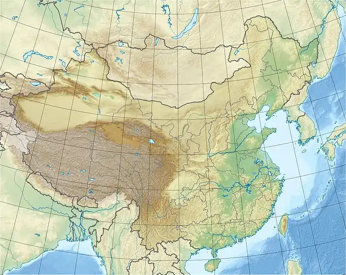
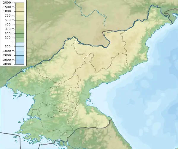
The Changbai Mountains are a major mountain range in Northeast Asia that extends from the Northeast Chinese provinces of Heilongjiang, Jilin and Liaoning, across the border between China and North Korea (41°41' to 42°51'N; 127°43' to 128°16'E), to the North Korean provinces of Ryanggang and Chagang. They are also referred to as the Jangbaek or Ohnan Mountains in Korean, and as the Šanggiyan Mountains in Manchu. Most peaks exceed 2,000 meters (6,600 feet) in height, with the highest being Paektu Mountain.
| Changbai Mountains | |
|---|---|
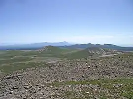 View from Mount Paektu, the highest peak in the range | |
| Highest point | |
| Peak | Mount Paektu |
| Elevation | 2,744 m (9,003 ft) |
| Prominence | 2,593 m (8,507 ft) |
| Geography | |
  | |
| Countries | China and North Korea |
| Range coordinates | 41.733°N 128.067°E |
| Changbai Mountains | |||||||||
|---|---|---|---|---|---|---|---|---|---|
| Chinese name | |||||||||
| Simplified Chinese | 长白山脉 | ||||||||
| Traditional Chinese | 長白山脈 | ||||||||
| Literal meaning | Perpetually White Mountains | ||||||||
| |||||||||
| Korean name | |||||||||
| Chosŏn'gŭl | 장백산맥 | ||||||||
| Hancha | 長白山脈 | ||||||||
| |||||||||
| Manchu name | |||||||||
| Manchu script | ᡤᠣᠯᠮᡳᠨ ᡧᠠᠩᡤᡳᠶᠠᠨ ᠠᠯᡳᠨ | ||||||||
| Romanization | Golmin šanggiyan alin | ||||||||
History

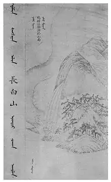
The range represents the mythical birthplace of Bukūri Yongšon, ancestor of Nurgaci (Nurhaci)[1] and the Aisin Gioro imperial family, who were the founders of both the Manchu state and the Qing dynasty of China. The Chinese name literally means "Perpetually-White Mountain Region".[2]
The Aisin Gioro emperor Hongtaiji claimed that their progenitor, Bukūri Yongšon[3] (布庫里雍順), was conceived from a virgin birth. According to the legend, three heavenly maidens, namely Enggulen (恩古倫), Jenggulen (正古倫) and Fekulen (佛庫倫), were bathing at a lake called Bulhūri Omo near the Changbai Mountains. A magpie dropped a piece of red fruit near Fekulen, who ate it. She then became pregnant with Bukūri Yongšon. However, another older version of the story by the Hurha (Hurka) tribe member Muksike recorded in 1635 contradicts Hongtaiji's version on location, claiming that it was in Heilongjiang province close to the Amur river at Bukuri mountain where Bulhuri lake was located where the "heavenly maidens" took their bath. This was recorded in the Jiu Manzhou Dang and his much shorter and simpler in addition to being older. This is believed to be the original version and Hongtaiji changed it to Changbai mountain. It shows that the Aisin Gioro clan originated in the Amur area and the Heje (Hezhen) and other Amur valley Jurchen tribes had an oral version of the same tale. It also fits with Jurchen history since some ancestors of the Manchus originated north before the 14th-15th centuries in the Amur and only later moved south.[4]
Geography and climate
The mountains are the source of the Songhua, Tumen, and Yalu Rivers.[5]
The Changbai Mountains are characterized by long, cold winters. Precipitation is low in winter, but higher in the summer and fall, with annual averages reaching as high as 1,400 millimeters (55 in).[6]
Flora and fauna
The vegetation of the mountain slopes is divided into several different zones. At the top, above 2,000 meters (6,562 ft), tundra predominates. From 1,700–2,000 meters (5,577–6,562 ft), vegetation is dominated by mountain birch and larch. Below this zone, and down to 1,100 meters (3,609 ft), the dominant trees are spruce, fir, and Korean pine. From 600–1,100 meters (1,969–3,609 ft), the landscape is dominated by mixed forest consisting of Amur linden (Tilia amurensis), Korean pine, maple, and elm. Further down, a temperate hardwood forest is found, dominated by second-growth poplar and birch.[7]
Protected areas
Popularity
The Changbai Mountains is mentioned in the first verse of the de facto national anthem of North Korea, Song of General Kim Il-sung, with its Korean name, "Jangbaek."[8]
References
- 愛新覺羅·瀛生《滿語口語音典》
- Crossley, Pamela Kyle (February 2000). A Translucent Mirror: History and Identity in Qing Imperial Ideology. University of California Press. p. 202. ISBN 9780520234246.
- Pamela Kyle Crossley (15 February 2000). A Translucent Mirror: History and Identity in Qing Imperial Ideology. University of California Press. pp. 198–. ISBN 978-0-520-92884-8.
- Huang, Pei (1990). "New Light on The Origins of The Manchus" (PDF). Harvard Journal of Asiatic Studies. 50 (1): 239–282. Archived from the original on 2020.
- "Changbai Mountains -- Scenic Wonderland". China.org.cn. Retrieved 12 July 2014.
- "Changbai Mountains mixed forests (PA0414)". WildWorld Ecoregion Profile, National Geographic Society. World Wildlife Fund. Archived from the original on 2010-03-08. Retrieved 9 February 2015.
- Liu, Q.J., Takamura, T., Takeuchi, N., Shao, G. (2002). Mapping of boreal vegetation of a temperate mountain in China by multitemporal LANDSAT imagery. International Journal of Remote Sensing 23(17), p. 3388
External links
| Wikimedia Commons has media related to Changbai / Paektu Mountains. |
Mountain ranges of China | |
|---|---|
| Northwest China | |
| Qinghai-Tibet and Southwest China | |
| Northeast China | |
| North and East China | |
| Central China | |
| South China | |
Heilongjiang topics | |
|---|---|
| General | |
| Geography | |
| Education | |
| Visitor attractions | |
| |