Chuadanga Sadar Upazila
Chuadanga Sadar (Bengali: চুয়াডাঙ্গা সদর) is an upazila of Chuadanga District[1] in the Division of Khulna, Bangladesh.
Chuadanga Sadar
চুয়াডাঙ্গা সদর | |
|---|---|
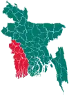
 Chuadanga Sadar Location in Bangladesh | |
| Coordinates: 23°38.5′N 88°51.5′E | |
| Country | |
| Division | Khulna Division |
| District | Chuadanga District |
| Area | |
| • Total | 289.59 km2 (111.81 sq mi) |
| Population (2011) | |
| • Total | 313.935 |
| • Density | 771/km2 (2,000/sq mi) |
| Time zone | UTC+6 (BST) |
| Website | chuadangasadar |
Geography
Chuadanga Sadar is located at 23.6417°N 88.8583°E. It has 41135 households and total area 289.59 km2.
Chuadanga Sadar Upazila is bounded by Alamdanga Upazila in Chuadanga District, on the north, Jhenaidah Sadar, Kotchandpur, Harinakunda Upazilas, in Jhenaidah District, on the east, Jibannagar Upazila, in Chuadanga District, on the South and Damurhuda Upazila in Chuadanga District and Krishnaganj CD Block, in Nadia District, West Bengal, India, on the west.[2][3]
1971 liberation war
The Bir Protik award for gallantry was awarded to Harunur Rashed of Chuadanga District. He was killed on November 27 at Jadupur, under Chuadanga Sadar Upazila. He is buried at Jadupur in the tomb on the day after the elimination of Johor. He fought heroically in many parts of Chuadanga. Every 16 December and 26 March Chuadanga honours his family. He has a son who was born six months after his father's death. His wife's name was Mst. Suraton Nesa. She died in 2004.[4]
Demographics
According to 2011 Bangladesh census, Chuadanga Sadar had a population of 313,935. Males constituted 49.94% of the population and females 50.06. Muslims formed 97.246% of the population, Hindus 2.683%, Christians 0.055% and others 0.016%. Chuadanga Sadar had a literacy rate of 47.54% for the population 7 years and above.[5]
As of the 1991 Bangladesh census, Chuadanga Sadar has a population of 223,247. Males constitute 51.37% of the population, and females 48.63%. This Upazila's eighteen up population is 115,858. Chuadanga Sadar has an average literacy rate of 28.7% (7+ years), and the national average of 32.4% literate.[6]
Administration
Chuadanga Sadar Upazila is divided into Chuadanga Municipality and nine union parishads: Alukdia, Begumpur, Kutubpur, Mominpur, Padmabila, Shankar Chandra, and Titudah. The union parishads are subdivided into 102 mauzas and 128 villages.[7]
Chuadanga Municipality is subdivided into 9 wards and 21 mahallas.[7]
Transport
Chuadanga is connected with Capital Dhaka by Road & Train. CD explorer, Royal Express, Purbasha Paribahan, JR Paribahan, Darsana deluxe and Sonartori etc. are the main bus operators.
Notable persons
- Solaiman Haque Joarder, MP
- Rahmot Jamy, writer
References
- Md. Faysal Kibria (2012), "Chuadanga Sadar Upazila", in Sirajul Islam; Ahmed A. Jamal (eds.), Banglapedia: National Encyclopedia of Bangladesh (Second ed.), Asiatic Society of Bangladesh
- "Chuadanga Upazila". Banglapedia. Retrieved 15 November 2018.
- "Tehsil Map of Nadia". CD Block/ Tehsil. Maps of India. Retrieved 15 November 2018.
- স্মৃতিফলকে নাম নেই বীরপ্রতীকের!. banglamail24.com (in Bengali). 17 December 2012. Archived from the original on 2 March 2016. Retrieved 20 February 2016.
- "Bangladesh Population and Housing Census 2011: Zila Report – Chuadanga" (PDF). Table P01 : Household and Population by Sex and Residence, Table P05 : Population by Religion, Age group and Residence, Table P09 : Literacy of Population 7 Years & Above by Religion, Sex and Residence. Bangladesh Bureau of Statistics (BBS), Ministry of Planning, Government of the People’s Republic of Bangladesh. Retrieved 9 December 2018.
- "Population Census Wing, BBS". Archived from the original on 2005-03-27. Retrieved November 10, 2006.
- "District Statistics 2011: Chuadanga" (PDF). Bangladesh Bureau of Statistics. Archived from the original (PDF) on 13 November 2014. Retrieved 14 July 2014.
| Upazilas | ||
|---|---|---|
| Constituencies | ||
| Inhabited areas | ||
| Transport | ||
| Education | ||