Jhikargacha Upazila
Jhikargachha (Bengali: ঝিকরগাছা) is an upazila of Jessore District in the Division of Khulna, Bangladesh.
Jhikargacha
ঝিকরগাছা | |
|---|---|
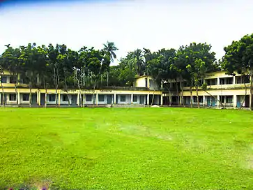 Mokamtala School is in Jhikargacha Upazila | |
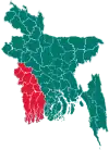
 Jhikargacha Location in Bangladesh | |
| Coordinates: 23°6′N 89°8′E | |
| Country | |
| Division | Khulna Division |
| District | Jessore District |
| Area | |
| • Total | 307.96 km2 (118.90 sq mi) |
| Population (2011 Census) | |
| • Total | 298,908 |
| • Density | 970/km2 (2,500/sq mi) |
| Time zone | UTC+6 (BST) |
| Website | Official Map of Jhikargachha |
History
Jhikargachha is named after the idogo planter Jhinkar. Bir Shresta Nur Muhammad Sheikh was killed on 5 September 1971 at the village of Goal Hat in an encounter with the East Pakistani army. In April 1971 many people were killed and wounded when the East Pakistani army attacked Krishnapur. Relics of the War of Liberation are a memorial and a mass killing site.
Geography
Jhikargachha is located at 23.1000°N 89.1333°E. It has 43,439 households and a total area of 307.28 km2.
Jhikargachha Upazila has an area of 307.96 km2. It is bordered by Chaugachha Upazila to the north, Kalaroa Upazila to the south, Jessore Sadar Upazila and Manirampur Upazilas to the east, and Sharsha Upazila to the west. Its main rivers are the Kapotakkho and Betna. Jhikargachha (Town) stands on the bank of the Kapotakkho, consists of 9 wards and 14 mahallas. The Jhikargachha Municipality was established in 1988. The area of the town is 16.34 km2.
Demographics
According to the 2011 Bangladesh census, Jhikargachha had a population of 298,908. Males constituted 49.22% of the population and females 50.78%. Muslims formed 94.26% of the population, Hindus 4.82%, Christians 0.89% and others 0.03%. Jhikargachha had a literacy rate of 53.02% for the population 7 years and above.[1]
At the 1991 Bangladesh census, Jhikargachha had a population of 235,882. Males constituted 51.24% of the population and females 48.76%. The population aged 18 or older is 119,652. Jhikargachha has an average literacy rate of 27.9% (7+ years), compared to the national average of 32.4%.[2]
Administration
Jhikargacha thana was turned into an upazila in 1983.
Jhikargacha Upazila is divided into Jhikargacha Municipality and 11 union parishads: Bankra, Ganganandapur, Gadkhali, Hajirbagh, Jhikargachha, Magura, Nabharan, Nibaskhola, Panisara, Shankarpur, and Shimula. The union parishads are subdivided into 164 mauzas and 174 villages.[3]
Jhikargacha Municipality is subdivided into 9 wards and 15 mahallas.[3]
Significant sites of Jhikargachha are the 12th century Rajbari of Mukut Roy at Laujani and the Dargah of Gazi Kalu.
Education
According to Banglapedia, Jhikargacha B. M. High School, founded in 1936, Ganganandapur High School (1940), Jhikargachha Pilot Girls High School (1953), Jhikargacha M. L. High School (1888), and Raghunath Nagar Secondary School (1922) are notable secondary schools.[4]
References
- "Bangladesh Population and Housing Census 2011: Zila Report – Jessore" (PDF). Table P01 : Household and Population by Sex and Residence, Table P05 : Population by Religion, Age group and Residence, Table P09 : Literacy of Population 7 Years & Above by Religion, Sex and Residence. Bangladesh Bureau of Statistics (BBS), Ministry of Planning, Government of the People’s Republic of Bangladesh. Retrieved 17 December 2018.
- "Population Census Wing, BBS". Archived from the original on 2005-03-27. Retrieved November 10, 2006.
- "District Statistics 2011: Jessore" (PDF). Bangladesh Bureau of Statistics. Archived from the original (PDF) on 13 November 2014. Retrieved 14 July 2014.
- Ansari, Firoj (2012). "Jhikargachha Upazila". In Islam, Sirajul; Jamal, Ahmed A. (eds.). Banglapedia: National Encyclopedia of Bangladesh (Second ed.). Asiatic Society of Bangladesh.
| Upazila/Thana: | ||
|---|---|---|