Dighalia Upazila
Dighalia (Bengali: দিঘলিয়া) is an upazila of Khulna District[1] in the Division of Khulna, Bangladesh.
Dighalia
দিঘলিয়া | |
|---|---|
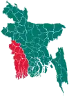
 Dighalia Location in Bangladesh | |
| Coordinates: 22°54.5′N 89°32′E | |
| Country | |
| Division | Khulna Division |
| District | Khulna District |
| Area | |
| • Total | 77.16 km2 (29.79 sq mi) |
| Population (1991) | |
| • Total | 107,840 |
| • Density | 1,400/km2 (3,600/sq mi) |
| Time zone | UTC+6 (BST) |
| Website | Official Map of Dighalia |
Geography
Dighalia is located at 22.9083°N 89.5333°E. It has 20,768 households and a total area of 77.16 km2.
Demographics
According to the 1991 Bangladesh census, Dighalia had a population of 107840. Males constitute 53% of the population, and females 47%. The population aged 18 or over was 56,104. Dighalia has an average literacy rate of 39.4% (7+ years), compared to the national average of 32.4%.[2]
Administration
Dighalia Upazila is divided into Dighalia Municipality and six union parishads: Aranghata, Barakpur, Dighalia, Gazirhat, Jogipol, and Senhati. The union parishads are subdivided into 29 mauzas and 43 villages.[3][4]
References
- Md Mamun Reza (2012), "Dighalia Upazila", in Sirajul Islam; Ahmed A. Jamal (eds.), Banglapedia: National Encyclopedia of Bangladesh (Second ed.), Asiatic Society of Bangladesh
- "Population Census Wing, BBS". Archived from the original on 2005-03-27. Retrieved November 10, 2006.
- "District Statistics 2011: Khulna" (PDF). Bangladesh Bureau of Statistics. Archived from the original (PDF) on 13 November 2014. Retrieved 14 July 2014.
- দিঘলিয়া উপজেলা [Unions]. Dighalia Upazila (in Bengali).
Capital: Khulna | ||
| Upazilas/Thanas | ||
| Constituencies | ||
| Attractions and sites | ||
| Education | ||
This article is issued from Wikipedia. The text is licensed under Creative Commons - Attribution - Sharealike. Additional terms may apply for the media files.