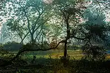
Kalia Upazila
Kalia (Bengali: কালিয়া) is an upazila of Narail District in the Division of Khulna, Bangladesh. Kalia Thana was established in 1866 and was converted into an upazila in 1984.[3] It is named after its administrative center, the town of Kalia.
Kalia
কালিয়া | |
|---|---|
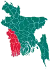
 Kalia Location in Bangladesh | |
| Coordinates: 23°2′N 89°38′E | |
| Country | |
| Division | Khulna Division |
| District | Narail District |
| Area | |
| • Total | 301.32 km2 (116.34 sq mi) |
| Population (2011 census)[2] | |
| • Total | 220,202 |
| • Density | 730/km2 (1,900/sq mi) |
| Time zone | UTC+6 (BST) |
| Postal code | 7520 |
| Website | kaliapaurashava |
Geography
Kalia Upazila has a total area of 301.32 square kilometres (116.34 sq mi).[1] It borders Lohagara Upazila to the north, Dhaka Division to the east, Bagerhat and Khulna districts to the south, Jessore District to the southwest, and Narail Sadar Upazila to the northwest. The Nabaganga River flows south through the upazila.[3]
Demographics
| Year | Pop. (000) | ±% |
|---|---|---|
| 1981 | 184 | — |
| 1991 | 197 | +7.1% |
| 2001 | 208 | +5.6% |
| 2011 | 220 | +5.8% |
| Source: Bangladesh Bureau of Statistics[1] | ||
According to the 2011 Bangladesh census, Kalia Upazila had 48,579 households and a population of 220,202, 16.3% of whom lived in urban areas.[2] 10.8% of the population was under the age of 5.[4] The literacy rate (age 7 and over) was 55.3%, compared to the national average of 51.8%.[5][6]
Administration
Kalia Upazila is divided into Kalia Municipality and 14 union parishads: Babrahasla, Baioshona, Boronaleliasabad, Chacuri, Hamidpur, Jaynagor, Kalabaria, Khashial, Mauli, Pahardanga, Panchgram, Peroli, Purulia, and Salamabad.[7] The union parishads are subdivided into 111 mauzas and 187 villages.
Kalia Municipality is subdivided into 9 wards and 19 mahallas.[1]
Education
There are five colleges in the upazila. They include Munshi Manik Miah College, and Shaheed Abdus Salam Degree College.[8]
History of the Liberation War
On 8 December 1971, freedom fighters attacked Kalia High School and Municipality house to Pakistani Army and Razakars camp. During the last 3 days (8-10 December), 3 freedom fighters were killed and 4 Pakistani soldiers and 9 Rajakars were killed.
Entertainment center

There is located Arunima Eco Park at Panipara, Kalia. [9]
References
- "District Statistics 2011: Narail" (PDF). Bangladesh Bureau of Statistics. Archived from the original (PDF) on November 13, 2014. Retrieved July 25, 2014.
- "Population Census 2011: Narail Table C-01" (PDF). Bangladesh Bureau of Statistics. Archived from the original (PDF) on July 29, 2014. Retrieved July 11, 2014.
- Aawhad, AAM (2012). "Kalia Upazila". In Islam, Sirajul; Jamal, Ahmed A. (eds.). Banglapedia: National Encyclopedia of Bangladesh (Second ed.). Asiatic Society of Bangladesh.
- "Population Census 2011: Narail Table C-04" (PDF). Bangladesh Bureau of Statistics. Archived from the original (PDF) on July 29, 2014. Retrieved July 11, 2014.
- "Population Census 2011: Narail Table C-06" (PDF). Bangladesh Bureau of Statistics. Archived from the original (PDF) on July 29, 2014. Retrieved July 11, 2014.
- "Population and Housing Census 2011: Bangladesh at a Glance" (PDF). Bangladesh Bureau of Statistics. Archived from the original (PDF) on July 28, 2014. Retrieved July 21, 2014.
- "Union List". Bangladesh National Portal. Retrieved March 20, 2016.
- "List of Institutions". Ministry of Education. Retrieved July 15, 2014.
- "Arunima Eco Park". Find Tourist Attractions in Bangladesh.
