Harinakunda Upazila
Harinakundu (Bengali: হরিণাকুন্ড) is an upazila of Jhenaidah District[1] in the Division of Khulna, Bangladesh.
Harinakundu
হরিণাকুন্ডু | |
|---|---|
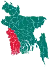
 Harinakundu Location in Bangladesh | |
| Coordinates: 23.6568°N 89.0424°E | |
| Country | |
| Division | Khulna Division |
| District | Jhenaidah District |
| Area | |
| • Total | 227.19 km2 (87.72 sq mi) |
| Population (2011) | |
| • Total | 197,723 |
| • Density | 870/km2 (2,300/sq mi) |
| Time zone | UTC+6 (BST) |
| Website | Official Map of Harinakunda |
Geography
Harinakunda is located at 23.6568°N 89.0424°E. It has 27,408 households and total area 227.19 km2.
Demographics
According to the 2011 Bangladesh census, Harinakunda had a population of 197,723. Males constituted 50.21% of the population and females 49.79%. Muslims formed 95.43% of the population, Hindus 4.42%, Christians 0.01% and others 0.14%. Harinakunda had a literacy rate of 42.31% for the population 7 years and above.[2]
As of the 1991 Bangladesh census, Harinakunda has a population of 162,078. Males constitute 51.57% of the population, and females 48.43%. This Upazila's eighteen up population is 79,363. Harinakunda has an average literacy rate of 20.8% (7+ years), and the national average of 32.4% literate.[3]
Administration
Harinakunda Upazila is divided into Harinakunda Municipality and eight union parishads: Bhayna, Chandpur, Daulatpur, Falsi, Joradah, Kapashatia, Raghunathpur, and Taherhuda. The union parishads are subdivided into 77 mauzas and 122 villages.[4]
Harinakunda Municipality is subdivided into 9 wards and 17 mahallas.[4]
References
- Tipu Sultan Bari (2012), "Harinakunda Upazila", in Sirajul Islam and Ahmed A. Jamal (ed.), Banglapedia: National Encyclopedia of Bangladesh (Second ed.), Asiatic Society of Bangladesh
- "Bangladesh Population and Housing Census 2011: Zila Report – Jhenaidah" (PDF). Table P01 : Household and Population by Sex and Residence, Table P05 : Population by Religion, Age group and Residence, Table P09 : Literacy of Population 7 Years & Above by Religion, Sex and Residence. Bangladesh Bureau of Statistics (BBS), Ministry of Planning, Government of the People’s Republic of Bangladesh. Retrieved 17 December 2018.
- "Population Census Wing, BBS". Archived from the original on 2005-03-27. Retrieved November 10, 2006.
- "District Statistics 2011: Jhenaidah" (PDF). Bangladesh Bureau of Statistics. Archived from the original (PDF) on 13 November 2014. Retrieved 14 July 2014.
| Upazila/Thana: | ||
|---|---|---|