Meherpur Sadar Upazila
Meherpur Sadar (Bengali: মেহেরপুর সদর) is an upazila of Meherpur District[1] in the Division of Khulna, Bangladesh. Meherpur is the smallest district of Bangladesh in the South-western part within the Khulna Division. Before the partition in 1947, Meherpur was a part of the Nadia district of undivided India. Before 1984, it was a subdivision of Kushtia district. Meherpur consists of 1 municipality, 9 wards and 72 mahallas, 3 upazilas, 18 union parishads, 277 villages, 190 mouzas. The upazilas are Meherpur Sadar, Gangni and Mujibnagar.
Meherpur Sadar
মেহেরপুর সদর | |
|---|---|
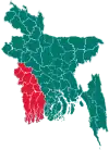
 Meherpur Sadar Location in Bangladesh | |
| Coordinates: 23°46.5′N 88°38.5′E | |
| Country | |
| Division | Khulna Division |
| District | Meherpur District |
| Area | |
| • Total | 374.1 km2 (144.4 sq mi) |
| Population (2011) | |
| • Total | 256,642 |
| • Density | 690/km2 (1,800/sq mi) |
| Time zone | UTC+6 (BST) |
| Website | Official Map of Meherpur Sadar |
History
Bangladesh's Proclamation of Independence was solemnly made at the village Baidyanathtola (now Mujibnagar), on 17 April 1971 of this district. The first provisional government of Bangladesh began here under the leadership of Tajuddin Ahmed. After that day on 18 April 1971, the Pakistani army killed 8 people at village of Amjhupi.
Geography
Meherpur Sadar is located at23.7750°N 88.6417°E. It has 49043 households and total area 374.1 km2.
Meherpur Sadar Upazila is bounded by Gangni Upazila and Tehatta I CD Block, in Nadia District, West Bengal, India, on the north, Gangni Upazila and Alamdanga Upazila, the latter in Chuadanga District, on the east, Damurhuda Upazila and Mujibnagar Upazila in Chuadanga District, on the south and Tehatta I CD Block in Nadia district, on the west.[2][3]
Main rivers
The main rivers are Bhairab, Mathabhaga and Kazli.
Demographics
According to 2011 Bangladesh census, Meherpur Sadar had a population of 256,642. Males constituted 49.60% of the population and females 50.40%. Muslims formed 98.317% of the population, Hindus 1.636%, Christians 0.044%, and others 0.002%. Meherpur Sadar had a literacy rate of 49.35% for the population 7 years and above.[4]
According to the 1991 Bangladesh census, Meherpur Sadar had a population of 262,779, of whom 140,387 were aged 18 or over. Males constituted 51.2% of the population, and females 48.8%. Meherpur Sadar has an average literacy rate of 24.9% (7+ years), and the national average of 32.4%.[5]
Administration
Meherpur Sadar Upazila is divided into Meherpur Municipality and five union parishads: Amdah, Amjhupi, Buripota, Kutubpur, and Pirojpur. The union parishads are subdivided into 61 mauzas and 104 villages.[6]
Meherpur Municipality is subdivided into 9 wards and 72 mahallas.[6]
References
- Gazi Rahman (2012), "Meherpur Sadar Upazila", in Sirajul Islam and Ahmed A. Jamal (ed.), Banglapedia: National Encyclopedia of Bangladesh (Second ed.), Asiatic Society of Bangladesh
- "Meherpur Sadar Upazila". Banglapedia. Retrieved 15 November 2018.
- "Tehsil Map of Nadia". CD Block/ Tehsil. Maps of India. Retrieved 15 November 2018.
- "Bangladesh Population and Housing Census 2011: Zila Report – Meherpur" (PDF). Table P01 : Household and Population by Sex and Residence, Table P05 : Population by Religion, Age group and Residence, Table P09 : Literacy of Population 7 Years & Above by Religion, Sex and Residence. Bangladesh Bureau of Statistics (BBS), Ministry of Planning, Government of the People’s Republic of Bangladesh. Retrieved 9 December 2018.
- "Population Census Wing, BBS". Archived from the original on 2005-03-27. Retrieved November 10, 2006.
- "District Statistics 2011: Meherpur" (PDF). Bangladesh Bureau of Statistics. Archived from the original (PDF) on 13 November 2014. Retrieved 14 July 2014.

