Cima Garlenda
Cima Garlenda is a 2141 m mountain of the Ligurian Alps, in Italy. After Monte Saccarello and Monte Frontè it is the third Ligurian summit.
| Cima Garlenda | |
|---|---|
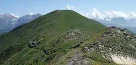 The mountain seen from Monte Frontè | |
| Highest point | |
| Elevation | 2,141 m (7,024 ft) [1] |
| Prominence | 60 m (200 ft) [2] |
| Coordinates | 44°03′40.39″N 07°45′34.2″E |
| Geography | |
 Cima Garlenda Location in the Alps | |
| Location | Liguria, Italy |
| Parent range | Ligurian Alps |
| Climbing | |
| First ascent | ancestral |
| Easiest route | from Passo Frontè |
Geography
The mountain is located in the province of Imperia, in Liguria. In the SOIUSA (International Standardized Mountain Subdivision of the Alps) it belongs to the Nodo del Monte Saccarello (SOIUSA code: I/A-1.II-A.1.a).[3] Cima Garlenda is located on the main chain of the Alps between Tanaro and Arroscia valleys, and is divided from the neighbouring Monte Frontè by Passo Frontè (2081 m).
History
The slopes of Cima Garlenda were deforested during past centuries in order to increase pasture land. The lower part of the mountain was mainly used by cattle while is upper part was mainly grazed by sheep and goats.[4] The slopes of the mountain belonging to Arroscia Valley are still used for grazing.
Access to the summit
The summit of Cima Garlenda can easily be accessed following an unmarked trak starting from passo Frontè, which is accessible by the Alta Via dei Monti Liguri, a long-distance trail from Ventimiglia (province of Imperia) to Bolano (province of La Spezia).[5] its whide summit ca also be accessed by mountain bike.[6]
Mountain huts
- Rifugio Sanremo (2,054 m)
Conservation
The southern side of the mountain since 2007 is included in the Parco naturale regionale delle Alpi Liguri.[7]
See also
References
![]() Media related to Cima Garlenda at Wikimedia Commons
Media related to Cima Garlenda at Wikimedia Commons
- Italian official map 1:25.00 of Istituto Geografico Militare (on-line on www.pcn.minambiente.it)
- key col: Passo Frontè (2081 m)
- Marazzi, Sergio (2005). Atlante Orografico delle Alpi. SOIUSA (in Italian). Priuli & Verlucca. p. 134. ISBN 978-88-8068-273-8.
- AA.VV. (1951). Memorie di Geografia Antropica (in Italian). 6, 7. Retrieved 2015-06-26.
- "Alta via dei monti liguri - 01 - Anello del Saccarello". www.altaviadeimontiliguri.it. Associazione Alta Via dei Monti Liguri. Archived from the original on 2016-03-03. Retrieved 2015-06-25.
- Monte Frontè (2152 m) & Cima Garlenda (2142 m), article on (access: June 26, 2015)
- Parco Naturale Regionale delle Alpi Liguri, www.parks.it
