City of Wangaratta
The City of Wangaratta was a local government area located about 260 kilometres (162 mi) northeast of Melbourne, the state capital of Victoria, Australia. The city covered an area of 25.53 square kilometres (9.9 sq mi), and existed from 1863 until 1994. It was responsible for the urban area of Wangaratta.
| City of Wangaratta Victoria | |||||||||||||||
|---|---|---|---|---|---|---|---|---|---|---|---|---|---|---|---|
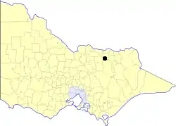 Location in Victoria | |||||||||||||||
| Population | 16,200 (1992)[1] | ||||||||||||||
| • Density | 634.5/km2 (1,643/sq mi) | ||||||||||||||
| Established | 1863 | ||||||||||||||
| Area | 25.53 km2 (9.9 sq mi) | ||||||||||||||
| Council seat | Wangaratta | ||||||||||||||
| County | Bogong, Moira | ||||||||||||||
_Council_1994.jpg.webp) | |||||||||||||||
| |||||||||||||||
History
Wangaratta was first incorporated as a borough on 19 June 1863, only nine days after the surrounding North Ovens Road District was proclaimed. On 15 April 1959, Wangaratta was proclaimed a city. It absorbed sections to its south on 31 May 1968 and 10 March 1976, and to its north on 1 October 1979, from the Shire of Wangaratta.[2]
On 18 November 1994, the City of Wangaratta was abolished, and, along with the Shires of Oxley and Wangaratta, and various surrounding districts, was merged into the newly created Rural City of Wangaratta.[3]
The city was not divided into wards, and its eight councillors represented the entire city.
Suburbs
- Wangaratta
- Laceby (shared with the Shire of Oxley)
- North Wangaratta (shared with the Shire of Wangaratta)
- Waldara
- Wangaratta South
Population
| Year | Population |
|---|---|
| 1954 | 10,715 |
| 1958 | 12,210* |
| 1961 | 13,784 |
| 1966 | 15,167 |
| 1971 | 15,633 |
| 1976 | 16,157 |
| 1981 | 16,202 |
| 1986 | 16,598 |
| 1991 | 15,984 |
* Estimate in the 1958 Victorian Year Book.
References
- Australian Bureau of Statistics, Victoria Office (1994). Victorian Year Book. p. 52. ISSN 0067-1223.
- Victorian Municipal Directory. Brunswick: Arnall & Jackson. 1992. pp. 510–511. Accessed at State Library of Victoria, La Trobe Reading Room.
- Australian Bureau of Statistics (1 August 1995). Victorian local government amalgamations 1994-1995: Changes to the Australian Standard Geographical Classification (PDF). Commonwealth of Australia. p. 9. ISBN 0-642-23117-6. Retrieved 5 January 2008.