Shire of Kara Kara
The Shire of Kara Kara was a local government area about 240 kilometres (149 mi) northwest of Melbourne, the state capital of Victoria, Australia. The shire covered an area of 2,292.79 square kilometres (885.3 sq mi), and existed from 1861 until 1994.
| Shire of Kara Kara Victoria | |||||||||||||||
|---|---|---|---|---|---|---|---|---|---|---|---|---|---|---|---|
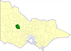 Location in Victoria | |||||||||||||||
 Former Shire offices in St Arnaud | |||||||||||||||
| Population | 1,160 (1992)[1] | ||||||||||||||
| • Density | 0.5059/km2 (1.310/sq mi) | ||||||||||||||
| Established | 1861 | ||||||||||||||
| Area | 2,292.79 km2 (885.3 sq mi) | ||||||||||||||
| Council seat | St Arnaud | ||||||||||||||
| County | Kara Kara | ||||||||||||||
| |||||||||||||||
History
Kara Kara was first incorporated as the St Arnaud Road District on 25 June 1861, which became a shire on 14 November 1864. It was renamed as Kara Kara on 20 October 1884.[2]
On 20 January 1995, the Shire of Kara Kara was abolished, and, along with the City of Stawell, the Town of St Arnaud, and parts of the Shires of Ararat, Avoca, Donald, Dunmunkle, Stawell, and the Grampians National Park within the Shire of Wimmera, was merged into the newly created Shire of Northern Grampians. The Cope Cope district was transferred to the newly created Shire of Buloke.[3]
Wards
The Shire of Kara Kara was divided into three ridings, each of which elected three councillors:
- South Riding
- East Riding
- West Riding
Towns and localities
- Avon Plains
- Beazleys Bridge
- Carapooee
- Coonooer West
- Cope Cope
- Emu
- Gooroc
- Gowar East
- Gre Gre
- Kooreh
- Moolerr
- Paradise
- Rostron
- Slaty Creek
- Stuart Mill
- St Arnaud North
- Sutherland
- Swanwater
- Tottington
- Traynors Lagoon
- Winjallok
Population
| Year | Population |
|---|---|
| 1954 | 1,663 |
| 1958 | 1,680* |
| 1961 | 1,421 |
| 1966 | 1,360 |
| 1971 | 1,193 |
| 1976 | 1,099 |
| 1981 | 1,069 |
| 1986 | 1,142 |
| 1991 | 1,123 |
* Estimate in the 1958 Victorian Year Book.
References
- Australian Bureau of Statistics, Victoria Office (1994). Victorian Year Book. pp. 49–52. ISSN 0067-1223.
- Victorian Municipal Directory. Brunswick: Arnall & Jackson. 1992. pp. 712–713. Accessed at State Library of Victoria, La Trobe Reading Room.
- Australian Bureau of Statistics (1 August 1995). Victorian local government amalgamations 1994-1995: Changes to the Australian Standard Geographical Classification (PDF). Commonwealth of Australia. p. 5,10. ISBN 0-642-23117-6. Retrieved 5 January 2008.