Shire of Lexton
The Shire of Lexton was a local government area about 150 kilometres (93 mi) northwest of Melbourne, the state capital of Victoria, Australia. The shire covered an area of 821.03 square kilometres (317.0 sq mi), and existed from 1860 until 1994.
| Shire of Lexton Victoria | |||||||||||||||
|---|---|---|---|---|---|---|---|---|---|---|---|---|---|---|---|
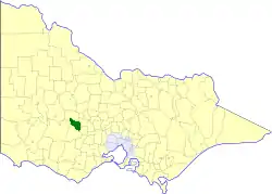 Location in Victoria | |||||||||||||||
| Population | 1,380 (1992)[1] | ||||||||||||||
| • Density | 1.681/km2 (4.353/sq mi) | ||||||||||||||
| Established | 1860 | ||||||||||||||
| Area | 821.03 km2 (317.0 sq mi) | ||||||||||||||
| Council seat | Lexton | ||||||||||||||
| County | Gladstone, Kara Kara, Ripon, Talbot | ||||||||||||||
| |||||||||||||||
History
Lexton was incorporated as a road district on 17 February 1860, and became a shire on 30 June 1864. In January 1941, it annexed parts of the Shire of Avoca.[2]
On 23 September 1994, the Shire of Lexton was abolished, and, along with the Shire of Ripon, and parts of the Shire of Avoca, was merged into the newly created Shire of Pyrenees.[3]
Wards
The Shire of Lexton was divided into three ridings on 1 April 1988, each of which elected three councillors:
- North Riding
- South Riding
- West Riding
Towns and localities
- Amphitheatre
- Burnbank
- Evansford
- Glenbrae
- Glenlogie
- Glenpatrick
- Langi Kal Kal
- Lexton
- Mount Lonarch
- Nowhere Creek
- Trawalla
- Waterloo
- Waubra
Population
| Year | Population |
|---|---|
| 1954 | 1,350 |
| 1958 | 1,470* |
| 1961 | 1,443 |
| 1966 | 1,371 |
| 1971 | 1,315 |
| 1976 | 1,280 |
| 1981 | 1,211 |
| 1986 | 1,295 |
| 1991 | 1,314 |
* Estimate in the 1958 Victorian Year Book.
References
- Australian Bureau of Statistics, Victoria Office (1994). Victorian Year Book. pp. 49–52. ISSN 0067-1223.
- Victorian Municipal Directory. Brunswick: Arnall & Jackson. 1992. pp. 738–739. Accessed at State Library of Victoria, La Trobe Reading Room.
- Australian Bureau of Statistics (1 August 1995). Victorian local government amalgamations 1994-1995: Changes to the Australian Standard Geographical Classification (PDF). Commonwealth of Australia. p. 11. ISBN 0-642-23117-6. Retrieved 5 January 2008.
This article is issued from Wikipedia. The text is licensed under Creative Commons - Attribution - Sharealike. Additional terms may apply for the media files.