Shire of Pyalong
The Shire of Pyalong was a local government area about 85 kilometres (53 mi) north of Melbourne, the state capital of Victoria, Australia. The shire covered an area of 577.57 square kilometres (223.0 sq mi), and existed from 1863 until 1994.
| Shire of Pyalong Victoria | |||||||||||||||
|---|---|---|---|---|---|---|---|---|---|---|---|---|---|---|---|
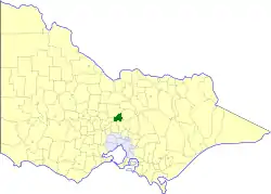 Location in Victoria | |||||||||||||||
| Population | 810 (1992)[1] | ||||||||||||||
| • Density | 1.402/km2 (3.632/sq mi) | ||||||||||||||
| Established | 1863 | ||||||||||||||
| Area | 577.57 km2 (223.0 sq mi) | ||||||||||||||
| Council seat | Pyalong | ||||||||||||||
| County | Dalhousie | ||||||||||||||
| |||||||||||||||
History
Pyalong was incorporated as a road district on 2 September 1863, and became a shire on 5 May 1871.[2]
On 18 November 1994, the Shire of Pyalong was abolished, and, along with the Rural City of Seymour and the Shire of Broadford, and parts of the Shire of McIvor, was merged into the newly created Shire of Mitchell.[3]
Wards
The Shire of Pyalong was divided into three ridings, each of which elected three councillors:
- East Riding
- South Riding
- West Riding
Towns and localities
- Glenaroua
- Moranding
- Puckapunyal
- Pyalong
- Sugarloaf Creek
Population
| Year | Population |
|---|---|
| 1954 | 483 |
| 1958 | 500* |
| 1961 | 456 |
| 1966 | 456 |
| 1971 | 439 |
| 1976 | 472 |
| 1981 | 495 |
| 1986 | 602 |
| 1991 | 744 |
* Estimate in the 1958 Victorian Year Book.
References
- Australian Bureau of Statistics, Victoria Office (1994). Victorian Year Book. p. 52. ISSN 0067-1223.
- Victorian Municipal Directory. Brunswick: Arnall & Jackson. 1992. pp. 811–812. Accessed at State Library of Victoria, La Trobe Reading Room.
- Australian Bureau of Statistics (1 August 1995). Victorian local government amalgamations 1994-1995: Changes to the Australian Standard Geographical Classification (PDF). Commonwealth of Australia. p. 9. ISBN 0-642-23117-6. Retrieved 5 January 2008.
This article is issued from Wikipedia. The text is licensed under Creative Commons - Attribution - Sharealike. Additional terms may apply for the media files.
