Shire of Bairnsdale
The Shire of Bairnsdale was a local government area about 280 kilometres (174 mi) east of Melbourne, the state capital of Victoria, Australia. The shire covered an area of 2,277.9 square kilometres (879.5 sq mi), and existed from 1867 until 1994. For its first one hundred years it governed both Bairnsdale and the surrounding area; however, after that time, Bairnsdale itself had its own local government authority.
| Shire of Bairnsdale Victoria | |||||||||||||||
|---|---|---|---|---|---|---|---|---|---|---|---|---|---|---|---|
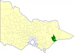 Location in Victoria | |||||||||||||||
| Population | 7,670 (1992)[1] | ||||||||||||||
| • Density | 3.3671/km2 (8.721/sq mi) | ||||||||||||||
| Established | 1867 | ||||||||||||||
| Area | 2,277.9 km2 (879.5 sq mi) | ||||||||||||||
| Council seat | Bairnsdale | ||||||||||||||
| County | Tanjil, Dargo, Wonnangatta | ||||||||||||||
_Council_1994.jpg.webp) | |||||||||||||||
| |||||||||||||||
History
Bairnsdale was first incorporated as a road district on 30 April 1867, and became a shire on 14 July 1868. On 6 January 1882, the Shire of Tambo, centred on Lakes Entrance, split away from Bairnsdale. On 27 May 1914 and 1 October 1964, it lost some land to its west to the Shire of Avon. On 31 May 1967, after a poll of ratepayers, the Centre Riding and parts of the East Riding severed, to form the Town of Bairnsdale, which became a city in 1990.[2]
On 2 December 1994, the Shire of Bairnsdale was abolished, and, along with the City of Bairnsdale, the Shires of Orbost and Tambo, parts of the Shire of Omeo and the Boole Boole Peninsula region from the Shire of Rosedale, was merged into the newly created Shire of East Gippsland. The West Dargo region was transferred to the newly created Shire of Wellington.[3]
Wards
The Shire of Bairnsdale was divided into three ridings, each of which elected three councillors:
- East Riding
- West Riding
- South Riding
Towns and localities
- Eagle Point
- Fernbank
- Iguana Creek
- Lindenow
- Lucknow
- Mount Taylor
- Paynesville
- Walba
- Wy Yung
Population
| Year | Population |
|---|---|
| 1954 | 10,104 |
| 1958 | 10,880* |
| 1961 | 11,198 |
| 1966 | 11,559 |
| 1971 | 3,741 |
| 1976 | 4,473 |
| 1981 | 5,245 |
| 1986 | 6,481 |
| 1991 | 7,239 |
* Estimate in the 1958 Victorian Year Book.
References
- Australian Bureau of Statistics, Victoria Office (1994). Victorian Year Book. pp. 49–52. ISSN 0067-1223.
- Victorian Municipal Directory. Brunswick: Arnall & Jackson. 1992. p. 579. Accessed at State Library of Victoria, La Trobe Reading Room.
- Australian Bureau of Statistics (1 August 1995). Victorian local government amalgamations 1994-1995: Changes to the Australian Standard Geographical Classification (PDF). Commonwealth of Australia. pp. 6, 12. ISBN 0-642-23117-6. Retrieved 5 January 2008.
