Shire of Upper Murray
The Shire of Upper Murray was a local government area about 400 kilometres (249 mi) northeast of Melbourne, the state capital of Victoria, Australia. The shire covered an area of 2,459.81 square kilometres (949.7 sq mi), and existed from 1920 until 1994.
| Shire of Upper Murray Victoria | |||||||||||||||
|---|---|---|---|---|---|---|---|---|---|---|---|---|---|---|---|
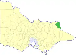 Location in Victoria | |||||||||||||||
| Population | 2,450 (1992)[1] | ||||||||||||||
| • Density | 0.9960/km2 (2.580/sq mi) | ||||||||||||||
| Established | 1920 | ||||||||||||||
| Area | 2,459.81 km2 (949.7 sq mi) | ||||||||||||||
| Council seat | Corryong | ||||||||||||||
| County | Benambra | ||||||||||||||
| |||||||||||||||
History
Upper Murray originally existed as the Corryong Riding and part of the Murray Riding of the Shire of Towong, and was first incorporated as a shire on 1 October 1920.[2]
On 18 November 1994, the Shire re-merged with the Shire of Tallangatta, which had remained from the original Towong shire, into the new Shire of Towong.[3]
Wards
Upper Murray was divided into three ridings, each of which elected three councillors:
- Corryong Riding
- Cudgewa Riding
- Tintaldra Riding
Population
| Year | Population |
|---|---|
| 1954 | 2,521 |
| 1958 | 2,670* |
| 1961 | 2,938 |
| 1966 | 3,335 |
| 1971 | 2,676 |
| 1976 | 2,557 |
| 1981 | 2,463 |
| 1986 | 2,428 |
| 1991 | 2,341 |
* Estimate in the 1958 Victorian Year Book.
References
- Australian Bureau of Statistics, Victoria Office (1994). Victorian Year Book. pp. 49–52. ISSN 0067-1223.
- Victorian Municipal Directory. Brunswick: Arnall & Jackson. 1992. pp. 865–866. Accessed at State Library of Victoria, La Trobe Reading Room.
- Australian Bureau of Statistics (1 August 1995). Victorian local government amalgamations 1994-1995: Changes to the Australian Standard Geographical Classification (PDF). Commonwealth of Australia. p. 11. ISBN 0-642-23117-6. Retrieved 5 January 2008.
This article is issued from Wikipedia. The text is licensed under Creative Commons - Attribution - Sharealike. Additional terms may apply for the media files.