Shire of Broadford
The Shire of Broadford was a local government area about 70 kilometres (43 mi) north of Melbourne, the state capital of Victoria, Australia. The shire covered an area of 576.3 square kilometres (222.5 sq mi), and existed from 1869 until 1994.
| Shire of Broadford Victoria | |||||||||||||||
|---|---|---|---|---|---|---|---|---|---|---|---|---|---|---|---|
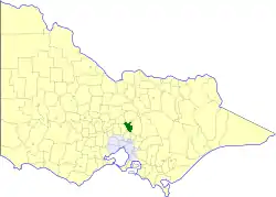 Location in Victoria | |||||||||||||||
| Population | 4,310 (1992)[1] | ||||||||||||||
| • Density | 7.479/km2 (19.370/sq mi) | ||||||||||||||
| Established | 1869 | ||||||||||||||
| Area | 576.3 km2 (222.5 sq mi) | ||||||||||||||
| Council seat | Broadford | ||||||||||||||
| County | Anglesey, Dalhousie | ||||||||||||||
| |||||||||||||||
History
Broadford was first incorporated as a road district on 29 January 1869, and became a shire on 24 December 1874.[2]
On 18 November 1994, the Shire of Broadford was abolished, and, along with the Rural City of Seymour, the Shire of Pyalong, and parts of the Shire of McIvor, was merged into the newly created Shire of Mitchell. The King Parrot and Strath Creek districts were transferred to the newly created Shire of Murrindindi.[3]
Wards
The Shire of Broadford was divided into three ridings, each of which elected three councillors:
- East Riding
- North Riding
- South Riding
Towns and localities
- Broadford
- Clonbinane
- Petersons
- Reedy Creek
- Strath Creek
- Tyaak
- Waterford Park
Population
| Year | Population |
|---|---|
| 1954 | 1,939 |
| 1958 | 2,040* |
| 1961 | 2,076 |
| 1966 | 1,978 |
| 1971 | 1,929 |
| 1976 | 2,045 |
| 1981 | 2,371 |
| 1986 | 3,230 |
| 1991 | 4,096 |
* Estimate in the 1958 Victorian Year Book.
References
- Australian Bureau of Statistics, Victoria Office (1994). Victorian Year Book. p. 52. ISSN 0067-1223.
- Victorian Municipal Directory. Brunswick: Arnall & Jackson. 1992. pp. 610–611. Accessed at State Library of Victoria, La Trobe Reading Room.
- Australian Bureau of Statistics (1 August 1995). Victorian local government amalgamations 1994-1995: Changes to the Australian Standard Geographical Classification (PDF). Commonwealth of Australia. p. 9,10. ISBN 0-642-23117-6. Retrieved 5 January 2008.