Coutras
Coutras is a commune in the Gironde department in Nouvelle-Aquitaine in southwestern France.
Coutras | |
|---|---|
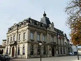 Town hall | |
.svg.png.webp) Coat of arms | |
Location of Coutras 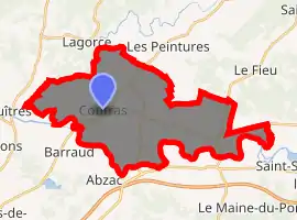
| |
 Coutras  Coutras | |
| Coordinates: 45°02′30″N 0°07′38″W | |
| Country | France |
| Region | Nouvelle-Aquitaine |
| Department | Gironde |
| Arrondissement | Libourne |
| Canton | Le Nord-Libournais |
| Intercommunality | Pays de Coutras |
| Government | |
| • Mayor (2008–2014) | Marie-Claire Arnaud |
| Area 1 | 33.69 km2 (13.01 sq mi) |
| Population (2017-01-01)[1] | 8,606 |
| • Density | 260/km2 (660/sq mi) |
| Time zone | UTC+01:00 (CET) |
| • Summer (DST) | UTC+02:00 (CEST) |
| INSEE/Postal code | 33138 /33230 |
| Elevation | 4–74 m (13–243 ft) (avg. 13 m or 43 ft) |
| 1 French Land Register data, which excludes lakes, ponds, glaciers > 1 km2 (0.386 sq mi or 247 acres) and river estuaries. | |
History
The Battle of Coutras, one of the most important battles of the French Wars of Religion, was fought there on 20 October 1587.
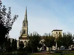
Coutras church
Population
| Year | Pop. | ±% |
|---|---|---|
| 1793 | 3,000 | — |
| 1800 | 3,060 | +2.0% |
| 1806 | 3,050 | −0.3% |
| 1821 | 2,821 | −7.5% |
| 1831 | 3,144 | +11.4% |
| 1836 | 3,172 | +0.9% |
| 1841 | 3,302 | +4.1% |
| 1846 | 3,200 | −3.1% |
| 1851 | 3,371 | +5.3% |
| 1856 | 3,532 | +4.8% |
| 1861 | 3,883 | +9.9% |
| 1866 | 3,789 | −2.4% |
| 1872 | 3,685 | −2.7% |
| 1876 | 3,944 | +7.0% |
| 1881 | 4,008 | +1.6% |
| 1886 | 5,092 | +27.0% |
| 1891 | 4,231 | −16.9% |
| 1896 | 3,903 | −7.8% |
| 1901 | 4,062 | +4.1% |
| 1906 | 4,406 | +8.5% |
| 1911 | 4,807 | +9.1% |
| 1921 | 4,924 | +2.4% |
| 1926 | 5,078 | +3.1% |
| 1931 | 5,211 | +2.6% |
| 1936 | 5,281 | +1.3% |
| 1946 | 5,540 | +4.9% |
| 1954 | 5,668 | +2.3% |
| 1962 | 5,948 | +4.9% |
| 1968 | 5,830 | −2.0% |
| 1975 | 6,040 | +3.6% |
| 1982 | 6,351 | +5.1% |
| 1990 | 6,689 | +5.3% |
| 1999 | 7,027 | +5.1% |
| 2008 | 7,902 | +12.5% |
See also
References
- "Populations légales 2017". INSEE. Retrieved 6 January 2020.
| Wikimedia Commons has media related to Coutras. |
| Authority control |
|---|
This article is issued from Wikipedia. The text is licensed under Creative Commons - Attribution - Sharealike. Additional terms may apply for the media files.