Talence
Talence is a commune in the Gironde department in Nouvelle-Aquitaine in southwestern France.
Talence | |
|---|---|
 The church in Talence | |
.svg.png.webp) Coat of arms | |
Location of Talence 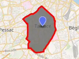
| |
 Talence  Talence | |
| Coordinates: 44°48′00″N 0°35′02″W | |
| Country | France |
| Region | Nouvelle-Aquitaine |
| Department | Gironde |
| Arrondissement | Bordeaux |
| Canton | Talence |
| Intercommunality | Bordeaux Métropole |
| Government | |
| • Mayor (2020–2026) | Emmanuel Sallaberry[1] |
| Area 1 | 8.35 km2 (3.22 sq mi) |
| Population (2017-01-01)[2] | 42,606 |
| • Density | 5,100/km2 (13,000/sq mi) |
| Time zone | UTC+01:00 (CET) |
| • Summer (DST) | UTC+02:00 (CEST) |
| INSEE/Postal code | 33522 /33400 |
| Elevation | 2–29 m (6.6–95.1 ft) (avg. 15 m or 49 ft) |
| 1 French Land Register data, which excludes lakes, ponds, glaciers > 1 km2 (0.386 sq mi or 247 acres) and river estuaries. | |
It is the third-largest suburb of the city of Bordeaux, and is adjacent to it on the south side. It is a member of the Bordeaux Métropole.
Talence is the home of Décastar, a prestigious yearly international decathlon event.
In Talence, there are different universities : Bordeaux University, Architecture School of Bordeaux, KEDGE Business School.
Population
|
|
Geography
Talence is situated with Bordeaux to the North, Bègles to the East, Villenave-d'Ornon to the South-East, Gradignan to the South-West, and Pessac to the West.
Climate
| Climate data for Talence (1981–2010 averages, extremes 1959–present) | |||||||||||||
|---|---|---|---|---|---|---|---|---|---|---|---|---|---|
| Month | Jan | Feb | Mar | Apr | May | Jun | Jul | Aug | Sep | Oct | Nov | Dec | Year |
| Record high °C (°F) | 21.0 (69.8) |
25.0 (77.0) |
28.0 (82.4) |
30.5 (86.9) |
35.0 (95.0) |
39.0 (102.2) |
39.0 (102.2) |
39.5 (103.1) |
36.8 (98.2) |
32.0 (89.6) |
26.0 (78.8) |
22.6 (72.7) |
39.5 (103.1) |
| Average high °C (°F) | 10.4 (50.7) |
12.1 (53.8) |
15.4 (59.7) |
17.8 (64.0) |
21.8 (71.2) |
25.0 (77.0) |
27.4 (81.3) |
27.3 (81.1) |
24.5 (76.1) |
19.9 (67.8) |
13.8 (56.8) |
10.6 (51.1) |
18.9 (66.0) |
| Daily mean °C (°F) | 6.7 (44.1) |
7.7 (45.9) |
10.4 (50.7) |
12.5 (54.5) |
16.4 (61.5) |
19.5 (67.1) |
21.7 (71.1) |
21.5 (70.7) |
18.7 (65.7) |
15.0 (59.0) |
9.8 (49.6) |
7.0 (44.6) |
13.9 (57.0) |
| Average low °C (°F) | 3.0 (37.4) |
3.3 (37.9) |
5.4 (41.7) |
7.2 (45.0) |
11.0 (51.8) |
14.0 (57.2) |
15.9 (60.6) |
15.8 (60.4) |
12.8 (55.0) |
10.2 (50.4) |
5.8 (42.4) |
3.5 (38.3) |
9.0 (48.2) |
| Record low °C (°F) | −14.6 (5.7) |
−12.0 (10.4) |
−6.8 (19.8) |
−2.2 (28.0) |
1.1 (34.0) |
5.1 (41.2) |
7.5 (45.5) |
6.0 (42.8) |
4.0 (39.2) |
−2.0 (28.4) |
−6.5 (20.3) |
−11.4 (11.5) |
−14.6 (5.7) |
| Average precipitation mm (inches) | 81.5 (3.21) |
68.8 (2.71) |
63.6 (2.50) |
79.0 (3.11) |
70.1 (2.76) |
57.3 (2.26) |
47.4 (1.87) |
52.6 (2.07) |
75.6 (2.98) |
81.2 (3.20) |
98.0 (3.86) |
98.4 (3.87) |
873.5 (34.39) |
| Average precipitation days (≥ 1.0 mm) | 12.3 | 10.3 | 11.1 | 11.7 | 10.9 | 8.2 | 7.3 | 7.4 | 9.4 | 10.7 | 12.3 | 12.1 | 123.7 |
| Source: Météo France[3] | |||||||||||||
Sights
Personalities
- Romain Brégerie, footballer
- Mireille Bousquet-Mélou, mathematician
- José Bové, radical activist
- Jérôme Cahuzac, politician
- Jules Carvallo, engineer
- Gérald Cid, footballer
- Émile Durkheim, sociologist, lived from 1887 to 1897 in Talence
- Henrik, Prince Consort of Denmark
- Florian Marange, professional footballer. He plays for the left side defender at SC Bastia
- Thierry Meyssan, writer
- Ed Tourriol, cartoonist
International relations
Talence is twinned with:
See also
References
- "Répertoire national des élus: les maires". data.gouv.fr, Plateforme ouverte des données publiques françaises (in French). 2 December 2020. Retrieved 11 December 2020.
- "Populations légales 2017". INSEE. Retrieved 6 January 2020.
- "Talence (33)" (PDF). Fiche Climatologique: Statistiques 1981–2010 et records (in French). Meteo France. Archived from the original (PDF) on 30 March 2018. Retrieved 29 March 2018.
External links
| Wikimedia Commons has media related to Talence. |
- Official website (in French)

| Authority control |
|---|
This article is issued from Wikipedia. The text is licensed under Creative Commons - Attribution - Sharealike. Additional terms may apply for the media files.