Saint-Sulpice-de-Faleyrens
Saint-Sulpice-de-Faleyrens is a commune in the Gironde department in Nouvelle-Aquitaine in southwestern France.
Saint-Sulpice-de-Faleyrens | |
|---|---|
 The town hall in Saint-Sulpice-de-Faleyrens | |
Location of Saint-Sulpice-de-Faleyrens 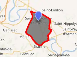
| |
 Saint-Sulpice-de-Faleyrens  Saint-Sulpice-de-Faleyrens | |
| Coordinates: 44°52′31″N 0°11′21″W | |
| Country | France |
| Region | Nouvelle-Aquitaine |
| Department | Gironde |
| Arrondissement | Libourne |
| Canton | Les Coteaux de Dordogne |
| Government | |
| • Mayor (2008–2014) | Yvan Dumonteuil |
| Area 1 | 18.17 km2 (7.02 sq mi) |
| Population (2017-01-01)[1] | 1,348 |
| • Density | 74/km2 (190/sq mi) |
| Time zone | UTC+01:00 (CET) |
| • Summer (DST) | UTC+02:00 (CEST) |
| INSEE/Postal code | 33480 /33330 |
| Elevation | 1–20 m (3.3–65.6 ft) (avg. 11 m or 36 ft) |
| 1 French Land Register data, which excludes lakes, ponds, glaciers > 1 km2 (0.386 sq mi or 247 acres) and river estuaries. | |
It is one of eight municipalities forming the jurisdiction of Saint-Emilion, which is a UNESCO World Heritage of Humanity for its historic vineyard landscape that has survived intact and in use.
Geography
Saint-Sulpice-de-Faleyrens is located 35 km (22 mi) northeast of Bordeaux, between Libourne and Branne.
Population
| Year | Pop. | ±% |
|---|---|---|
| 1962 | 1,180 | — |
| 1968 | 1,219 | +3.3% |
| 1975 | 1,304 | +7.0% |
| 1982 | 1,625 | +24.6% |
| 1990 | 1,613 | −0.7% |
| 1999 | 1,583 | −1.9% |
| 2008 | 1,504 | −5.0% |
Economy
The main activity of the town is related to viticulture.
Sights
- The Peyrefitte menhir is the largest menhir of Aquitaine. It was classified as a historical monument in 1889.
See also
References
- "Populations légales 2017". INSEE. Retrieved 6 January 2020.
External links
| Wikimedia Commons has media related to Saint-Sulpice-de-Faleyrens. |
| Authority control |
|---|
This article is issued from Wikipedia. The text is licensed under Creative Commons - Attribution - Sharealike. Additional terms may apply for the media files.