Saint George Parish, New Brunswick
Saint George is a civil parish in Charlotte County, New Brunswick, Canada,[2] located between St. Stephen and Saint John. It includes the town of St. George and two local service districts (LSDs): Fundy Bay and the parish of Saint George, all of which are members of the Southwest New Brunswick Service Commission (SNBSC).[3]
Saint George
St. George | |
|---|---|
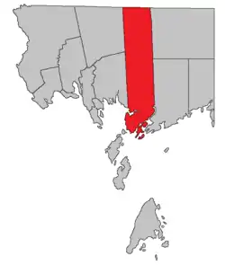 Location within Charlotte County. | |
| Country | |
| Province | |
| County | Charlotte County |
| Erected | 1786 |
| Area | |
| • Land | 500.23 km2 (193.14 sq mi) |
| Population (2016)[1] | |
| • Total | 2,341 |
| • Density | 4.7/km2 (12/sq mi) |
| • Pop 2011-2016 | |
| • Dwellings | 1,254 |
| Time zone | UTC-4 (AST) |
| • Summer (DST) | UTC-3 (ADT) |
The Census subdivision of the same name includes all of the parish except St. George.[1]
Origin of name
William F. Ganong believed the name suggested by other Saint names in the area.[4] Five of the original six mainland parishes of Charlotte County used names of major saints recognised by the Church of England: Andrew (Scotland), David (Wales), George (England), Patrick (Ireland), and Stephen.
History
Saint George was erected in 1786 as one of the original parishes of Charlotte County.[5] The northern boundary was a continuation of Saint David Parish's and the southern boundary including any islands with two miles of the mainland, taking in some of modern West Isles Parish.
In 1814 the parish was extended north to the county line.[6]
In 1877 the southern boundary was altered to run through Letete Passage, losing several islands to West Isles Parish.[7]
Delineation
Saint George Parish is defined in the Territorial Division Act[2] as being bounded:
- West by Saint Patrick Parish, Dumbarton Parish and Passamaquoddy Bay; north by the County line; east by the rear line of lot number three, granted to William Payne and its prolongation northerly to the County line, and southerly to Letang River; south by the Bay of Fundy, the channel to and through Letete Passage, and the channel to and through Letang Harbour and River, including Bliss Island.
Communities
Parish population total does not include incorporated municipalities (in bold):
|
|
|
Bodies of water and islands
This is a list of rivers, lakes, streams, creeks, marshes and islands that are at least partially in this parish
|
|
|
Demographics
Population
| Canada census – Saint George Parish, New Brunswick community profile | |||
|---|---|---|---|
| 2016 | 2011 | 2006 | |
| Population: | 2,341 (-5.3% from 2011) | 2,472 (-0.2% from 2006) | 2,476 (+5.4% from 2001) |
| Land area: | 500.23 km2 (193.14 sq mi) | 499.76 km2 (192.96 sq mi) | 499.51 km2 (192.86 sq mi) |
| Population density: | 4.7/km2 (12/sq mi) | 4.9/km2 (13/sq mi) | 5.0/km2 (13/sq mi) |
| Median age: | 46.3 (M: 46.2, F: 46.4) | 45.1 (M: 45.1, F: 45.1) | 43.3 (M: 42.5, F: 44.1) |
| Total private dwellings: | 1,254 | 1,196 | 1,262 |
| Median household income: | $62,123 | $50,205 | $41,632 |
| References: 2016[8] 2011[9] 2006[10] earlier[11] | |||
|
|
| |||||||||||||||||||||||||||
| [12][1] | |||||||||||||||||||||||||||||
Language
| Canada Census mother tongue - Saint George Parish, New Brunswick[12] | ||||||||||||||||||
|---|---|---|---|---|---|---|---|---|---|---|---|---|---|---|---|---|---|---|
| Census | Total | English |
French |
English & French |
Other | |||||||||||||
| Year | Responses | Count | Trend | Pop % | Count | Trend | Pop % | Count | Trend | Pop % | Count | Trend | Pop % | |||||
2011 |
2,470 |
2,390 | 96.76% | 30 | 1.21% | 10 | 0.40% | 40 | 1.62% | |||||||||
2006 |
2,465 |
2,395 | 97.16% | 35 | 1.42% | 0 | 0.00% | 35 | 1.42% | |||||||||
2001 |
2,340 |
2,320 | 99.15% | 10 | 0.43% | 0 | 0.00% | 10 | 0.43% | |||||||||
1996 |
2,350 |
2,295 | n/a | 97.66% | 15 | n/a | 0.64% | 0 | n/a | 0.00% | 40 | n/a | 1.70% | |||||
Access routes
Highways and numbered routes that run through the parish, including external routes that start or finish at the parish limits:[13]
See also
References
- "Census Profile, 2016 Census: Saint George, Parish [Census subdivision], New Brunswick". Statistics Canada. Retrieved 30 August 2019.
- "Chapter T-3 Territorial Division Act". Government of New Brunswick. Retrieved 14 August 2020.
- "Communities in each of the 12 Regional Service Commissions (RSC) / Les communautés dans chacune des 12 Commissions de services régionaux (CSR)" (PDF), Government of New Brunswick, July 2017, retrieved 1 February 2021
- Ganong, William F. (1896). A Monograph of the Place-Nomenclature of the Province of New Brunswick. Royal Society of Canada. p. 268.
- "26 Geo. III Chapter I. An Act for the better ascertaining and confirming the Boundaries of the several Counties within this Province, and for subdividing them into Towns or Parishes.". Acts of the General Assembly of His Majesty's Province of New-Brunswick, passed in the year 1786. Saint John, New Brunswick: Government of New Brunswick. 1786. pp. 3–12.
- "54 Geo. III c. 15 An Act to enlarge the limits of the Parishes of Saint Patrick and Saint George, in the County of Charlotte.". Acts of the General Assembly of His Majesty's Province of New-Brunswick; Passed in the Year 1814. Saint John, New Brunswick: Government of New Brunswick. 1814. p. 15.
- "Chapter 2 The Division of the Province into Counties, Towns, and Parishes.". The Consolidated Statutes of New Brunswick. Fredericton: Government of New Brunswick. 1877. pp. 56–85.
- "2016 Community Profiles". 2016 Canadian Census. Statistics Canada. 21 February 2017. Retrieved 30 August 2019.
- "2011 Community Profiles". 2011 Canadian Census. Statistics Canada. 5 July 2013. Retrieved 17 March 2014.
- "2006 Community Profiles". 2006 Canadian Census. Statistics Canada. 30 March 2011. Retrieved 17 March 2014.
- "2001 Community Profiles". 2001 Canadian Census. Statistics Canada. 17 February 2012.
- Statistics Canada: 1996, 2001, 2006, 2011 census
- Atlantic Canada Back Road Atlas ISBN 978-1-55368-618-7 Pages 4, 12
Places adjacent to Saint George Parish, New Brunswick | |
|---|---|
| Subdivisions | |
|---|---|
| Cities | |
| Counties | |
| |