Fayzabad, Badakhshan
Fayzabad (also spelled Feyzabad or Faizabad) (Persian: فيض آباد, romanized: Fayzâbâd) is a city in northeast Afghanistan, with a population of about 30,000 people. It serves as the provincial capital and largest city of Badakhshan Province. It is situated in Fayzabad District and is at an altitude of 1,200 m. (3,937 ft.).[1]
Fayzabad
فيض آباد | |
|---|---|
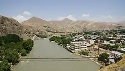 The Kokcha River next to Fayzabad | |
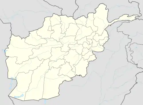 Fayzabad Location in Afghanistan | |
| Coordinates: 37°7′03″N 70°34′47″E | |
| Country | |
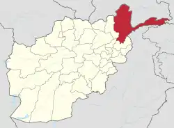
| Province | Badakhshan |
| District | Fayzabad |
| Area | |
| • Total | 7 km2 (3 sq mi) |
| Elevation | 1,254 m (4,114 ft) |
| Population (2006) | |
| • Total | 44,421 |
| • Density | 6,300/km2 (16,000/sq mi) |
| Time zone | UTC+4:30 |
| Fayzabad | ||||||||||||||||||||||||||||||||||||||||||||||||||||||||||||
|---|---|---|---|---|---|---|---|---|---|---|---|---|---|---|---|---|---|---|---|---|---|---|---|---|---|---|---|---|---|---|---|---|---|---|---|---|---|---|---|---|---|---|---|---|---|---|---|---|---|---|---|---|---|---|---|---|---|---|---|---|
| Climate chart (explanation) | ||||||||||||||||||||||||||||||||||||||||||||||||||||||||||||
| ||||||||||||||||||||||||||||||||||||||||||||||||||||||||||||
| ||||||||||||||||||||||||||||||||||||||||||||||||||||||||||||
Fayzabad is the main commercial and administrative center of the Pamir region. The Kokcha River runs alongside the city. The Fayzabad Airport is located next to the city, which provides limited domestic flight services.[2] The Afghan Air Force also uses the airport.
History
The city was called Jauz Gun until 1680 because of the number of nuts ("jauz") in the area. The name was changed to Faizabad, which can be roughly translated as "abode of divine bounty, blessing, and charity", when the robe of Muhammed was delivered to the city. Tradition states that it was brought here by Muhammad Shaykh Ziya and Shaykh Niyaz after Wais Quran brought it to Balkh.[3]
At that time the city replaced Munjan as the capital of Badakhshan. Later, in 1768, Ahmad Durrani took the robe to Kandahar, and established the Mosque of the Cloak of the Prophet Mohammed there in 1695 (A.D.).[3] The Sáhibzádas of Samarkand removed the relic of the prophet from the capital in 1734 (A.D.). His clothing which came from the Turkish Campaign, was taken by Temorlane to Samarkand. Whilst the relic was being conveyed to India it was captured by Mír Yár Beg who deposited it at Fayzabad.
Many visitors used to come to a shrine erected in the city. The Khoja community of Badakhshán were made attendants at the shrine.
There are seven historical forts in and around the city, several of which are in ruins. These forts were built to help defend the city or the roads leading in and out.[3]
In 1979 the town became a hotbed of guerrilla groups as Afghans sought to repel the Soviet invasion. Fayzabad was taken by Soviet forces in 1980 and became a base for the Soviet garrison.
Many NGOs who work in the Badakhshan province have placed their headquarters in the new part of the city. Near the city Germany is leading the Provincial Reconstruction Team. Danish and Czech teams had been a part of the PRT but the Czechs left in 2007 and the Danes in 2008. The camp is based at an old Soviet airstrip.
Geography
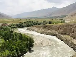
The city is located on the right bank of the Kokcha River near where the river exits from a gorge and before it reaches a large open plain.[3]
Climate
Fayzabad has a hot summer Mediterranean continental climate (Köppen climate classification Dsa). It has hot, dry summers and cold, moderately wet winters. Precipitation mostly falls in spring and winter.
| Climate data for Fayzabad | |||||||||||||
|---|---|---|---|---|---|---|---|---|---|---|---|---|---|
| Month | Jan | Feb | Mar | Apr | May | Jun | Jul | Aug | Sep | Oct | Nov | Dec | Year |
| Record high °C (°F) | 19.6 (67.3) |
20.5 (68.9) |
28.0 (82.4) |
33.2 (91.8) |
37.5 (99.5) |
41.4 (106.5) |
42.6 (108.7) |
41.2 (106.2) |
36.8 (98.2) |
34.2 (93.6) |
29.0 (84.2) |
21.4 (70.5) |
42.6 (108.7) |
| Average high °C (°F) | 6.0 (42.8) |
8.2 (46.8) |
14.3 (57.7) |
21.3 (70.3) |
25.1 (77.2) |
31.6 (88.9) |
35.7 (96.3) |
34.9 (94.8) |
29.9 (85.8) |
23.1 (73.6) |
15.9 (60.6) |
9.7 (49.5) |
21.3 (70.4) |
| Daily mean °C (°F) | −0.1 (31.8) |
2.0 (35.6) |
7.7 (45.9) |
14.1 (57.4) |
17.6 (63.7) |
23.7 (74.7) |
27.1 (80.8) |
25.7 (78.3) |
20.3 (68.5) |
14.2 (57.6) |
7.5 (45.5) |
2.7 (36.9) |
13.5 (56.4) |
| Average low °C (°F) | −4.3 (24.3) |
−1.2 (29.8) |
2.4 (36.3) |
8.0 (46.4) |
10.6 (51.1) |
13.9 (57.0) |
16.8 (62.2) |
15.5 (59.9) |
10.3 (50.5) |
6.3 (43.3) |
1.5 (34.7) |
−1.9 (28.6) |
6.5 (43.7) |
| Record low °C (°F) | −23.5 (−10.3) |
−24.5 (−12.1) |
−10.5 (13.1) |
−4.0 (24.8) |
1.1 (34.0) |
6.6 (43.9) |
9.0 (48.2) |
8.0 (46.4) |
2.0 (35.6) |
−2.9 (26.8) |
−8.8 (16.2) |
−17.2 (1.0) |
−24.5 (−12.1) |
| Average precipitation mm (inches) | 49.4 (1.94) |
65.0 (2.56) |
91.9 (3.62) |
97.9 (3.85) |
77.0 (3.03) |
8.2 (0.32) |
5.8 (0.23) |
1.0 (0.04) |
1.5 (0.06) |
23.4 (0.92) |
29.7 (1.17) |
34.1 (1.34) |
484.9 (19.08) |
| Average rainy days | 3 | 6 | 11 | 14 | 12 | 4 | 2 | 0 | 1 | 4 | 4 | 4 | 65 |
| Average snowy days | 9 | 7 | 3 | 0 | 0 | 0 | 0 | 0 | 0 | 0 | 1 | 4 | 24 |
| Average relative humidity (%) | 79 | 76 | 71 | 67 | 61 | 43 | 30 | 28 | 33 | 46 | 64 | 72 | 56 |
| Mean monthly sunshine hours | 117.3 | 116.7 | 149.2 | 186.2 | 256.9 | 313.6 | 324.5 | 305.2 | 279.1 | 224.2 | 176.4 | 127.3 | 2,576.6 |
| Source: NOAA (1964-1983)[4] | |||||||||||||
Economy
Fayzabad has historically been relatively isolated from other parts of the country because of the lack of paved roads. There are two active bazaars in the city where items as diverse as cotton, cotton cloth and goods, salt, sugar, tea, indigo, and cutlery are traded.[3] It has been two years since the asphalted ring road of Afghanistan reached Fayzabad. The cost of the road connecting Fayzabad with Taloqan and Kunduz was about $US 200 million which was paid for by USAID.
Several varieties of cash crops are grown in the vicinity including barley, wheat and rice and there are a number of gardens and orchards. There has been some success in panning for gold in the vicinity, beryl can be found and there is a salt mine located nearby. The city also has a handicraft industry producing woolen goods and there are flour and rice mills. There is a working power station in the city and there is considerable potential for expansion of hydroelectric power. A new power station is under construction.[5][6]
Demographics and culture
The majority of the inhabitants are Tajiks, while there are also minority communities of Pashtuns, Pamiris, Uzbeks, Hazaras and Turkmens.
Eleven languages are spoken in the city, including Dari, Wakhi, Munji, Pashto, Ishkashimi, Yazgulyam, Sarikoli, Shughni, Rushani, Uzbek and Turkmen.[3]
There are a number of mosques and shrines of historical importance in the city.[3]
Education
Badakhshan University is located in Fayzabad. The city has several public schools including an all-girls school.
Public services
There is a government-run hospital in the province. There are a number of private guesthouses in the city, Qasre Kokcha Hotel is the best among them which has security, central heating system, electricity and internet. There is also a guest house called Lapis Lazuli for expatriates.
See also
References
- Dupree, Nancy Hatch (1977): An Historical Guide to Afghanistan. 1st Edition: 1970. 2nd Edition. Revised and Enlarged. Afghan Tourist Organization. Archived 2007-09-27 at the Wayback Machine (See Chap. 28).
- Faizabad Airport, Badakhshan Province on YouTube, June 18, 2013, USAIDAfghanistan.
- Adamec, Ludwig W., ed. (1972). Historical and Political Gazetteer of Afghanistan. 1. Graz, Austria: Akadamische Druck-u. Verlangsanstalt. p. 67.
- "Faiz Abad Climate Normals 1964-1983". National Oceanic and Atmospheric Administration. Retrieved December 24, 2012.
- https://www.kfw.de/stories/environment/renewable-energy/shorabak-hydro-power-station/
- https://www.youtube.com/watch?v=AZm8MXX9sE0
External links
| Wikimedia Commons has media related to Fayzabad, Badakhshan. |
- Faizabad Airport, Badakhshan Province on YouTube (USAIDAfghanistan, June 18, 2013)
| Authority control |
|
|---|