Gülnar
Gülnar is a district of Mersin Province of Turkey, 150 km (93 mi) south-west of the city of Mersin.
Gülnar | |
|---|---|
 Gülnar | |
| Coordinates: 36°20′00″N 33°24′00″E | |
| Country | Turkey |
| Province | Mersin |
| Government | |
| • Mayor | Ahmet Günel (MHP) |
| • Kaymakam | Adnan Daldal |
| Area | |
| • District | 1,563.40 km2 (603.63 sq mi) |
| Elevation | 1,000 m (3,000 ft) |
| Population (2012)[2] | |
| • Urban | 7,504 |
| • District | 26,433 |
| • District density | 17/km2 (44/sq mi) |
| Post code | 3370x |
| Website | www.gulnar.bel.tr |
Geography
The town of Gülnar is 32 km (20 mi) inland on a plain high in the Taurus Mountains, attractive countryside known for its vineyards and its green meadows used for summer grazing. Gülnar is a small town providing high schools and other basic amenities to the surrounding villages.(Town population. 8 357) The road from central Anatolia to Anamur on the Mediterranean coast passes through here, one of the windiest roads imaginable, making Gulnar a remote district indeed.
The land area of Gülnar is 1,669 km2 (644 sq mi) of which 351.1 km2 (136 sq mi) is cultivated, 848.09 km2 (327 sq mi) is forested hillside, 1.3 km2 (1 sq mi) is high meadow, and 468.51 km2 (181 sq mi) is rocky mountains. Much of the cultivated area is vineyards, other important crops are grains and chick peas. The high meadows are used for summer grazing.
History
The area has been occupied since the time of the Hittites, and was later settled by the Assyrians, Persians, Egyptians, the Greeks, the Ancient Romans and Armenians. The people of Gülnar today are descendants of the Turkmen tribes that came here from Central Asia in the 13th century. (Among older generation of Turkmens Gülnar is usually named as Anaypazarı )
See also
References
- "Area of regions (including lakes), km²". Regional Statistics Database. Turkish Statistical Institute. 2002. Retrieved 2013-03-05.
- "Population of province/district centers and towns/villages by districts - 2012". Address Based Population Registration System (ABPRS) Database. Turkish Statistical Institute. Retrieved 2013-02-27.
Gülnar in Mersin Province of Turkey | |||||||||||||||||||||||||||
|---|---|---|---|---|---|---|---|---|---|---|---|---|---|---|---|---|---|---|---|---|---|---|---|---|---|---|---|
| Districts | 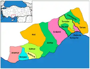 Districts of Mersin | ||||||||||||||||||||||||||
| |||||||||||||||||||||||||||
Metropolitan municipalities are bolded. | |||||||||||||||||||||||||||
| Authority control |
|
|---|