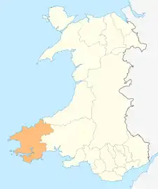
Grade II* listed buildings in Pembrokeshire
This is a list of Grade II*-listed buildings in the county of Pembrokeshire, Wales.
In the United Kingdom, the term listed building refers to a building or other structure officially designated as being of special architectural, historical, or cultural significance; Grade II* structures are those considered to be "particularly important buildings of more than special interest".[1] Listing was begun by a provision in the Town and Country Planning Act 1947. Once listed, strict limitations are imposed on the modifications allowed to a building's structure or fittings. In Wales, the authority for listing under the Planning (Listed Buildings and Conservation Areas) Act 1990[2] rests with Cadw.
Buildings
| Name | Location | Date Listed | Grid Ref.[note 1] Geo-coordinates |
Function | Notes | Reference Number | Image |
|---|---|---|---|---|---|---|---|
| Dovecote | Angle | 14 May 1970 | SM8660603075 51°41′09″N 5°05′19″W |
Dovecote | In field immediately N of Castle Farm.[3][4] | 5922 |  |
| St. Michael and All Angel's Church | Bosherston, Stackpole | 14 May 1970 | SR9661194826 51°36′55″N 4°56′21″W |
Church | At the north end of Bosherston village.[5][6] | 5927 | 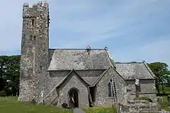 |
| Church of Saint David | Caldey Island, Tenby | 14 May 1970 | SS1428296641 51°38′16″N 4°41′07″W |
Church | Situated some 50m W of Caldey Abbey chapel.[7][8] | 5933 | 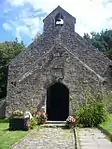 |
| Carew Bridge | Carew | 14 May 1970 | SN0476103827 51°41′57″N 4°49′36″W |
Bridge | About 500 m E of Carew Castle carrying the Carew to Cresselly A4075 road across the estuary of the Carew River.[9][10] | 5939 | 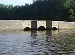 |
| The Fortified Rectory | Carew | 14 May 1972 | SN0445202733 51°41′21″N 4°49′50″W |
Rectory | 100 m SW of St Mary's churchyard.[11][12] | 5947 | |
| The Old Vicarage (remains) | Castlemartin | 14 May 1970 | SR9109998888 51°38′59″N 5°01′16″W |
Vicarage (ruin) | Within St Michael's churchyard, about 40 m E of the church.[13][14] | 5949 | |
| Church of St Lawrence | Gumfreston, St Florence | 5 April 1970 | SN1092501102 51°40′36″N 4°44′10″W |
Church | 150 m S of the B4318 in Gumfreston.[15][16] | 5958 | 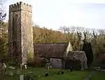 |
| Hodgeston Parish Church | Hodgeston, Lamphey | 14 May 1970 | SS0294699378 51°39′31″N 4°51′01″W |
Church | In village of Hodgeston, E of Lamphey[17][18] | 5959 | 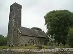 |
| Lamphey Court | Lamphey | 14 May 1970 | SN0171201104 51°40′25″N 4°52′09″W |
Hotel | To the N of Lamphey Village.[19][20] | 5968 | 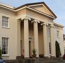 |
| Church of St Caradoc | Lawrenny, Martletwy | 14 May 1970 | SN0164806892 51°43′32″N 4°52′24″W |
Church | At the W of Lawrenny village, at the entrance to the grounds of the former Lawrenny Castle.[21][22] | 5971 | .jpg.webp) |
| Dovecote | Manorbier | 14 May 1970 | SS0626797855 51°38′46″N 4°48′06″W |
Dovecote | 5977 | 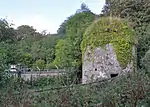 | |
| Sunny Hill Farmhouse | Manorbier | 14 May 1970 | SS0622499974 51°39′54″N 4°48′12″W |
Farmhouse | 300 m S of the Ridgeway, 500 m W of turning to St Florence.[23][24] | 5984 | |
| Norchard | Manorbier | 14 May 1970 | SS0818599465 51°39′40″N 4°46′29″W |
House | 800 m S of the Ridgeway and 1 km E of Manobier Station.[25][26] | 5986 | |
| Church of St Nicholas | Penally | 14 May 1970 | SS1177299177 51°39′35″N 4°43′22″W |
Church | In the centre of the village of Penally. The churchyard is enclosed within a rubble masonry wall with simple iron gates.[27][28] | 5992 | 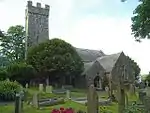 |
| Carswell Mediaeval House | Penally | 14 May 1970 | SN0980201058 51°40′34″N 4°45′08″W |
House (ruin) | 50 m N of Carswell Farm House, in the farmyard. It is the western of the two ruined buildings.[29][30] | 6005 | 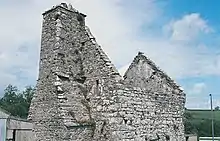 |
| Church of St Florence | St Florence | 14 May 1970 | SN0823101159 51°40′35″N 4°46′30″W |
Church | Centrally placed in a compact village.[31][32] | 6008 | .jpg.webp) |
| St. Twynnell's Church | Stackpole | 14 May 1970 | SR9495497592 51°38′23″N 4°57′53″W |
Church | Mediaeval church restored by Lord Cawdor in 1858.[33][34] | 6018 | 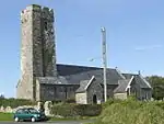 |
| Park House | Stackpole | 14 May 1970 | SR9810296166 51°37′41″N 4°55′06″W |
House | House of c.1700 with mid-18th century alterations.[35][36] | 6021 | |
| St. Mary's Church | Castlemartin | 14 May 1970 | SR9323197505 51°38′18″N 4°59′22″W |
Church | 2 km E of Castlemartin.[37][38] | 6035 | 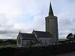 |
| Carew Tidal Mill and Tidal Barrier | Carew | 29 September 1971 | SN0415503831 51°41′56″N 4°50′07″W |
Mill/Tidal barrier | The Tidal Barrier lies across the estuary of the Carew River about 300 m W of Carew Castle. The tidal mill stands on it near to the left (S) bank, over the deeper water where the natural river channel lies.[39][40] | 6038 | .jpg.webp) |
| St Elidyr's Church | Amroth | 21 June 1971 | SN1631507898 51°44′23″N 4°39′42″W |
Church | 1 km N of Amroth Village, in an isolated group with Amroth Farm and the old village school. The group is called 'Castle Back'. The church is in a roundish graveyard surrounded by walls and hedges.[41][42] | 6044 | 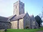 |
| Church of St. Mary | Kilgetty-Begelly | 21 June 1971 | SN1181507311 51°43′58″N 4°43′36″W |
Church | In village of Begelly, 0.5 km N of the A477(T). The church is in a large churchyard with low stone wall, stile and lychgate to N.[43][44] | 6045 | 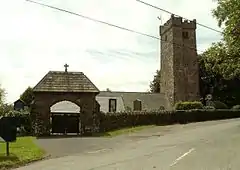 |
| Church of Saint Mary | Bletherston, New Moat | 21 June 1971 | SN0703421206 51°51′21″N 4°48′12″W |
Church | In a prominent position in the centre of Bletherston village.[45][46] | 6046 | 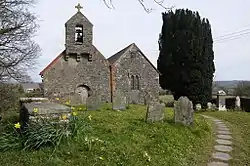 |
| Church of St. Elidyr | Lampeter Velfrey | 21 June 1971 | SN1411910913 51°45′57″N 4°41′43″W |
Church | 4 km S of village of Lampeter Velfrey, about 400 m N of Ludchurch village, in a square churchyard partly walled.[47][48] | 6050 | 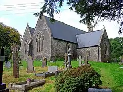 |
| Church of St Jeffrey and St Oswald | Jeffreyston | 21 June 1971 | SN0894806525 51°43′29″N 4°46′03″W |
Church | In the centre of the village of Jeffreyston. The churchyard is circular with late C19 extensions N and E. There is a preaching cross (separately listed) to the S side and a small free-standing mortuary chapel to the N side.[49][50] | 6052 | 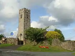 |
| Church of St Aidan | Llawhaden | 21 June 1971 | SN0752017468 51°49′21″N 4°47′40″W |
Church | In a square churchyard on the right bank of the Eastern Cleddau, 300 m N of Llawhaden Bridge.[51][52] | 6062 | 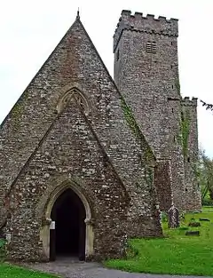 |
| Llawhaden Bridge and River Bank Wall | Llawhaden | 21 June 1971 | SN0747317251 51°49′14″N 4°47′42″W |
Bridge | On Eastern Cleddau ? km E of Llawhaden Village[53][54] | 6064 | 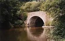 |
| Vaynor | Llawhaden | 21 June 1971 | SN0980517513 51°49′26″N 4°45′40″W |
House | Reached by a private drive on the E side of the B4313 Pont Sh?n to Bethesda road[55] | 6072 | |
| Church of St Leonard | Loveston, Jeffreyston | 21 June 1971 | SN0841108477 51°44′32″N 4°46′35″W |
Church | Loveston[56][57] | 6076 | 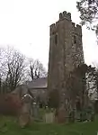 |
| Parish Church of Saint Nicholas | New Moat | 21 June 1971 | SN0624325241 51°53′31″N 4°49′02″W |
Church | Prominently situated on S side of village on W side of road; raised rounded graveyard.[58][59] | 6086 | 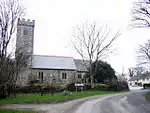 |
| Blackpool Bridge | Martletwy | 21 June 1971 | SN0601214514 51°47′44″N 4°48′52″W |
Bridge | Crossing the Eastern Cleddau adjacent to Blackpool Mill, closest to the highest navigable point of the river. Also in Slebech[60][61] | 6089 | 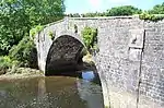 |
| Blackpool Mill | Martletwy | 21 June 1971 | SN0599914489 51°47′43″N 4°48′53″W |
Mill | On the left bank of the Eastern Cleddau 1 km SW of Canaston Bridge.[62][63] | 6090 | 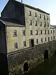 |
| St Issell's Church | Saundersfoot | 21 June 1971 | SN1325305818 51°43′12″N 4°42′18″W |
1km N of the village of Saundersfoot. The church stands in a large undulating graveyard through which a stream passes.[64] | 6093 | .jpg.webp) | |
| Slebech Park | Slebech | 21 June 1971 | SN0314113977 51°47′23″N 4°51′21″W |
Country house | In extensive grounds 2 km E of Picton Castle, overlooking the Eastern Cleddau.[65] | 6102 | 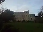 |
| Tenby Castle remains | Tenby | 19 March 1951 | SN1371400501 51°40′20″N 4°41′44″W |
Castle ruin | Remains are situated at various locations on Castle Hill, on the NE side of the town.[66][67] | 6111 | 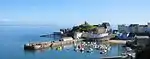 |
| Laston House | Tenby | 19 March 1951 | SN1365600550 51°40′22″N 4°41′47″W |
House | Situated on the N side of Castle Square facing S to St Julian's Street.[68] | 6119 | .JPG.webp) |
| The Prize House | Tenby | 31 May 1954 | SN1331900585 51°40′23″N 4°42′04″W |
House | Facing the sea next to the Royal Lion Hotel just S of the junction of the High Street and White Lion Street.[69] | 6165 | 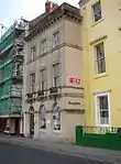 |
| Medieval structure in the churchyard | Tenby | 19 March 1951 | SN1338900457 51°40′18″N 4°42′00″W |
Situated some 20m W of the Church of Saint Mary in Liberty.[70] | 6175 | | |
| Norton House, including garden wall to street | Tenby | 19 March 1951 | SN1315900880 51°40′32″N 4°42′13″W |
House | Situated on the W side of The Norton some 110m N of the junction with St John's Hill.[71] | 6211 |  |
| The Former Assembly Rooms | Tenby | 19 March 1951 | SN1364200561 51°40′22″N 4°41′48″W |
Situated in a prominent position between the harbour and the sea at the N end of Pier Hill.[72] | 6223 | 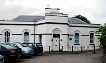 | |
| Plantagenet House | Tenby | 19 March 1951 | SN1352500433 51°40′18″N 4°41′53″W |
Situated on the W side of Quay Hill between Tudor Square and Bridge Street.[73] | 6227 | 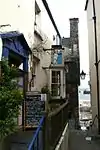 | |
| Saint Catherine's Fort | Tenby | 19 March 1951 | SN1395200307 51°40′14″N 4°41′31″W |
Situated in a prominent position on Saint Catherine's Island to the E of the town and SE of Castle Hill.[74][75] | 6229 | 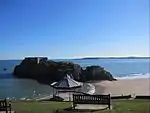 | |
| No 3 Rock Terrace including railings | Tenby | 19 March 1951 | SN1360100345 51°40′15″N 4°41′49″W |
Houses | Set back from the street line on the S side of St Julian's Street opposite Slate House with rear facade overlooking Iron Bar Sands.[76] | 6261 | 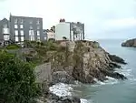 |
| No 1 Lexden Terrace, including area railings | Tenby | 19 March 1951 | SN1365100382 51°40′16″N 4°41′47″W |
Houses | Lexden Terrace lies at a tangent to the E side of St Julian's Street, the rear overlooking Castle Sands, all set back behind a forecourt wall.[77] | 6268 | 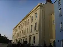 |
| Dovecote in field to NW of Priory Farmhouse | Pembroke | 14 July 1981 | SM9765201754 51°40′41″N 4°55′41″W |
Dovecote | Situated near the centre of a field some 350m NW of Priory Farmhouse.[78] | 6327 | |
| Priory Farmhouse | Pembroke | 10 February 1951 | SM9787801478 51°40′32″N 4°55′29″W |
Situated in Monkton approximately 50m W of the Priory Church of Saint Nicholas.[79] | 6328 | | |
| Pembroke town walls | Pembroke | 9 June 1976 | SM9876601234 51°40′25″N 4°54′42″W |
Wall | On the S side of the town extending some 225m E from no. 5 Common Road to Rock Terrace.[80] | 6342 | .jpg.webp) |
| Outbuilding range at Kingston Farm to SE of old farmhouse | Pembroke | 14 July 1981 | SR9945799468 51°39′29″N 4°54′03″W |
Situated SE of the house at Kingston Farm some 2km SE of the centre of Pembroke.[81] | 6363 | | |
| Nos 89/91 Main Street | Pembroke | 10 February 1951 | SM9867501353 51°40′29″N 4°54′47″W |
On the S side of Main Street some 35m E of its W junction with East Back.[82] | 6385 | | |
| 111 Main Street | Pembroke | 14 July 1981 | SM9881701310 51°40′28″N 4°54′40″W |
House | On the S side of Main Street near its E junction with East Back and opposite the entrance to the Church of Saint Michael.[83] | 6395 | |
| Zion Free Church, Meyrick Street | Pembroke Dock | 14 July 1981 | SM9667403435 51°41′34″N 4°56′36″W |
Church | Built 1846-8, extended 1866-7 and renovated 1882, 1911 and 1986.[84] Formerly listed as Wesleyan Methodist Chapel | 6415 | .jpg.webp) |
| Former Guard House, the Dockyard | Pembroke Dock | 18 January 1974 | SM9603603636 51°41′39″N 4°57′09″W |
6436 | .jpg.webp) | ||
| The Old Storehouse, the Dockyard | Pembroke Dock | 18 January 1974 | SM9602503742 51°41′43″N 4°57′10″W |
Situated to W of Sunderland House, behind ferry terminal.[85] formerly listed as Main Stores of R Hayes Investments Ltd | 6441 | 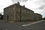 | |
| The Defensible Barracks Presely View (W End) | Pembroke Dock | 18 January 1974 | SM9606703083 51°41′22″N 4°57′07″W |
Barracks | 6448 | .jpg.webp) | |
| No 1, The Terrace | Pembroke Dock | 18 January 1974 | SM9603803521 51°41′36″N 4°57′09″W |
House | formerly listed together with the Commodore Club[86] | 6454 | |
| No 2, The Terrace, The Dockyard | Pembroke Dock | 18 January 1974 | SM9606303504 51°41′35″N 4°57′08″W |
House | 6455 | | |
| Garrison Chapel | Pembroke Dock | 18 January 1974 | SM9628003484 51°41′35″N 4°56′56″W |
Museum | 6458 | 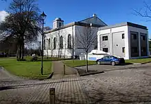 | |
| Flemish Cottage | Pembroke | 14 July 1981 | SM9818701527 51°40′34″N 4°55′13″W |
On the S side of the road opposite Pembroke Castle and some 65m E of Monkton Bridge.[87] | 6468 | | |
| Panteg farmhouse | Llanddewi Velfrey | 2 April 1986 | SN1570916121 51°48′48″N 4°40′30″W |
Farmhouse | On an elevated site to SE of village, overlooking Lampeter Vale. Reached by a long curving track along wooded hillside.[88] | 6547 | |
| Orielton Field Centre | Orielton, Hundleton | 14 May 1970 | SR9545399036 51°39′10″N 4°57′30″W |
Field Centre | Clay Lane, Orielton | 6573 | 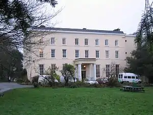 |
| Former Banqueting Tower | Orielton, Hundleton | 14 May 1970 | SR9543598750 51°39′01″N 4°57′30″W |
Tower | about 300m SE OF Orielton Field Centre[89] | 6586 | .jpg.webp) |
| Former Church of Saint Mary, Pwllcrochan | Pwllcrochan, Hundleton | 14 May 1970 | SM9205102657 51°41′02″N 5°00′35″W |
6587 | 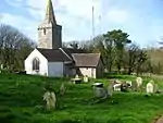 | ||
| Dovecote and attached Courtyard Ranges of Outbuildings | West Orielton, Hundleton | 29 September 1993 | SR9529698961 51°39′07″N 4°57′38″W |
Dovecote | Farm Buildings E of West Orielton[90] | 6600 | |
| Llechryd Bridge | Manordeifi | 21 September 1964 | SN2179743627 52°03′44″N 4°36′03″W |
Bridge | Situated across Afon Teifi between Llechryd and Castell Malgwyn lodge.[91] | 9895 | 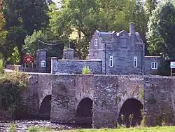 |
| Church of St Llawddog | Cilgerran | 16 January 1952 | SN1906543074 52°03′23″N 4°38′26″W |
Church | Church Street (S side) | 11972 | .jpg.webp) |
| Glandovan | Cilgerran | 16 January 1952 | SN1992441504 52°02′33″N 4°37′38″W |
House | 16th century house.[92][93] | 11973 | |
| Benton Castle | Burton | 13 December 1951 | SN0053806887 51°43′30″N 4°53′22″W |
Castle | Built on a spectacular position high above the W side of the Daugleddau some 2.3km NE of the church at Burton.[94][95] | 11981 | .jpg.webp) |
| Rosemarket dovecote | Rosemarket | 13 December 1951 | SM9539008241 51°44′07″N 4°57′53″W |
Dovecote | In the centre of a field known as Pigeon Hay some 100m NE of the crossroads near the Church of Saint Ismael.[96] | 11983 | |
| Scolton Manor | Scolton, Spittal | 13 December 1951 | SM9900022038 51°51′38″N 4°55′14″W |
Museum | Situated in own grounds on W side of B4329 some 1.5 km SE of Spittal village.[97] | 11984 | 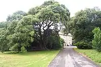 |
| Church of Saint Mary | Burton | 3 January 1963 | SM9854105649 51°42′48″N 4°55′03″W |
Church | On the N side of Burton at the end of Church Road.[98] | 11987 | .jpg.webp) |
| Church of St Ishmael | Camrose | 3 January 1963 | SM9271220066 51°50′26″N 5°00′38″W |
Church | Situated in churchyard in centre of Camrose village.[99] | 11988 | 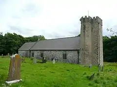 |
| Camrose House | Camrose | 3 January 1963 | SM9269719787 51°50′17″N 5°00′38″W |
House | Situated on the S side of the village, the drive to Camrose House and Home Farm off a minor road just S of the bridge over Camrose Brook.[100] | 11989 | |
| Clareston | Freystrop | 3 January 1963 | SM9572010472 51°45′20″N 4°57′40″W |
House | At the end of a drive running SW off the road through Freystrop just S of Puddleduck Bridge.[101] | 11991 | |
| Church of St Peter | Johnston | 3 January 1963 | SM9321210406 51°45′15″N 4°59′51″W |
Church | In centre of village, in churchyard to E of main road.[102] | 11996 | .jpg.webp) |
| Nolton Rectory | Nolton and Roch | 3 January 1963 | SM8667718128 51°49′15″N 5°05′48″W |
Rectory | Situated opposite Nolton church in Nolton village.[103] | 12000 | |
| Cottesmore including attached E conservatory and NW wing. | Rudbaxton | 3 January 1963 | SM9484218604 51°49′42″N 4°58′43″W |
House | Reached by a drive of some 650m W off the A40 at Tangiers.[104] | 12002 | |
| Church of Saint Andrew | Walwyn's Castle | 3 January 1963 | SM8847909593 51°44′42″N 5°03′55″W |
Church | On the S side of the minor road through Robeston West.[105] | 12005 | 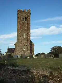 |
| Poyston including attached service ranges to NW. | Rudbaxton | 3 January 1963 | SM9675119815 51°50′23″N 4°57′06″W |
House | Situated some 1.3 km E of the A40 and just N of the airfield at Withybush.[106] | 12010 | |
| Church of St Dogfael | St Dogswells, Wolfscastle | 3 January 1963 | SM9689228005 51°54′48″N 4°57′16″W |
Church | Situated S of the Afon Anghof some 150m E of Sealyham Bridge and some 400m N of St Dogwells Farm.[107] | 12011 | 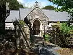 |
| Church of St Mary | Wiston | 3 January 1963 | SN0221817959 51°49′30″N 4°52′17″W |
Church | In a prominent position on the S side of the road through Wiston and some 200m S of Wiston Castle.[108] | 12017 | 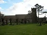 |
| New Bridge and four lamp standards | Haverfordwest | 7 January 1974 | SM9551915689 51°48′08″N 4°58′02″W |
Bridge | Situated between Picton Place and Victoria Place, across the Western Cleddau river.[109] | 12020 | 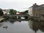 |
| The Old Bridge | Haverfordwest | 10 December 1951 | SM9540415876 51°48′14″N 4°58′08″W |
Bridge | Situated across river between N end of Bridge Street and Old Bridge.[110] | 12021 | 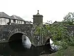 |
| Church of Saint Martin of Tours | Haverfordwest | 10 December 1951 | SM9516915733 51°48′09″N 4°58′20″W |
Church | Situated in churchyard raised above Church Street and Chapel Lane.[111] | 12041 | 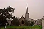 |
| Tabernacle Congregational Church | Haverfordwest | 7 January 1974 | SM9509715744 51°48′10″N 4°58′24″W |
Church | Situated on SW corner of City Road/Barn St, facing across main road to St Martin's Church.[112] | 12044 | 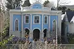 |
| Tabernacle Church School | Haverfordwest | 7 January 1974 | SM9510715761 51°48′10″N 4°58′23″W |
School | Situated adjoining Tabernacle Church to N, overlooking junction of City Road and Perrots Road.[113] | 12045 | 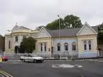 |
| Forecourt dwarf wall and railings to Tabernacle Church and to Tabernacle Church School | Haverfordwest | 7 January 1974 | SM9511815744 51°48′10″N 4°58′23″W |
Situated across the E fronts of the chapel and school, overlooking junction with Perrots Road.[114] | 12046 | 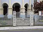 | |
| Williamston House including area railings | Haverfordwest | 7 January 1974 | SM9531215463 51°48′01″N 4°58′12″W |
House | On the S side of Goat Street some 45m E of its junction with Market Street.[115] | 12081 | |
| 8 Goat Street | Haverfordwest | 10 December 1951 | SM9530115483 51°48′01″N 4°58′13″W |
House | Large 18th-century terraced house, attached to the similar Grade II* listed No. 10[116][117] | 12090 | |
| Foley House | Haverfordwest | 10 December 1951 | SM9533215505 51°48′02″N 4°58′11″W |
House | Situated in own grounds on sloping site half way down street, set back in terraced forecourt.[118] | 12092 |  |
| Hermon's Hill House | Haverfordwest | 10 December 1951 | SM9541715492 51°48′02″N 4°58′07″W |
Situated at top end of Hill Lane to S of No 27 Hill Lane.[119] | 12097 | | |
| 15 High Street | Haverfordwest | 10 December 1951 | SM9527315580 51°48′05″N 4°58′14″W |
Shop | On the S side of the High Street opposite its junction with Dark Street.[120] | 12104 | |
| The Shire Hall | Haverfordwest | 10 December 1951 | SM9541415609 51°48′06″N 4°58′07″W |
Restaurant | On the S side of the High Street some 25m W of its junction with Quay Street.[121] | 12110 | 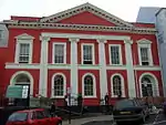 |
| Railings, gates, steps and retaining wall to the Shire Hall | Haverfordwest | 7 January 1974 | SM9541115623 51°48′06″N 4°58′07″W |
Railings/gates/steps | On the S side of the High Street some 25m W of its junction with Quay Street.[122] | 12111 | |
| 12 High Street | Haverfordwest | 7 January 1974 | SM9526215611 51°48′05″N 4°58′15″W |
Office | Situated attached to No 1 Dark Street, at junction of High Street and Dark Street.[123] | 12116 | 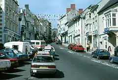 |
| 22 High Street | Haverfordwest | 7 January 1974 | SM9530615609 51°48′05″N 4°58′13″W |
House | Situated two doors down from set-back for C20 National Westminster Bank.[124] | 12118 | |
| 36 and 38 High Street | Haverfordwest | 12 October 1951 | SM9536515628 51°48′06″N 4°58′10″W |
Shops | On the N side of the High Street some 60m W of its junction with Quay Street.[125] | 12122 | |
| 40 High Street | Haverfordwest | 12 October 1951 | SM9537415632 51°48′06″N 4°58′09″W |
Offices | On the N side of the High Street some 50m W of its junction with Quay Street.[126] | 12123 | |
| 29 Hill Street | Haverfordwest | 12 October 1951 | SM952153 51°47′58″N 4°58′18″W |
House | Situated in terraced row against right end of C20 College Court development.[127] | 12137 | |
| Palace Cinema and 2 Hill Street | Haverfordwest | 7 January 1974 | SM9525515424 51°47′59″N 4°58′15″W |
Cinema and house | Situated on corner of Upper Market Street with facades to both streets.[128] | 12148 | 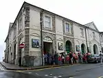 |
| Hillborough House and area railings | Haverfordwest | 7 January 1974 | SM9518015411 51°47′59″N 4°58′19″W |
Some 30m S of the junction of Hill Street and Horn's Lane.[129] | 12152 | | |
| The Crypt | Haverfordwest | 10 December 1951 | SM9522615560 51°48′04″N 4°58′17″W |
Crypt | Situated on the corner of Market Street and High St, opposite St Mary's Church.[130] | 12172 |  |
| Plas Glyn-y-Mel, including quadrant wall & gatepier to W service court | Fishguard, Fishguard and Goodwick | 24 November 1978 | SM9661236965 51°59′38″N 4°57′50″W |
House | Situated in its own grounds at the end of Glyn-y-Mel Road.[131] | 12256 | 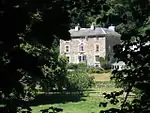 |
| Hermon Baptist Church including forecourt walls and steps | Fishguard, Fishguard and Goodwick | 24 November 1978 | SM9567436903 51°59′34″N 4°58′39″W |
Chapel | Situated set back from the street line W of No 21, in raised paved forecourt.[132] | 12273 | 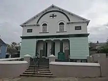 |
| Church of St Hywel, Llanhowell | Llanrhian | 2 April 1991 | SM8189427427 51°54′09″N 5°10′19″W |
Church | 12423 | 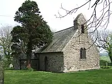 | |
| Church of St Mary | Newport | 16 January 1952 | SN0579738964 52°00′54″N 4°49′53″W |
Church | Church Street (east side) | 12483 | 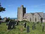 |
| Ebenezer Congregational Chapel (Capel Ebenezer) | Newport | 14 April 1992 | SN0580939176 52°01′01″N 4°49′53″W |
Chapel | Lower St Mary's Street | 12497 | 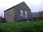 |
| The Close Wall | St Davids and the Cathedral Close | 3 January 1963 | SM7510625315 51°52′51″N 5°16′08″W |
Wall | Encircling the Cathedral Close, formerly listed with Porth-y-Tŵr.[133] | 12542 | 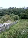 |
| Pont Cerwyn Dewi / Merryvale Bridge and attached tower | St Davids and the Cathedral Close | 3 January 1963 | SM7495325356 51°52′52″N 5°16′16″W |
Bridge | the Cathedral Close | 12543 | 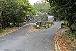 |
| The City Cross | St Davids | 3 January 1963 | SM7534025320 51°52′52″N 5°15′56″W |
Cross | Cross Square (in centre) | 12575 | 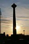 |
| Capel Caerfarchell and outbuilding to north-eastern corner of forecourt, Caerfarchell | Caerfarchell | 28 July 1992 | SM7946527001 51°53′52″N 5°12′25″W |
Chapel | 12664 | 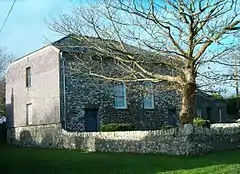 | |
| Rhosson Uchaf / Rhosson Farmhouse, Rhosson | St Davids | 13 December 1951 | SM7292525267 51°52′46″N 5°18′02″W |
Farmhouse | 12708 | | |
| St Non's Well, St Non's | St Davids | 3 January 1963 | SM7510424369 51°52′21″N 5°16′06″W |
Well | A pilgrimage site since medieval times.[134][135] | 12712 | 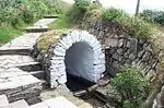 |
| Treleddyn Uchaf / Upper Treleddyn, including gardens walls with crosshead | Treleddyn, St Davids | 13 December 1951 | SM7319525948 51°53′09″N 5°17′50″W |
12737 | | ||
| Church of St Brynarch | Nevern | 16 January 1952 | SN0833240029 52°01′32″N 4°47′42″W |
Church | B4582 (N side) | 12746 | 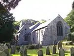 |
| Churchyard of church of St Brynarch, including wall and gates | Nevern | 16 January 1952 | SN0833440017 52°01′31″N 4°47′42″W |
Churchyard | B4582 (N. side) | 12747 |  |
| Church of St Andrew | Bayvil, Nevern | 16 January 1952 | SN1016340620 52°01′53″N 4°46′08″W |
Church | B4582 (N. side) Bayvil/Beifil | 12756 | 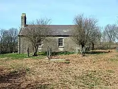 |
| Berry Hill House | Berry Hill, Nevern | 27 October 1992 | SN0683340192 52°01′35″N 4°49′01″W |
Berry Hill | 12757 | 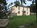 | |
| Llwyngoras, including garden walls with gate piers | Moylgrove, Nevern | 27 October 1992 | SN0920639504 52°01′16″N 4°46′56″W |
House | Glanrhyd Road, Llwyngoras | 12772 | 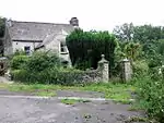 |
| Trewern | Trewern, Nevern | 4 September 1980 | SN0882638106 52°00′30″N 4°47′13″W |
House | 12808 | | |
| Church of St Katharine | Milford Haven | 17 July 1951 | SM9086305754 51°42′41″N 5°01′43″W |
Church | Sandhurst Road | 12905 |  |
| Fort Hubberston | Hakin, Milford Haven | 22 February 1993 | SM8907505508 51°42′31″N 5°03′16″W |
Fort | Situated on headland, approached by access drive running S from Primary School in Picton Road.[136] | 12920 | .jpg.webp) |
| The Observatory | Milford | 6 March 1964 | SM8921105956 51°42′45″N 5°03′09″W |
Observatory (ruined) | Picton Road, Hakin[137][138] | 12922 | 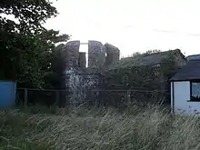 |
| Pill Priory Ruins | Lower Priory, Milford Haven | 28 January 1963 | SM9027707263 51°43′29″N 5°02′17″W |
Priory (ruined) | Lower Priory[139][140] | 12927 | 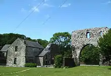 |
| The Steps, (including property formerly known as Brook Villa) | Lower Priory, Milford Haven | 28 January 1963 | SM9027807244 51°43′28″N 5°02′17″W |
House | Lower Priory[141] | 12928 | |
| The Priory Inn (including 3 properties formerly known as Priory Farmhouse) | Milford Haven | 28 January 1963 | SM9026407226 51°43′28″N 5°02′17″W |
Inn | The Steps above Priory Farm | 12929 |  |
| Church of St Peter & St Cewydd | Steynton, Milford Haven | 22 February 1993 | SM9177807820 51°43′49″N 5°01′00″W |
Church | Situated on E side of main road in Steynton village.[142] | 12934 | 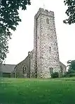 |
| Church of St. Gwyndaf | Llanwnda, Pencaer | 14 July 1993 | SM9321839584 52°00′58″N 5°00′53″W |
Church | 12980 | 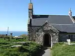 | |
| Tregwnt, Tregwynt, Granston/Treopert | Pencaer | 3 January 1963 | SM8896634617 51°58′11″N 5°04′25″W |
House | 12996 | 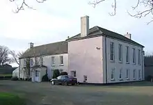 | |
| North Wing & Low Farm Range to W. of Tregwynt | Tregwynt, Granston/Treopert, Pencaer | 3 January 1963 | SM8893734630 51°58′12″N 5°04′27″W |
House | 12997 | | |
| St Brides Castle | Marloes and St Brides | 29 October 1979 | SM7961910706 51°45′05″N 5°11′39″W |
Guest house | Situated in wooded parkland, overlooking and some 700m SW of St Brides Haven.[143] | 13018 | 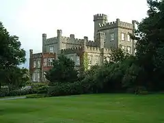 |
| The Pigeon House and Railings at Cilwendeg Farm | Capel Colman, Boncath | 23 January 1976 | SN2222538823 52°01′09″N 4°35′32″W |
Situated at rear NE end of farm complex, below barn.[144] | 13024 | | |
| The Shell House, Cilwendeg Farm | Capel Colman, Boncath | 23 January 1976 | SN2219438685 52°01′05″N 4°35′33″W |
Shell House | Situated in undergrowth backing onto track running SW from Cilwendeg Farm some 70m SW of Counting House.[145] | 13025 | 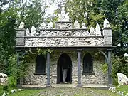 |
| Farm buildings W of Temple Druid | Maenclochog | 28 September 1989 | SN0959827206 51°54′39″N 4°46′10″W |
To the rear of Temple Druid Cottages and just W of the house at Temple Druid.[146] | 13054 | | |
| Court / Cwrt including screen wall and outside kitchen to service court | Cwm Gwaun | 20 July 1992 | SM9892435672 51°58′59″N 4°55′46″W |
Approximately 0.5 km NE of Llanychaer, situated on fine elevated site facing W towards Fishguard. Reached by a steep track from the bridge over Afon Gwaun.[147] | 13067 | | |
| Rickeston Hall | Rickeston, Brawdy | 8 October 1993 | SM8469825387 51°53′07″N 5°07′48″W |
Farmhouse | Situated immediately W of Brawdy Airfield, some 2km N of A487.[148] | 13077 | 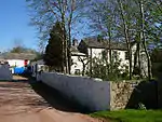 |
| Y Felin | St Dogmaels (part) | 15 November 1993 | SN1652745912 52°04′52″N 4°40′44″W |
Mill | Situated some 100m ENE of the abbey ruins.[149] | 13096 | 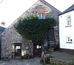 |
| The South West Martello Tower | Pembroke Dock | 18 February 1994 | SM9551803606 51°41′38″N 4°57′36″W |
Martello tower | Fort Road (W End)[150] | 14353 | _-_geograph.org.uk_-_462600.jpg.webp) |
| North East Martello Tower | Pembroke Dock | 18 February 1994 | SM9640603835 51°41′46″N 4°56′51″W |
Martello tower | Front Street (N Side)[151] | 14354 | 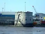 |
| Dry-Moat Walls, Presely View (W end) | Pembroke Dock | 18 January 1974 | SM9606703083 51°41′22″N 4°57′07″W |
14371 | | ||
| Barracks Platform, Presely View (W Side) | Pembroke Dock | 18 January 1994 | SM9606703083 51°41′22″N 4°57′07″W |
14372 | | ||
| Dockyard Gates, the Dockyard | Pembroke Dock | 18 January 1974 | SM9602803524 51°41′36″N 4°57′10″W |
14377 | .jpg.webp) | ||
| Piers and Lodges (formerly listed with Dockyard Wall), the Dockyard | Pembroke Dock | 18 January 1974 | SM9601403529 51°41′36″N 4°57′10″W |
14378 | | ||
| The Port Hotel (formerly listed as the Commodore Club), the Dockyard | Pembroke Dock | 18 January 1974 | SM9599803533 51°41′36″N 4°57′11″W |
14379 | | ||
| Long Stable Range to South, the Dockyard | Pembroke Dock | 18 January 1974 | SM9599103507 51°41′35″N 4°57′11″W |
14380 | | ||
| No 3, The Terrace, The Dockyard | Pembroke Dock | 18 January 1974 | SM9607403501 51°41′35″N 4°57′07″W |
14381 | | ||
| The Graving Dock including Bollards and Capstans (formerly listed with 13 Building Slips and Carr Jet | Pembroke Dock | 18 January 1974 | SM9583903927 51°41′49″N 4°57′20″W |
Graving Dock | 14393 | | |
| Church of Saint David | Brawdy | 3 January 1963 | SM8580424040 51°52′25″N 5°06′47″W |
Church | 14396 | 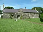 | |
| Forecourt, Railings, Piers and Gates, Meyrick Street (W side) | Pembroke Dock | 14 July 1981 | SM9669403432 51°41′34″N 4°56′35″W |
14420 | | ||
| Hescwm Mill/Felin Hescwm | Dinas Cross | 18 March 1994 | SM9976438467 52°00′30″N 4°55′08″W |
Mill | Situated some 200m inland from Aber Bach or Hesgwm cove, approached by narrow lane from Bwlchmawr. The mill lies to the south of the group of buildings.[152] | 14535 | 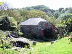 |
| Brynhenllan Chapel | Brynhenllan, Dinas Cross | 17 November 1994 | SN0091139561 52°01′07″N 4°54′10″W |
Chapel | 14942 | .jpg.webp) | |
| Manordeifi Old Church | Manordeifi | 24 November 1994 | SN2283743162 52°03′30″N 4°35′08″W |
Church | Situated just above Teifi flood meadows, some 1.1km ESE of Llechryd Bridge.[153][154] | 15115 | 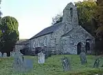 |
| Terrace, Walls and Balustrades S of Ffynone House | Manordeifi | 24 November 1994 | SN2424138585 52°01′04″N 4°33′46″W |
Terrace,Walls and Balustrade | 15123 | 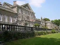 | |
| Cilrhue, Boncath | Boncath | 25 January 1995 | SN1979639734 52°01′36″N 4°37′41″W |
House | 15388 | 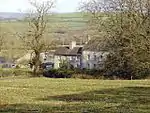 | |
| The Stable and Coach House at Cilwendeg Farm | Capel Colman, Boncath | 23 January 1976 | SN2230438777 52°01′08″N 4°35′28″W |
Stable | Situated to NE of farmhouse and N of mansion.[155] | 15393 | |
| Four Mediaeval House at Upper Lamphey Park Farm | Lamphey | 28 February 1995 | SN0252001320 51°40′33″N 4°51′27″W |
Houses | About 500m S of Deerpark Lane, at NW end of the farm complex.[156] | 15663 | |
| Cresselly House | Jeffreyston | 21 June 1971 | SN0645606543 51°43′27″N 4°48′13″W |
House | Situated in its own grounds and approached along the N drive or through the stable courtyard to S. Faces E with terrace to W.[157][158] | 15933 | |
| Flimston Farmhouse | Castlemartin | 12 August 1995 | SR9242995646 51°37′16″N 5°00′00″W |
Farmhouse (ruined) | On RAC Castlemartin Range, W of road to Stack Rocks.[159] | 16590 | 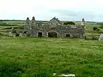 |
| Pricaston Farmhouse | Castlemartin | 12 August 1995 | SR9177496481 51°37′42″N 5°00′36″W |
Farmhouse (ruined) | On RAC Castlemartin Range, entered by Linney Gate.[160] | 16604 | .jpg.webp) |
| West Set of Kilns | Penally | 26 April 1996 | SN1205500124 51°40′06″N 4°43′09″W |
Kilns | At the S side of the main private road entering the Kiln Park caravan site, on the E side of the A4139. They are related to the extensive Black Rock quarries at their rear.[161] | 16918 | 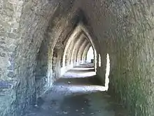 |
| The Almshouse | Angle | 14 May 1970 | SM8655002858 51°41′02″N 5°05′21″W |
Almshouse | At S of the village street, opposite the school.[162] | 17149 | |
| Fort Popton | Angle | 26 January 1996 | SM8944603752 51°41′34″N 5°02′52″W |
Fort | On the headland at the NE corner of Angle Bay.[163][164] | 17168 | 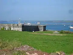 |
| Thorne Island Fort | Angle | 26 January 1996 | SM8463903828 51°41′30″N 5°07′03″W |
Fort | Off N headland of West Angle Bay.[165][166] | 17169 | 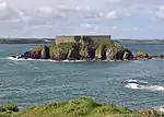 |
| Caldey Abbey | Tenby | 23 September 1996 | SS1417396605 51°38′15″N 4°41′12″W |
Abbey | On hillside above the village, about 500m SE of the harbour.[167] | 17324 | 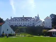 |
| Brewery | Stackpole | 2 August 1996 | SR9770296123 51°37′39″N 4°55′27″W |
Brewery | 17990 | | |
| Eight-Arch Bridge | Stackpole | 2 August 1996 | SR9772595602 51°37′22″N 4°55′25″W |
Bridge | Built in 1797.[168][169] | 18003 | 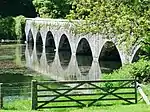 |
| West Blockhouse Fort | Dale | 12 October 1997 | SM8181903560 51°41′18″N 5°09′29″W |
Fort | Situated on West Blockhouse Point, and reached by drive of some 1.5 km from Merryborough Farm, S of Dale.[170] | 19148 | 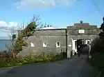 |
| Church of Saint Peter | Marloes, Marloes and St Brides | 23 February 1998 | SM7948508235 51°43′45″N 5°11′41″W |
Church | Situated at the SE end of the village of Marloes, above and to the S of the main street.[171] | 19393 | 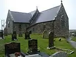 |
| Blackpool Bridge | Slebech | 26 February 1998 | SN0600614519 51°47′44″N 4°48′53″W |
Bridge | Across the Eastern Cleddau adjacent to Blackpool Mill, at the highest navigable point of the river. The bridge is half in Martletwy Community and half in Slebech Community.[172] | 19408 | |
| Sandy Haven House | St Ishmaels | 25 August 1998 | SM8508707614 51°43′33″N 5°06′48″W |
House | Situated just S of Sandy Haven Farm some 450m NW of Sandy Haven.[173] | 20351 | |
| Church of St Justinian | Trecwn | 11 October 1998 | SM9532833898 51°57′57″N 4°58′51″W |
Church | About 1km E of Scleddau, beyond farmhouse at end of track beginning on E side of A40, near old quarry, then across field to churchyard.[174] | 20818 | |
| Bethesda Baptist Church including vestry block attached to left | Haverfordwest | 14 May 1975 | SM9511815675 51°48′07″N 4°58′23″W |
Church | Situated near the centre of Haverfordwest, on the E side of Barn Street near its junction with City Road and Perrots Road.[175] | 22762 | 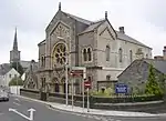 |
| Lofted outbuilding, wings and gin-house at Camrose Home Farm | Camrose | 30 April 2001 | SM9318919471 51°50′07″N 5°00′11″W |
Farm building | Situated on the N side of the farm court at Camrose Home Farm.[176] | 25159 | |
| No 2 Lexden Terrace | Tenby | 19 March 1951 | SN1365200389 51°40′17″N 4°41′47″W |
House | Lexden Terrace lies at a tangent to the E side of St Julian's Street, the rear overlooking Castle Sands, all set back behind a forecourt wall.[177] | 26319 | |
| No 3 Lexden Terrace | Tenby | 19 March 1951 | SN1365400395 51°40′17″N 4°41′47″W |
Lexden Terrace lies at a tangent to the E side of St Julian's Street, the rear overlooking Castle Sands, all set back behind a forecourt wall.[178] | 26320 | | |
| No 4 Lexden Terrace | Tenby | 19 March 1951 | SN1365600400 51°40′17″N 4°41′47″W |
Lexden Terrace lies at a tangent to the E side of St Julian's Street, the rear overlooking Castle Sands, all set back behind a forecourt wall.[179] | 26321 | | |
| No 5 Lexden Terrace | Tenby | 19 March 1951 | SN1365900406 51°40′17″N 4°41′46″W |
Lexden Terrace lies at a tangent to the E side of St Julian's Street, the rear overlooking Castle Sands, all set back behind a forecourt wall.[180] | 26322 | | |
| No 4 Rock Terrace | Tenby | 19 March 1951 | SN1361000348 51°40′15″N 4°41′49″W |
House | Set back from the street line on the S side of St Julian's Street with rear facade overlooking Iron Bar Sands.[181] | 26340 | |
| No 6 Lexden Terrace (Lexden House) | Tenby | 19 March 1951 | SN1366100413 51°40′17″N 4°41′46″W |
Lexden Terrace lies at a tangent to the E side of St Julian's Street, No 6, the farthest, is set back in a separate forecourt.[182] | 26349 | | |
| Former Tenby Market Cross and well-chamber | Tenby | 28 March 2002 | SN1310401035 51°40′37″N 4°42′16″W |
Market cross | Situated at the N end of the water garden in the centre of Merlins Gardens.[183] | 26423 | .jpg.webp) |
| Stack Rock Fort | Herbrandston | 3 April 2004 | SM8643504946 51°42′09″N 5°05′32″W |
Fort | On Stack Rock island in Milford Haven some 2.7km S of Herbranston village.[184][185] | 82592 | 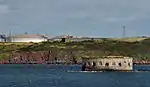 |
| The defensible barracks at South Hook Fort | Herbrandston | 3 April 2004 | SM8704405557 51°42′29″N 5°05′01″W |
Barracks | In a prominent position some 200m N of the cliffs at South Hook Point.[186][187] | 82593 | |
| Higgon's Well | Uzmaston and Boulston | 16 July 2004 | SM9614815055 51°47′49″N 4°57′28″W |
Well | On the E side of the estuary of the Cleddau Wen some 700m S of Haverfordwest station.[188] | 82964 | |
| Lancych | Clydau | 26 July 2004 | SN2599838382 52°00′59″N 4°32′13″W |
House | Set in its own extensive grounds on the S side of the Afon Cych some 200m W of Pont Glan Cych.[189] | 82984 | |
| 10 Goat Street | Haverfordwest | 7 January 1974 | SM9530915486 51°48′02″N 4°58′12″W |
House | Large 18th-century terraced house, attached to the similar Grade II* listed No. 8[190][191] | 87060 | |
| Gateway and walls to 'The Abbey' | Marloes and St Brides | 23 February 1998 | SM8035310787 51°45′09″N 5°11′01″W |
Gateway | Situated at St Brides Green, some 200m SW of St Brides Cross and some 200m SE of the coast at St Brides Haven.[192] | 87482 | |
| Church of St Rhian | Llanrhian | 1 March 1963 | SM8192831442 51°56′19″N 5°10′26″W |
Church | Situated in Llanrhian village about 100m NE of crossroads.[193] | 87554 | 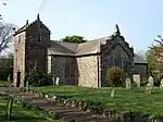 |
Notes
- Sometimes known as OSGB36, the grid reference is based on the British national grid reference system used by the Ordnance Survey.
References
- "Buildings & Conservation Areas". Cadw. Retrieved 18 June 2013.
- "Planning (Listed Buildings and Conservation Areas) Act 1990". The National Archives. Retrieved 18 June 2013.
- Cadw. "Dovecote (5922)". National Historic Assets of Wales. Retrieved 9 April 2019.
- "Dovecote". British Listed Buildings.
- Cadw. "St. Michael and All Angel's Church (5927)". National Historic Assets of Wales. Retrieved 9 April 2019.
- "St. Michael and All Angel's Church". British Listed Buildings.
- Cadw. "Church of Saint David (5933)". National Historic Assets of Wales. Retrieved 9 April 2019.
- "Church of Saint David". British Listed Buildings.
- Cadw. "Carew Bridge (5939)". National Historic Assets of Wales. Retrieved 9 April 2019.
- "Carew Bridge". British Listed Buildings.
- Cadw. "The Fortified Rectory (5947)". National Historic Assets of Wales. Retrieved 9 April 2019.
- "The Fortified Rectory". British Listed Buildings.
- Cadw. "The Old Vicarage (remains) (5949)". National Historic Assets of Wales. Retrieved 9 April 2019.
- "The Old Vicarage (remains)". British Listed Buildings.
- Cadw. "Church of St Lawrence (5958)". National Historic Assets of Wales. Retrieved 9 April 2019.
- "Church of St Lawrence". British Listed Buildings.
- Cadw. "Hodgeston Parish Church (5959)". National Historic Assets of Wales. Retrieved 9 April 2019.
- "Hodgeston Parish Church". British Listed Buildings.
- Cadw. "Lamphey Court (5968)". National Historic Assets of Wales. Retrieved 9 April 2019.
- "Lamphey Court". British Listed Buildings.
- Cadw. "Church of St Caradoc (5971)". National Historic Assets of Wales. Retrieved 9 April 2019.
- "Church of St Caradoc". British Listed Buildings.
- Cadw. "Sunny Hill Farmhouse (5984)". National Historic Assets of Wales. Retrieved 9 April 2019.
- "Sunny Hill Farmhouse". British Listed Buildings.
- Cadw. "Norchard (5986)". National Historic Assets of Wales. Retrieved 9 April 2019.
- "Norchard". British Listed Buildings.
- Cadw. "Church of St Nicholas (5992)". National Historic Assets of Wales. Retrieved 9 April 2019.
- "Church of St Nicholas". British Listed Buildings.
- Cadw. "Carswell Mediaeval House (6005)". National Historic Assets of Wales. Retrieved 9 April 2019.
- "Carswell Mediaeval House". British Listed Buildings.
- Cadw. "Church of St Florence (6008)". National Historic Assets of Wales. Retrieved 9 April 2019.
- "Church of St Florence". British Listed Buildings.
- Cadw. "St. Twynnell's Church (6018)". National Historic Assets of Wales. Retrieved 9 April 2019.
- "St. Twynnell's Church". British Listed Buildings.
- Cadw. "Park House (6021)". National Historic Assets of Wales. Retrieved 9 April 2019.
- "Park House". British Listed Buildings.
- Cadw. "St. Mary's Church (6035)". National Historic Assets of Wales. Retrieved 9 April 2019.
- "St. Mary's Church". British Listed Buildings.
- Cadw. "French Mill and Tidal Barrier (6038)". National Historic Assets of Wales. Retrieved 9 April 2019.
- "French Mill and Tidal Barrier". British Listed Buildings.
- Cadw. "St Elidyr's Church (6044)". National Historic Assets of Wales. Retrieved 9 April 2019.
- "St Elidyr's Church". British Listed Buildings.
- Cadw. "Church of St. Mary (6045)". National Historic Assets of Wales. Retrieved 9 April 2019.
- "Church of St. Mary". British Listed Buildings.
- Cadw. "Church of Saint Mary (6046)". National Historic Assets of Wales. Retrieved 9 April 2019.
- "Church of Saint Mary". British Listed Buildings.
- Cadw. "Church of St. Elidyr (6050)". National Historic Assets of Wales. Retrieved 9 April 2019.
- "Church of St. Elidyr". British Listed Buildings.
- Cadw. "Church of St. Jeffrey and St. Oswald (6052)". National Historic Assets of Wales. Retrieved 9 April 2019.
- "Church of St. Jeffrey and St. Oswald". British Listed Buildings.
- Cadw. "Church of St. Aidan (6062)". National Historic Assets of Wales. Retrieved 9 April 2019.
- "Church of St. Aidan". British Listed Buildings.
- Cadw. "Llawhaden Bridge and River Bank Wall (6064)". National Historic Assets of Wales. Retrieved 9 April 2019.
- "Llawhaden Bridge and River Bank Wall". British Listed Buildings.
- Cadw. "Vaynor (6072)". National Historic Assets of Wales. Retrieved 9 April 2019.
- Cadw. "Church of St Leonard (6076)". National Historic Assets of Wales. Retrieved 9 April 2019.
- "Church of St Leonard". British Listed Buildings.
- Cadw. "Parish Church of Saint Nicholas (6086)". National Historic Assets of Wales. Retrieved 9 April 2019.
- "Parish Church of Saint Nicholas". British Listed Buildings.
- Cadw. "Blackpool Bridge (6089)". National Historic Assets of Wales. Retrieved 9 April 2019.
- "Blackpool Bridge". British Listed Buildings.
- Cadw. "Blackpool Mill (6090)". National Historic Assets of Wales. Retrieved 9 April 2019.
- "Blackpool Mill". British Listed Buildings.
- Cadw. "St.Issell's Church (6093)". National Historic Assets of Wales. Retrieved 9 April 2019.
- Cadw. "Slebech Park (6102)". National Historic Assets of Wales. Retrieved 9 April 2019.
- Cadw. "Tenby Castle remains (6111)". National Historic Assets of Wales. Retrieved 9 April 2019.
- "Tenby Castle remains". British Listed Buildings.
- Cadw. "Laston House (6119)". National Historic Assets of Wales. Retrieved 9 April 2019.
- Cadw. "The Prize House (6165)". National Historic Assets of Wales. Retrieved 9 April 2019.
- Cadw. "Medieval structure in the churchyard (6175)". National Historic Assets of Wales. Retrieved 9 April 2019.
- Cadw. "Norton House, including garden wall to street (6211)". National Historic Assets of Wales. Retrieved 9 April 2019.
- Cadw. "The Former Assembly Rooms (6223)". National Historic Assets of Wales. Retrieved 9 April 2019.
- Cadw. "Plantagenet House (6227)". National Historic Assets of Wales. Retrieved 9 April 2019.
- Cadw. "Saint Catherine's Fort (6229)". National Historic Assets of Wales. Retrieved 9 April 2019.
- "Saint Catherine's Fort". British Listed Buildings.
- Cadw. "No 3 Rock Terrace including railings (6261)". National Historic Assets of Wales. Retrieved 9 April 2019.
- Cadw. "No 1 Lexden Terrace, including area railings (6268)". National Historic Assets of Wales. Retrieved 9 April 2019.
- Cadw. "Dovecote in field to NW of Priory Farmhouse (6327)". National Historic Assets of Wales. Retrieved 9 April 2019.
- Cadw. "Priory Farmhouse (6328)". National Historic Assets of Wales. Retrieved 9 April 2019.
- Cadw. "Walls on line of medieval town walls, including two medieval towers, gazebo, and lime-kiln (6342)". National Historic Assets of Wales. Retrieved 9 April 2019.
- Cadw. "Outbuilding range at Kingston Farm to SE of old farmhouse (6363)". National Historic Assets of Wales. Retrieved 9 April 2019.
- Cadw. "Nos 89/91 Main Street (6385)". National Historic Assets of Wales. Retrieved 9 April 2019.
- Cadw. "Penfro (6395)". National Historic Assets of Wales. Retrieved 9 April 2019.
- Cadw. "Zion Free Church (6415)". National Historic Assets of Wales. Retrieved 9 April 2019.
- Cadw. "The Old Storehouse (6441)". National Historic Assets of Wales. Retrieved 9 April 2019.
- Cadw. "NO 1, THE TERRACE (FORMERLY LISTED TOGETHER WITH THE COMMODORE CLUB),,,,,DYFED, (6454)". National Historic Assets of Wales. Retrieved 9 April 2019.
- Cadw. "Flemish Cottage (6468)". National Historic Assets of Wales. Retrieved 9 April 2019.
- Cadw. "Panteg farmhouse (6547)". National Historic Assets of Wales. Retrieved 9 April 2019.
- Cadw. "Former Banqueting Tower, about 300m SE of Orielton Field Centre (6586)". National Historic Assets of Wales. Retrieved 9 April 2019.
- Cadw. "Dovecote and attached Courtyard Ranges of outbuilding Farm Buildings E of West Orielton (6600)". National Historic Assets of Wales. Retrieved 9 April 2019.
- Cadw. "Llechryd Bridge (partly in Manordeifi community, Pembrokeshire) (9895)". National Historic Assets of Wales. Retrieved 9 April 2019.
- Cadw. "Glandovan (11973)". National Historic Assets of Wales. Retrieved 9 April 2019.
- "Glandovan". British Listed Buildings.
- Cadw. "Benton Castle (11981)". National Historic Assets of Wales. Retrieved 9 April 2019.
- "Benton Castle". British Listed Buildings.
- Cadw. "Rosemarket dovecote (11983)". National Historic Assets of Wales. Retrieved 9 April 2019.
- Cadw. "Scolton Manor (11984)". National Historic Assets of Wales. Retrieved 9 April 2019.
- Cadw. "Church of Saint Mary (11987)". National Historic Assets of Wales. Retrieved 9 April 2019.
- Cadw. "Church of St Ishmael (11988)". National Historic Assets of Wales. Retrieved 9 April 2019.
- Cadw. "Camrose House (11989)". National Historic Assets of Wales. Retrieved 9 April 2019.
- Cadw. "Clareston (11991)". National Historic Assets of Wales. Retrieved 9 April 2019.
- Cadw. "Church of St Peter (11996)". National Historic Assets of Wales. Retrieved 9 April 2019.
- Cadw. "Nolton Rectory (12000)". National Historic Assets of Wales. Retrieved 9 April 2019.
- Cadw. "Cottesmore including attached E conservatory and NW wing (12002)". National Historic Assets of Wales. Retrieved 9 April 2019.
- Cadw. "Church of Saint Andrew (12005)". National Historic Assets of Wales. Retrieved 9 April 2019.
- Cadw. "Poyston including attached service ranges to NW (12010)". National Historic Assets of Wales. Retrieved 9 April 2019.
- Cadw. "Church of Saint Dogfael (12011)". National Historic Assets of Wales. Retrieved 9 April 2019.
- Cadw. "Church of Saint Mary (12017)". National Historic Assets of Wales. Retrieved 9 April 2019.
- Cadw. "New Bridge and four lamp standards (12020)". National Historic Assets of Wales. Retrieved 9 April 2019.
- Cadw. "The Old Bridge (12021)". National Historic Assets of Wales. Retrieved 9 April 2019.
- Cadw. "Church of Saint Martin of Tours (12041)". National Historic Assets of Wales. Retrieved 9 April 2019.
- Cadw. "Tabernacle Congregational Church (12044)". National Historic Assets of Wales. Retrieved 9 April 2019.
- Cadw. "Tabernacle Church School (12045)". National Historic Assets of Wales. Retrieved 9 April 2019.
- Cadw. "Forecourt dwarf wall and railings to Tabernacle Church and to Tabernacle Church School (12046)". National Historic Assets of Wales. Retrieved 9 April 2019.
- Cadw. "Williamston House including area railings (12081)". National Historic Assets of Wales. Retrieved 9 April 2019.
- Cadw. "NOS.8 & 10 GOAT STREET AND GARAGES,,,,,DYFED, (12090)". National Historic Assets of Wales. Retrieved 9 April 2019.
- "NOS.8 & 10 GOAT STREET AND GARAGES,,,,,DYFED,". British Listed Buildings.
- Cadw. "Foley House (12092)". National Historic Assets of Wales. Retrieved 9 April 2019.
- Cadw. "Hermon's Hill House (12097)". National Historic Assets of Wales. Retrieved 9 April 2019.
- Cadw. "NO.15 HIGH STREET (PREMISES OCCUPIED BY W.H. SMITH & SON),,,,,DYFED, (12104)". National Historic Assets of Wales. Retrieved 9 April 2019.
- Cadw. "The Shire Hall (12110)". National Historic Assets of Wales. Retrieved 9 April 2019.
- Cadw. "Railings, gates, steps and retaining wall to the Shire Hall (12111)". National Historic Assets of Wales. Retrieved 9 April 2019.
- Cadw. "NO.12 HIGH STREET,,,,,DYFED,,12116 (12116)". National Historic Assets of Wales. Retrieved 9 April 2019.
- Cadw. "NO.22 HIGH STREET,,,,,DYFED, (12118)". National Historic Assets of Wales. Retrieved 9 April 2019.
- Cadw. "Nos. 36 and 38 High Street (12122)". National Historic Assets of Wales. Retrieved 9 April 2019.
- Cadw. "NOS.40 & 42 HIGH STREET,,,,,DYFED, (12123)". National Historic Assets of Wales. Retrieved 9 April 2019.
- Cadw. "NO.29 HILL STREET,,,,,DYFED, (12137)". National Historic Assets of Wales. Retrieved 9 April 2019.
- Cadw. "Palace Cinema and No. 2 Hill Street (12148)". National Historic Assets of Wales. Retrieved 9 April 2019.
- Cadw. "Hillborough House and area railings (12152)". National Historic Assets of Wales. Retrieved 9 April 2019.
- Cadw. "The Crypt (12172)". National Historic Assets of Wales. Retrieved 9 April 2019.
- Cadw. "Plas Glyn-y-Mel, including quadrant wall & gatepier to W service court (12256)". National Historic Assets of Wales. Retrieved 9 April 2019.
- Cadw. "Hermon Baptist Church including forecourt walls and steps (12273)". National Historic Assets of Wales. Retrieved 9 April 2019.
- Cadw. "The Close Wall (formerly listed with Porth Y Twr) (12542)". National Historic Assets of Wales. Retrieved 9 April 2019.
- Cadw. "St Non's Well (12712)". National Historic Assets of Wales. Retrieved 9 April 2019.
- "St Non's Well". British Listed Buildings.
- Cadw. "Fort Hubberston (12920)". National Historic Assets of Wales. Retrieved 9 April 2019.
- Cadw. "The Observatory (12922)". National Historic Assets of Wales. Retrieved 9 April 2019.
- "The Observatory". British Listed Buildings.
- Cadw. "Pillpriory Ruins (12927)". National Historic Assets of Wales. Retrieved 9 April 2019.
- "Pillpriory Ruins". British Listed Buildings.
- Cadw. "The Steps (including property formerly known as Brook Villa) (12928)". National Historic Assets of Wales. Retrieved 9 April 2019.
- Cadw. "Church of St Peter & St Cewydd (12934)". National Historic Assets of Wales. Retrieved 9 April 2019.
- Cadw. "St Brides Castle (13018)". National Historic Assets of Wales. Retrieved 9 April 2019.
- Cadw. "The Pigeon House and railings at Cilwendeg Farm (13024)". National Historic Assets of Wales. Retrieved 9 April 2019.
- Cadw. "The Shell House Cilwendeg Farm (13025)". National Historic Assets of Wales. Retrieved 9 April 2019.
- Cadw. "Farm buildings W of Temple Druid (13054)". National Historic Assets of Wales. Retrieved 9 April 2019.
- Cadw. "Court / Cwrt including screen wall and outside kitchen to service court (13067)". National Historic Assets of Wales. Retrieved 9 April 2019.
- Cadw. "Rickeston Hall (13077)". National Historic Assets of Wales. Retrieved 9 April 2019.
- Cadw. "Y Felin (13096)". National Historic Assets of Wales. Retrieved 9 April 2019.
- Cadw. "The South West Martello Tower (14353)". National Historic Assets of Wales. Retrieved 9 April 2019.
- Cadw. "North East Martello Tower (14354)". National Historic Assets of Wales. Retrieved 9 April 2019.
- Cadw. "Hescwm Mill/Felin Hescwm (14535)". National Historic Assets of Wales. Retrieved 9 April 2019.
- Cadw. "Manoreifi Old Church (15115)". National Historic Assets of Wales. Retrieved 9 April 2019.
- "Manoreifi Old Church". British Listed Buildings.
- Cadw. "The Stable & Coach House at Cilwendeg Farm (15393)". National Historic Assets of Wales. Retrieved 9 April 2019.
- Cadw. "Four Mediaeval House at Upper Lamphey Park Farm (15663)". National Historic Assets of Wales. Retrieved 9 April 2019.
- Cadw. "Cresselly House (15933)". National Historic Assets of Wales. Retrieved 9 April 2019.
- "Cresselly House". British Listed Buildings.
- Cadw. "Flimston Farmhouse (16590)". National Historic Assets of Wales. Retrieved 9 April 2019.
- Cadw. "Pricaston Farmhouse (16604)". National Historic Assets of Wales. Retrieved 9 April 2019.
- Cadw. "West Set of Kilns (16918)". National Historic Assets of Wales. Retrieved 9 April 2019.
- Cadw. "The Almshouse (17149)". National Historic Assets of Wales. Retrieved 9 April 2019.
- Cadw. "Fort Popton (17168)". National Historic Assets of Wales. Retrieved 9 April 2019.
- "Fort Popton". British Listed Buildings.
- Cadw. "Thorne Island Fort (17169)". National Historic Assets of Wales. Retrieved 9 April 2019.
- "Thorne Island Fort". British Listed Buildings.
- Cadw. "Caldey Abbey (17324)". National Historic Assets of Wales. Retrieved 9 April 2019.
- Cadw. "Eight-Arch Bridge (18003)". National Historic Assets of Wales. Retrieved 9 April 2019.
- "Eight-Arch Bridge". British Listed Buildings.
- Cadw. "West Blockhouse Fort (19148)". National Historic Assets of Wales. Retrieved 9 April 2019.
- Cadw. "Church of Saint Peter (19393)". National Historic Assets of Wales. Retrieved 9 April 2019.
- Cadw. "Blackpool Bridge (19408)". National Historic Assets of Wales. Retrieved 9 April 2019.
- Cadw. "Sandy Haven House (20351)". National Historic Assets of Wales. Retrieved 9 April 2019.
- Cadw. "Church of St Justinian (20818)". National Historic Assets of Wales. Retrieved 9 April 2019.
- Cadw. "Bethesda Baptist Church including vestry block attached to left (22762)". National Historic Assets of Wales. Retrieved 9 April 2019.
- Cadw. "Lofted outbuilding, wings and gin-house at Camrose Home Farm (25159)". National Historic Assets of Wales. Retrieved 9 April 2019.
- Cadw. "No 2 Lexden Terrace (26319)". National Historic Assets of Wales. Retrieved 9 April 2019.
- Cadw. "No 3 Lexden Terrace (26320)". National Historic Assets of Wales. Retrieved 9 April 2019.
- Cadw. "No 4 Lexden Terrace (26321)". National Historic Assets of Wales. Retrieved 9 April 2019.
- Cadw. "No 5 Lexden Terrace (26322)". National Historic Assets of Wales. Retrieved 9 April 2019.
- Cadw. "No 4 Rock Terrace (26340)". National Historic Assets of Wales. Retrieved 9 April 2019.
- Cadw. "No 6 Lexden Terrace (Lexden House) (26349)". National Historic Assets of Wales. Retrieved 9 April 2019.
- Cadw. "Former Tenby Market Cross and well-chamber (26423)". National Historic Assets of Wales. Retrieved 9 April 2019.
- Cadw. "Stack Rock Fort (82592)". National Historic Assets of Wales. Retrieved 9 April 2019.
- "Stack Rock Fort". British Listed Buildings.
- Cadw. "The defensible barracks at South Hook Fort (82593)". National Historic Assets of Wales. Retrieved 9 April 2019.
- "The defensible barracks at South Hook Fort". British Listed Buildings.
- Cadw. "Higgon's Well (82964)". National Historic Assets of Wales. Retrieved 9 April 2019.
- Cadw. "Lancych (82984)". National Historic Assets of Wales. Retrieved 9 April 2019.
- Cadw. ",10,Goat Street,,Haverfordwest,,SA61 1PX (87060)". National Historic Assets of Wales. Retrieved 9 April 2019.
- ",10,Goat Street,,Haverfordwest,,SA61 1PX". British Listed Buildings.
- Cadw. "Gateway and walls to "The Abbey" (87482)". National Historic Assets of Wales. Retrieved 9 April 2019.
- Cadw. "Church of St Rhian (87554)". National Historic Assets of Wales. Retrieved 9 April 2019.
External links
![]() Media related to Grade II* listed buildings in Pembrokeshire at Wikimedia Commons
Media related to Grade II* listed buildings in Pembrokeshire at Wikimedia Commons
