Havelock Parish, New Brunswick
Havelock is a civil parish in Kings County, New Brunswick, Canada.[2]
Havelock | |
|---|---|
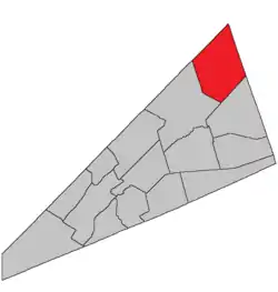 Location within Kings County, New Brunswick. | |
| Coordinates: 45.84°N 64.59°W | |
| Country | |
| Province | |
| County | Kings County |
| Erected | 1859 |
| Area | |
| • Land | 349.23 km2 (134.84 sq mi) |
| Population (2016)[1] | |
| • Total | 1,061 |
| • Density | 3.0/km2 (8/sq mi) |
| • Change 2011-2016 | |
| • Dwellings | 550 |
| Time zone | UTC-4 (AST) |
| • Summer (DST) | UTC-3 (ADT) |
For governance purposes it forms the local service district of the parish of Havelock,[3] which further includes the western part of the service area of Havelock Inside.[lower-alpha 1] The local service district is a member of Regional Service Commission 8 (RSC8).[4]
Origin of name
The parish was named for Henry Havelock, commander of British forces at the Siege of Lucknow in 1857, who died shortly after the siege was lifted.[5]
History
Havelock was erected in 1859 from the eastern polling district of Studholm Parish.[6]
In 1871 part of Havelock along Windgap Brook was returned to Studholm.[7]
Delineation
Havelock Parish is defined in the Territorial Division Act[2] as being bounded:
- West by Studholm Parish; northwest and east by the County lines, and south by Cardwell Parish.
Communities
Parish population total does not include incorporated municipalities (in bold):
Bodies of water & Islands
This is a list of rivers, lakes, streams, creeks, marshes and Islands that are at least partially in this parish
- None
Demographics
Access Routes
Highways and numbered routes that run through the parish, including external routes that start or finish at the parish limits:[10]
|
|
|
|
See also
Notes
- Regulation 84-168 does not explicitly state that Havelock Inside extends outside the parish of Havelock but its boundary description makes it obvious it does.
References
- "Census Profile, 2016 Census: Havelock, Parish [Census subdivision], New Brunswick". Statistics Canada. Retrieved September 20, 2019.
- "Chapter T-3 Territorial Division Act". Government of New Brunswick. Retrieved 13 November 2020.
- "New Brunswick Regulation 84-168 under the Municipalities Act (O.C. 84-582)". Government of New Brunswick. Retrieved 19 July 2020.
- "Communities in each of the 12 Regional Service Commissions (RSC) / Les communautés dans chacune des 12 Commissions de services régionaux (CSR)" (PDF), Government of New Brunswick, July 2017, retrieved 2 February 2021
- Ganong, William F. (1896). A Monograph of the Place-Nomenclature of the Province of New Brunswick. Royal Society of Canada. p. 240.
- "21 Vic. c. 39 An Act to divide the Parish of Studholm into two separate and distinct Parishes.". Acts of the General Assembly of Her Majesty's Province of New Brunswick, Passed in March and April 1858. Fredericton: Government of New Brunswick. 1858. pp. 89–90.
- "34 Vic. c. 63 An Act to alter the division line between the Parishes of Studholm and Havelock, in King's County.". Acts of the General Assembly of Her Majesty's Province of New Brunswick. Passed in the Month of May 1871. Fredericton: Government of New Brunswick. 1871. p. 268.
- Statistics Canada: 2001, 2006 census
- 2011 Statistics Canada Census Profile: Havelock Parish, New Brunswick
- Atlantic Canada Back Road Atlas ISBN 978-1-55368-618-7
Places adjacent to Havelock Parish, New Brunswick | ||||||||||
|---|---|---|---|---|---|---|---|---|---|---|
| ||||||||||
| Subdivisions | |
|---|---|
| Cities | |
| Counties | |
| |