Studholm Parish, New Brunswick
Studholm is a civil parish in Kings County, New Brunswick, Canada.[2]
Studholm | |
|---|---|
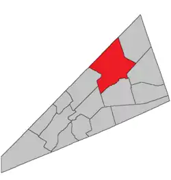 Location within Kings County, New Brunswick. | |
| Coordinates: 45.84°N 64.59°W | |
| Country | |
| Province | |
| County | Kings County |
| Erected | 1840 |
| Area | |
| • Land | 449.37 km2 (173.50 sq mi) |
| Population (2016)[1] | |
| • Total | 3,522 |
| • Density | 7.8/km2 (20/sq mi) |
| • Pop 2011-2016 | |
| • Dwellings | 1,481 |
| Time zone | UTC-4 (AST) |
| • Summer (DST) | UTC-3 (ADT) |
For governance purposes it forms the local service district of the parish of Studholm,[3] which further includes the service area of Lower Millstream.[3] The local service district is a member of Regional Service Commission 8 (RSC8).[4]
Origin of name
The parish was named in honour of Gilfred Studholme, a Loyalist military commander during the American Revolution,[5] who later settled in the area and served on the first Executive Council of New Brunswick.
History
Studholm was erected in 1840 from Sussex Parish.[6] It included Havelock Parish.
In 1859 the eastern polling district was erected as Havelock Parish.[7]
In 1871 part of Havelock along Windgap Brook was returned to Studholm.[8]
Delineation
Studholm Parish is defined in the Territorial Division Act[2] as being bounded:
- West by Springfield Parish and the line running north from the mouth of the Halfway Brook; northwest by the County line; east by the western side line of the grant of nine hundred and ninety-seven acres to Thomas Leonard, the northern prolongation thereof to the County line, and the southerly prolongation thereof to Windgap Brook; thence following the several courses of said brook down stream until it intersects a line running south forty-two degrees thirty minutes east by the magnet of the year one thousand eight hundred and thirty-nine from the southwest angle of lot number one south granted to James Caruth; thence following the said last-mentioned line prolonged to Cardwell Parish, and south by Sussex and Cardwell Parishes.
Communities
Parish population total does not include incorporated municipalities (in bold).
|
|
|
Bodies of water & Islands
This is a list of rivers, lakes, streams, creeks, marshes and Islands that are at least partially in this parish
- None
Demographics
Population
| Canada census – Studholm Parish, New Brunswick community profile | |||
|---|---|---|---|
| 2016 | 2011 | 2006 | |
| Population: | 3,522 (-2.5% from 2011) | 3,612 (+2.4% from 2006) | 3,526 (-5.2% from 2001) |
| Land area: | 449.37 km2 (173.50 sq mi) | 449.43 km2 (173.53 sq mi) | 449.43 km2 (173.53 sq mi) |
| Population density: | 7.8/km2 (20/sq mi) | 8.0/km2 (21/sq mi) | 7.8/km2 (20/sq mi) |
| Median age: | 45.9 (M: 45.6, F: 46.0) | 43.0 (M: 42.9, F: 43.0) | 40.8 (M: 41.0, F: 40.7) |
| Total private dwellings: | 1,481 | 1,459 | 1,382 |
| Median household income: | $61,248 | $53,700 | $44,605 |
| References: 2016[9] 2011[10] 2006[11] earlier[12] | |||
|
|
| |||||||||||||||||||||||||||
| [13][1] | |||||||||||||||||||||||||||||
Language
| Canada Census Mother Tongue - Studholm Parish, New Brunswick[13] | ||||||||||||||||||
|---|---|---|---|---|---|---|---|---|---|---|---|---|---|---|---|---|---|---|
| Census | Total | English |
French |
English & French |
Other | |||||||||||||
| Year | Responses | Count | Trend | Pop % | Count | Trend | Pop % | Count | Trend | Pop % | Count | Trend | Pop % | |||||
2011 |
3,545 |
3,425 | 96.61% | 45 | 1.27% | 15 | 0.42% | 60 | 1.69% | |||||||||
2006 |
3,480 |
3,335 | 95.83% | 15 | 0.43% | 15 | 0.43% | 115 | 3.30% | |||||||||
2001 |
3,670 |
3,590 | 97.82% | 50 | 1.36% | 10 | 0.27% | 20 | 0.54% | |||||||||
1996 |
3,705 |
3,625 | n/a | 97.84% | 35 | n/a | 0.94% | 10 | n/a | 0.27% | 35 | n/a | 0.94% | |||||
Access Routes
Highways and numbered routes that run through the parish, including external routes that start or finish at the parish limits:[14]
See also
References
- "Census Profile, 2016 Census Studholm, Parish [Census subdivision], New Brunswick". Statistics Canada. Retrieved August 27, 2019.
- "Chapter T-3 Territorial Division Act". Government of New Brunswick. Retrieved 13 November 2020.
- "New Brunswick Regulation 84-168 under the Municipalities Act (O.C. 84-582)". Government of New Brunswick. Retrieved 19 July 2020.
- "Communities in each of the 12 Regional Service Commissions (RSC) / Les communautés dans chacune des 12 Commissions de services régionaux (CSR)" (PDF), Government of New Brunswick, July 2017, retrieved 2 February 2021
- Ganong, William F. (1896). A Monograph of the Place-Nomenclature of the Province of New Brunswick. Royal Society of Canada. p. 274.
- "3 Vic. c. 30 An Act for erecting a part of the Parish or Township of Sussex, in King's County, into a separate and distinct Parish or Township.". Acts of the General Assembly of Her Majesty's Province of New Brunswick, Passed in the Year 1840. Fredericton: Government of New Brunswick. 1840. pp. 14–15.
- "21 Vic. c. 39 An Act to divide the Parish of Studholm into two separate and distinct Parishes.". Acts of the General Assembly of Her Majesty's Province of New Brunswick, Passed in March and April 1858. Fredericton: Government of New Brunswick. 1858. pp. 89–90.
- "34 Vic. c. 63 An Act to alter the division line between the Parishes of Studholm and Havelock, in King's County.". Acts of the General Assembly of Her Majesty's Province of New Brunswick. Passed in the Month of May 1871. Fredericton: Government of New Brunswick. 1871. p. 268.
- "2016 Community Profiles". 2016 Canadian Census. Statistics Canada. February 21, 2017. Retrieved 2019-08-27.
- "2011 Community Profiles". 2011 Canadian Census. Statistics Canada. July 5, 2013. Retrieved 2014-03-27.
- "2006 Community Profiles". 2006 Canadian Census. Statistics Canada. March 30, 2011. Retrieved 2014-03-27.
- "2001 Community Profiles". 2001 Canadian Census. Statistics Canada. February 17, 2012.
- Statistics Canada: 1996, 2001, 2006, 2011 census
- Atlantic Canada Back Road Atlas ISBN 978-1-55368-618-7 Pages 4, 12
Places adjacent to Studholm Parish, New Brunswick | |
|---|---|
| Subdivisions | |
|---|---|
| Cities | |
| Counties | |
| |