Jerrawangala
Jerrawangala is a locality in the City of Shoalhaven in New South Wales, Australia.[2][3] It consists of a small settlement on the Princes Highway south of Nowra and a large unpopulated area to the northwest that lies on both sides of the Braidwood Road between Nowra and Nerriga. It is about 35 kilometres south of Nowra and about 205 km south of Sydney. Jerrawangala is fairly rugged sandstone country and largely consists of forest. Much of it lies within the Jerrawangala National Park or state forests. Jerrawangala lookout is located to the east of the Braidwood Road. At the 2016 census, it had a population of 70.[1]
| Jerrawangala New South Wales | |||||||||||||||
|---|---|---|---|---|---|---|---|---|---|---|---|---|---|---|---|
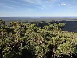 Sussex Inlet from Jerrawangala lookout | |||||||||||||||
Jerrawangala Location in New South Wales | |||||||||||||||
| Coordinates | 35°04′13″S 150°26′20″E | ||||||||||||||
| Population | 70 (2016 census)[1] | ||||||||||||||
| Postcode(s) | 2622 | ||||||||||||||
| Location | |||||||||||||||
| LGA(s) | City of Shoalhaven | ||||||||||||||
| Region | South Coast | ||||||||||||||
| County | St Vincent | ||||||||||||||
| Parish |
| ||||||||||||||
| State electorate(s) | South Coast | ||||||||||||||
| Federal Division(s) | Gilmore | ||||||||||||||
| |||||||||||||||
Part of the Braidwood Road through Jerrawangala and part of the access road to Jerrawangala lookout were built as part of The Wool Road in 1841.
References
- Australian Bureau of Statistics (27 June 2017). "Jerrawangala". 2016 Census QuickStats. Retrieved 5 May 2018.

- "Jerrawangala". Geographical Names Register (GNR) of NSW. Geographical Names Board of New South Wales. Retrieved 5 May 2018.
- "Jerrawangala". OpenStreetMap. Retrieved 5 May 2018.