Kempsey, New South Wales
Kempsey is a town in the Mid North Coast region of New South Wales, Australia and is the council seat for Kempsey Shire. It is located roughly 16.5 kilometres inland from the coast of the Pacific Ocean, on the Macleay Valley Way near where the Pacific Highway and the North Coast railway line cross the Macleay River. It is roughly 345 kilometres north of Sydney. As of June 2018 Kempsey had a population of 15,309.[1]
| Kempsey New South Wales | |||||||||
|---|---|---|---|---|---|---|---|---|---|
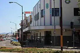 Kempsey Town Centre | |||||||||
Kempsey | |||||||||
| Coordinates | 31°5′S 152°50′E | ||||||||
| Population | 15,309 (2018)[1] | ||||||||
| Established | 1836 | ||||||||
| Postcode(s) | 2440 | ||||||||
| Elevation | 2.3 m (8 ft) | ||||||||
| Location | 345 km (214 mi) from Sydney | ||||||||
| LGA(s) | Kempsey Shire | ||||||||
| Region | Mid North Coast | ||||||||
| Parish | All Saints Catholic Parish | ||||||||
| State electorate(s) | Oxley[2] | ||||||||
| Federal Division(s) | Cowper[3] | ||||||||
| |||||||||
Kempsey history
European settlement
Enoch William Rudder is credited with founding the settlement. He arrived from Birmingham in 1834 and bought land on the southern bank of the river in 1836, at what was then the limit of authorized settlement (the boundary of County Macquarie). He was initially attracted by red cedar cutting opportunities but planned also to profit by selling parts of his land. He had riverside blocks surveyed and established a private town, with the first blocks sold in November 1836. He called it Kempsey because the surrounding areas reminded him of the Kempsey Valley in Worcestershire.[4] The collapse in red cedar prices in the early 1840s nearly led to the failure of the town.[5][6]
The main (and most flood-prone) part of Kempsey was founded by John Verge, sub-dividing a grant on the flood-plain opposite Rudder's settlement. In 1854, a government town was surveyed at West Kempsey and government facilities moved there when it became clear that no town would form around the police station and courthouse at Belgrave Falls. Rudder's settlement was renamed East Kempsey.
Kempsey initially flourished as a centre for logging and sawmilling. Large reserves of Australian red cedar Toona australis, (sold in Britain and the USA as "Indian mahogany") were extracted down until the 1920s, and with greater difficulty until the 1960s, by which time the resource was effectively exhausted. Dairying was the major industry in the area until the 1960s, with a Nestlé Milo factory at nearby Smithtown, and several cheese and butter factories.
Burnt Bridge
John Moseley was an Aboriginal farmer who moved to Burnt Bridge, Euroka Creek, near Kempsey, in 1892. Like the European farmers in the district, he grew maize. In 1900, Aboriginal children were excluded from Euroka Public School. Moseley, his son Percy and others petitioned for a Aboriginal school, which was created at Burnt Bridge in 1905.[7]
Under the Aborigines Protection Act 1909, the Aborigines Protection Board (APB) became responsible for the care and control of Aboriginal people, which included powers to remove children from their families. The APB pursued a policy of taking land from Aboriginal farmers and putting it in the hands of white farmers (by sale or lease). His protests to no avail, Moseley was forced to share-farm on a property he formerly owned. In October 1925, Moseley and Jimmy Linwood addressed a meeting at Kempsey showground organised by the Aborigines Progressive Association.[7]
Around 1930, other members of the Moseley family joined John on the farm at Euroka Creek. In 1937 the APB secured a large block next to the farm for the creation of Burnt Bridge Aboriginal Reserve (sometimes referred to as Burnt Bridge Mission). Aboriginal people from various other communities were moved there and forced to live with inadequate housing or a poor water supply.[7]
Children were removed from the Reserve, including girls who were taken to the Cootamundra Domestic Training Home for Aboriginal Girls, and became part of the Stolen Generations.[8][9]
The manager of the reserve tried to take over the Moseleys' land, but after several scuffles, stand-offs, a letter to the local press by Moseley, a visit to Sydney by one of his sons, and intervention by Michael Sawtell, the APB agreed to leave them alone. After John's death in July 1938, Percy continued to make a claim on the land; he was then threatened with expulsion. He was granted permissive occupancy of 80 acres (32 ha) of the old reserve in June 1939, but never won title to the land.[7]
Heritage listings
Kempsey has a number of heritage-listed sites, including:
- Belgrave Street: Kempsey Post Office[10]
- North Coast railway: Macleay River railway bridge[11]
- 67 Smith Street: St Andrew's Presbyterian Church and Hall[12]
Climate
| Climate data for Kempsey (Kempsey Airport AWS, 2001-) | |||||||||||||
|---|---|---|---|---|---|---|---|---|---|---|---|---|---|
| Month | Jan | Feb | Mar | Apr | May | Jun | Jul | Aug | Sep | Oct | Nov | Dec | Year |
| Record high °C (°F) | 43.9 (111.0) |
46.7 (116.1) |
42.0 (107.6) |
33.2 (91.8) |
30.6 (87.1) |
27.5 (81.5) |
27.8 (82.0) |
35.8 (96.4) |
37.0 (98.6) |
39.2 (102.6) |
39.8 (103.6) |
42.3 (108.1) |
46.7 (116.1) |
| Average high °C (°F) | 29.3 (84.7) |
28.9 (84.0) |
27.4 (81.3) |
25.2 (77.4) |
22.5 (72.5) |
20.1 (68.2) |
19.9 (67.8) |
21.6 (70.9) |
24.4 (75.9) |
25.8 (78.4) |
27.0 (80.6) |
28.2 (82.8) |
25.0 (77.0) |
| Average low °C (°F) | 17.8 (64.0) |
18.0 (64.4) |
16.4 (61.5) |
13.1 (55.6) |
8.7 (47.7) |
6.8 (44.2) |
5.0 (41.0) |
5.3 (41.5) |
8.2 (46.8) |
10.9 (51.6) |
14.5 (58.1) |
16.2 (61.2) |
11.7 (53.1) |
| Record low °C (°F) | 10.0 (50.0) |
11.9 (53.4) |
9.2 (48.6) |
3.0 (37.4) |
−2.3 (27.9) |
−2.6 (27.3) |
−3.6 (25.5) |
−2.2 (28.0) |
−0.4 (31.3) |
1.2 (34.2) |
5.8 (42.4) |
7.6 (45.7) |
−3.6 (25.5) |
| Average rainfall mm (inches) | 124.0 (4.88) |
159.2 (6.27) |
155.4 (6.12) |
74.4 (2.93) |
68.7 (2.70) |
116.4 (4.58) |
22.6 (0.89) |
59.7 (2.35) |
43.7 (1.72) |
74.2 (2.92) |
111.3 (4.38) |
101.5 (4.00) |
1,128.4 (44.43) |
| Average precipitation days | 14.1 | 14.2 | 15.6 | 13.6 | 12.0 | 13.6 | 9.8 | 8.3 | 9.1 | 10.2 | 13.6 | 14.2 | 148.3 |
| Average afternoon relative humidity (%) | 58 | 62 | 60 | 59 | 54 | 54 | 48 | 44 | 48 | 53 | 59 | 57 | 55 |
| Source: Bureau of Meteorology[13] | |||||||||||||
Floods
Geographically, Kempsey stretches out around a long loop of the Macleay River at the top of the flood-plain. It is famous for its floods. The 1949 flood was particularly destructive, having washed a large part of the town centre away when the railway viaduct (which was acting as a dam-wall due to a build-up of debris against the approaches to the railway bridge) gave way. The area most affected by this flood is now the site of playing fields. The shire council has a policy of buying up land in areas designated as flood plains and many houses have been transported to higher ground in recent years. Other major floods occurred in 1949, 1950, 1963, 2001, 2009, 2013.
Economy
Kempsey has a history of economic problems and disadvantage. Of the 10,374 residents in the area 1,573 worked full-time and 1,105 worked part-time. The area has an unemployment rate significantly higher than the national average. A plurality (35.1) of children live in families in which no member works. The median weekly household income is $691, nearly half the national average.[14]
Despite a period of economic stagnation in past decades compared to nearby coastal centres of growth, Kempsey has a growing local economy based on tourism, farming and service industries. As a local centre it has many shops and services including three major supermarkets and fast food chain stores such as Subway, McDonald's and KFC.
In 2014, the Australian Bureau of Statistics ranked Kempsey as one of the poorest Local Government areas in New South Wales.[15]
A Coles supermarket development (known as the "Kempsey Central Shopping Centre") has been built and is situated where the Tattersalls Hotel and various small businesses were in Little Belgrave Street. This shopping centre opened on 6 December 2008. Target Country closed their department store on 9 June 2018 - this ends a 33 year connection to the Macleay Valley (Fosseys was formerly in town before being rebranded as Target Country).
Growing industries include wineries and nut production. Kempsey is a service centre for the nearby coastal resorts of South West Rocks, Arakoon, Hat Head, and Crescent Head, which are popular places for retirees and holiday-makers alike.
Demographics
According to the 2016 Australian Census the median age in the Kempsey area is 42. 16.7% of residents are Aboriginal or Torres Strait Islander, with the median age of that group being 23. 84.2% of people were born in Australia. compared with the national average of 66.7%. The next most common country of birth was England at 1.6%. 72.8% reported having both parents born in Australia; this is significantly higher than the national average of 47.3%. 84.9% of Kempsey residents spoke only English at home.
The most common responses for religion were Catholic 23.5%, No Religion 23.1% and Anglican 20.8%.[16]
Crime
In recent decades Kempsey has attracted attention for its high and rising rate of crime when compared with state averages.[17] In 2016 crime figures released by the NSW Police Force revealed crime levels in Kempsey are two times the state average.[18] Break and enter is a particular problem, with a rate three times the state average. From 2014-2016 most crimes increased in Kempsey, with domestic violence, robbery with a firearm and break and enters all rising.
In 2015 it was reported in the Sydney Morning Herald that Kempsey was experiencing violent crime linked to ice addiction.[19] Offences for methamphetamine trafficking are roughly twice the state average. There followed a proactive program of crime prevention and community safety initiatives funded through the Australian, NSW and local government that has seen the town revitalised and crime incidents reduced. The 2016-17 Annual Report of Kempsey Shire Council indicated 80% of residents felt safe in their homes and public spaces.
Facilities
Government buildings such as the council chambers, library and several offices - are located west of the North Coast Railway line in West Kempsey. This area is not subject to the flooding that the CBD occasionally sees and is seen as a second business district with a variety of businesses and banking facilities. Opened in July 2004, the Mid North Coast Correctional Centre, a minimum to medium prison for 500 male and female inmates, is located in Aldavilla, approximately 14 kilometres (8.7 mi) west of Kempsey. As of 2019 there are plans to add extra housing for more inmates by 2020.
Transport
Until a new 14.5 kilometre bypass opened on 27 March 2013, the Pacific Highway passed through Kempsey. The former alignment is now known as the Macleay Valley Way. The new bypass included a 3.2 kilometre Macleay River Bridge, the longest bridge in Australia.[20][21]
Kempsey railway station is located on the North Coast line providing a connection to Sydney and Brisbane.
Education
Primary schools
- Kempsey East Public School
- Kempsey South Public School
- Kempsey West Public School
- Kempsey Adventist School
- Green Hill Public School
- St Joseph's Primary School
High schools
- Kempsey High School in West Kempsey largely servicing students living north of the Macleay.
- Melville High School in South Kempsey servicing students living south of the river and in the beachside communities.
- St Paul's College
- Kempsey Adventist School in South Kempsey servicing students all around the Macleay.
- Macleay Vocational College
- Mid North Coast Correctional Centre provides education equivalent to high school level as a means of rehabilitation and reintegration
Notable people
- Richard James Allen, Australian poet, dancer, filmmaker
- Jolene Anderson, actress and It Takes Two Series 2 winner
- Joseph Donovan, Olympic boxer
- Slim Dusty (David Gordon Kirkpatrick), singer
- Charles Louis Gabriel, Medical practitioner
- Silas Gill, Methodist preacher
- Terry Giddy, Australian Paralympic athlete
- David Griffin, Paralympic swimmer & gold medallist
- Greg Inglis, professional rugby league player
- Albert Kelly, professional rugby league player
- Thomas Keneally, novelist[22]
- Robin Klein, Australian author
- Henry Tasman Lovell, Psychologist and educator
- Amos Morris, singer
- Andy Patmore, professional rugby league player.
- Penelope Plummer, Miss World 1968
- Dennis Richardson, Officer of the Order of Australia, former Director-General of Security of the Australian Security Intelligence Organisation, and former Australian ambassador to the United States
- Amos Roberts, former professional rugby league footballer
- James Roberts, professional rugby league player.
- Joe Robinson, guitarist and winner of Australia's Got Talent, Season 2
- Dave Sands, Indigenous Australian boxer
- Hector Thompson, boxer of the 1970s and 1980s
- Aiden Tolman, professional rugby league player.
- Jack Verge, Australian rugby union player
- Amy Winters, Paralympic gold medallist
See also
| Wikimedia Commons has media related to Kempsey, New South Wales. |
References
- "3218.0 – Regional Population Growth, Australia, 2017-18: Population Estimates by Significant Urban Area, 2008 to 2018". Australian Bureau of Statistics. Australian Bureau of Statistics. 27 March 2019. Retrieved 22 April 2019. Estimated resident population, 30 June 2018.
- "Oxley Electoral District". New South Wales Electoral Commission. Retrieved 23 November 2019.
- "Cowper". Australian Electoral Commission. Archived from the original on 16 August 2010. Retrieved 21 November 2006.
- "Kempsey". Geographical Names Register (GNR) of NSW. Geographical Names Board of New South Wales. Retrieved 4 August 2013.

- Valley of the Macleay, Marie H. Neil, 1972, ISBN 0-85587-037-0
- "Kempsey". The Sydney Morning Herald. 8 February 2004. Archived from the original on 3 July 2007. Retrieved 14 July 2007.
- Morris, Barry (2005). "John Moseley". Australian Dictionary of Biography. Retrieved 22 February 2020.
...first published in hardcopy in Australian Dictionary of Biography, Supplementary Volume, (MUP), 2005
- Poole, Fiona (14 February 2008). "When sorry will be enough". ABC Mid North Coast NSW. Australian Broadcasting Corporation. Retrieved 22 February 2020.
- "Bringing them Home - Jennifer story". Australian Human Rights Commission. 2 December 2001. Retrieved 22 February 2020.
- "Kempsey Post Office". New South Wales State Heritage Register. Office of Environment and Heritage. H01420. Retrieved 18 May 2018.
- "Kempsey rail bridge over Macleay River". New South Wales State Heritage Register. Office of Environment and Heritage. H01041. Retrieved 18 May 2018.
- "St Andrew's Presbyterian Church and Hall". New South Wales State Heritage Register. Office of Environment and Heritage. H00384. Retrieved 18 May 2018.
- "Kempsey Airport AWS". Climate statistics for Australian locations. Bureau of Meteorology. Retrieved 25 July 2017.
- "Archived copy". Archived from the original on 25 January 2018. Retrieved 2 July 2017.CS1 maint: archived copy as title (link)
- "Kempsey shire among NSW's poorest". Australian Broadcasting Commission. 3 July 2014. Archived from the original on 1 November 2016. Retrieved 25 November 2015.
- Australian Bureau of Statistics (27 June 2017). "Kempsey". 2016 Census QuickStats. Retrieved 30 November 2017.
- "Archived copy". Archived from the original on 30 October 2016. Retrieved 2 July 2017.CS1 maint: archived copy as title (link)
- "Archived copy". Archived from the original on 28 July 2017. Retrieved 2 July 2017.CS1 maint: archived copy as title (link)
- "Archived copy". Archived from the original on 14 August 2017. Retrieved 2 July 2017.CS1 maint: archived copy as title (link)
- "Kempsey bypass open" Archived 3 March 2015 at the Wayback Machine ABC News 27 March 2013
- Kempsey bypass completed Archived 25 February 2015 at the Wayback Machine Roads & Maritime Services
- "Tom Keneally, interviewed by Peter Thompson". Talking Heads. ABC Television. 30 July 2007. Archived from the original on 8 December 2012. Retrieved 12 November 2008.
External links
- Kempsey Shire Council Homepage
- Macleay Valley Coast Tourist Information Site
- Macleay Valley Newspaper and Weather
| Authority control |
|---|