Macleay Valley Way
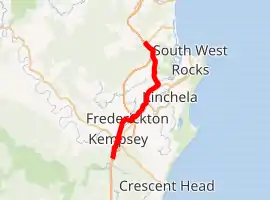
The Macleay Valley Way is a road in the Mid North Coast region of New South Wales that connects the Pacific Highway to Kempsey and Frederickton. It runs along a former section of the Pacific Highway that was bypassed by a newer alignment between 2013 and 2016.
Macleay Valley Way | |
|---|---|
| |
South end North end | |
| Coordinates |
|
| General information | |
| Type | Road |
| Length | 39 km (24 mi)[1] |
| Maintained by | Transport for NSW |
| Former route number | Kempsey Frederickton |
| Major junctions | |
| South end | |
| North end | |
| Location(s) | |
| Region | Mid North Coast |
| LGA(s) | Kempsey Shire |
| Major suburbs | Kempsey, Frederickton |
| Highway system | |
Route description
The Macleay Valley Way branches from the Pacific Highway at the Kempsey South Service Centre. It follows the former Pacific Highway alignment. Instead of bypassing population centres, the Macleay Valley Way passes through the towns of Kempsey and Frederickton.
History
Macleay Valley Way became the secondary road in two stages, as the new Pacific Highway was opened in two stages. The southern part of the new road is east of the old road which is now Macleay Valley Way through Kempsey.[2] The northern part is west of the Macleay Valley Way. The new bridge over the Macleay River and bypass of Kempsey and Frederickton was opened first, on 27 March 2013.[2]
The section north of Frederickton opened on 16 May 2016.[3][4]
This northern section of Macleay Valley Way includes the part of the former Pacific Highway that was the site of the Kempsey bus crash which occurred in the locality of Clybucca in 1989 when two loaded tour buses collided head-on.[4]
Major junction list
| LGA | Location | km[1] | mi | Destinations | Notes |
|---|---|---|---|---|---|
| Kempsey | South Kempsey | 0 | 0.0 | Slim Dusty Interchange[2] | |
| 3.6 | 2.2 | North Coast railway line | |||
| 3.8 | 2.4 | ||||
| East Kempsey, Kempsey | 6.1 | 3.8 | Macleay River | ||
| Frederickton, Bellimbopinni | 14.5 | 9.0 | Dunghutti Interchange[2] | ||
| Seven Oaks | 20 | 12 | Smithtown Road – Gladstone, Smithtown, South West Rocks | ||
| Clybucca | 25.7 | 16.0 | |||
| 27.3 | 17.0 | Clybucca Creek | |||
| Barraganyatti | 36.6 | 22.7 | Barraganyatti Creek | ||
| Barraganyatti, Yarrengai | 39.0 | 24.2 | |||
| 1.000 mi = 1.609 km; 1.000 km = 0.621 mi | |||||
See also
- Big River Way - bypassed section of Pacific Highway and the site of the Grafton bus crash
- Giinagay Way - bypassed section of Pacific Highway at Nambucca Heads and Urunga
References
- Google (23 April 2017). "Macleay Valley Way" (Map). Google Maps. Google. Retrieved 23 April 2017.
- "Kempsey Bypass". Roads and Maritime Services. Retrieved 23 April 2017.
- "Frederickton to Eungai - Pacific Highway upgrade". Roads and Maritime Services. Retrieved 23 April 2017.
- Merkell, Helen (16 May 2016). "Deadly stretch of Pacific Highway to be bypassed today, 27 years after bus crash". ABC Mid North Coast. Retrieved 23 April 2017.
